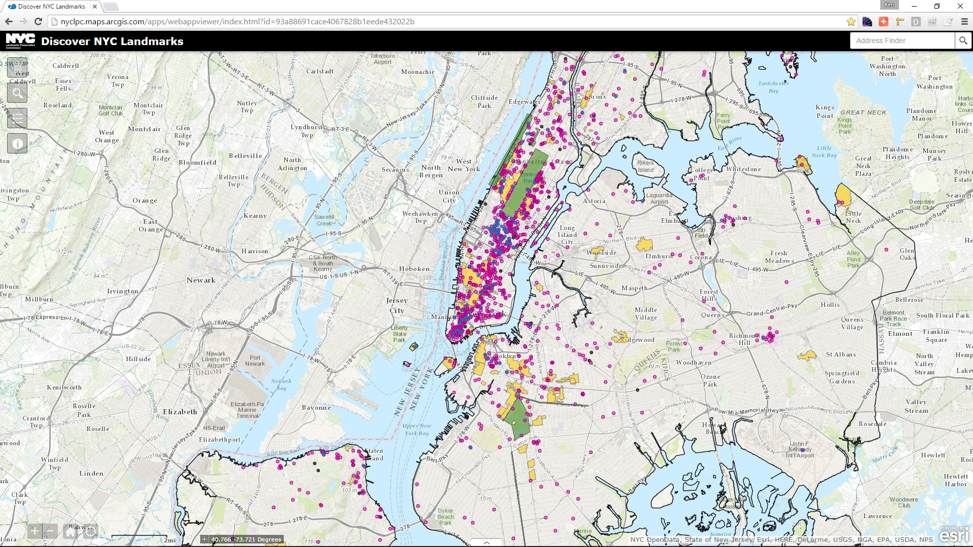
The Landmarks Preservation Commission has outdone itself with the new “Discover NYC Landmarks” web site. This interactive map is the fastest way to find and explore the city’s architectural heritage.
Since its creation in 1965, the Landmarks Preservation Commission has granted landmark status to more than 35,000 buildings and sites, including 1364 individual landmarks, 117 interior landmarks, 10 scenic landmarks and 139 historic districts and extensions in all five boroughs. LPC shields this cultural history against defacement or destruction.
Equally if not more importantly, LPC has researched and written volumes of reports that examine and interpret those landmarks in the context of New York City and neighborhood history. The commission’s researchers also reveal the architects, builders and owners of the buildings.
Last but not least, LPC has made its work accessible in many ways. It published the “Guide to New York City Landmarks” (Fourth Edition – Wiley, 2009), and made individual report .PDFs available from its website.
Since 2011, I’ve relied on the LPC reports for details about the buildings I’ve photographed for NewYorkitecture.com. Thank you, thank you, thank you!
Best Yet From Landmarks Preservation Commission
The new “Discover NYC Landmarks” site is LPC’s best-yet platform for browsing our architectural heritage. It’s an interactive map of the city, showing the locations of all landmarks and historic districts. Click on a landmark or district, a popup shows you the landmark name and designation date. Click on the popup image, and a .PDF report opens up. While the map itself is a major accomplishment, LPC has also upgraded its pre-computer reports. Old typewritten documents that had been scanned into .PDFs were often difficult to read and could not be searched electronically. The upgraded documents have been cleaned up dramatically and sometimes reformatted to make them easier to search and navigate.
The 433-page Greenwich Village Historic District report, for example, was originally published in two volumes. Here are the “before” and “after” versions of the original 1969 title page: The updated version combines both volumes and includes navigable bookmarks.
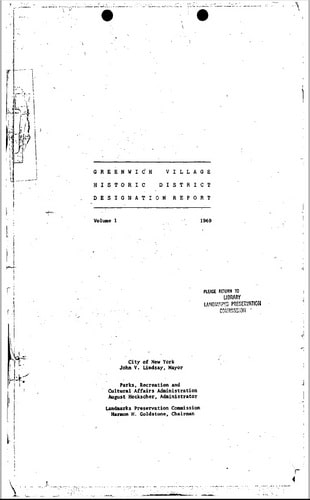
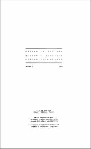
I’ve been using the improved report to document my new photos of Greenwich Village – it is so much easier to work with. Thank you, LPC!
![[Kingsbridge Armory] IMG_9737 [8/23/2012 11:43:47 AM] [Kingsbridge Armory] IMG_9737 [8/23/2012 11:43:47 AM]](https://www.newyorkitecture.com/wp-content/gallery/kingsbridge-armory/IMG_9737_resize.jpg)
![[Kingsbridge Armory] IMG_9809 [8/23/2012 1:07:04 PM] [Kingsbridge Armory] IMG_9809 [8/23/2012 1:07:04 PM]](https://www.newyorkitecture.com/wp-content/gallery/kingsbridge-armory/IMG_9809_resize.jpg)
![[Kingsbridge Armory] IMG_9805 [8/23/2012 1:05:59 PM] [Kingsbridge Armory] IMG_9805 [8/23/2012 1:05:59 PM]](https://www.newyorkitecture.com/wp-content/gallery/kingsbridge-armory/IMG_9805_resize.jpg)
![[Kingsbridge Armory] IMG_9800 [8/23/2012 1:05:40 PM] [Kingsbridge Armory] IMG_9800 [8/23/2012 1:05:40 PM]](https://www.newyorkitecture.com/wp-content/gallery/kingsbridge-armory/IMG_9800_resize.jpg)
![[Kingsbridge Armory] IMG_9789 [8/23/2012 12:58:18 PM] [Kingsbridge Armory] IMG_9789 [8/23/2012 12:58:18 PM]](https://www.newyorkitecture.com/wp-content/gallery/kingsbridge-armory/IMG_9789_resize.jpg)
![[Kingsbridge Armory] IMG_9763 [8/23/2012 11:59:30 AM] [Kingsbridge Armory] IMG_9763 [8/23/2012 11:59:30 AM]](https://www.newyorkitecture.com/wp-content/gallery/kingsbridge-armory/IMG_9763_resize.jpg)
![[Kingsbridge Armory] IMG_9755 [8/23/2012 11:52:40 AM] [Kingsbridge Armory] IMG_9755 [8/23/2012 11:52:40 AM]](https://www.newyorkitecture.com/wp-content/gallery/kingsbridge-armory/IMG_9755_resize.jpg)
![[Kingsbridge Armory] IMG_9748 [8/23/2012 11:51:32 AM] [Kingsbridge Armory] IMG_9748 [8/23/2012 11:51:32 AM]](https://www.newyorkitecture.com/wp-content/gallery/kingsbridge-armory/IMG_9748_resize.jpg)
![[Kingsbridge Armory] IMG_9741 [8/23/2012 11:46:19 AM] [Kingsbridge Armory] IMG_9741 [8/23/2012 11:46:19 AM]](https://www.newyorkitecture.com/wp-content/gallery/kingsbridge-armory/IMG_9741_resize.jpg)
![[Kingsbridge Armory] IMG_9740 [8/23/2012 11:45:00 AM] [Kingsbridge Armory] IMG_9740 [8/23/2012 11:45:00 AM]](https://www.newyorkitecture.com/wp-content/gallery/kingsbridge-armory/IMG_9740_resize.jpg)
![[Kingsbridge Armory] IMG_9609 [8/23/2012 10:36:26 AM] [Kingsbridge Armory] IMG_9609 [8/23/2012 10:36:26 AM]](https://www.newyorkitecture.com/wp-content/gallery/kingsbridge-armory/IMG_9609_resize.jpg)
![[Kingsbridge Armory] IMG_9734 [8/23/2012 11:43:15 AM] [Kingsbridge Armory] IMG_9734 [8/23/2012 11:43:15 AM]](https://www.newyorkitecture.com/wp-content/gallery/kingsbridge-armory/IMG_9734_resize1.jpg)
![[Kingsbridge Armory] IMG_9724 [8/23/2012 11:35:52 AM] [Kingsbridge Armory] IMG_9724 [8/23/2012 11:35:52 AM]](https://www.newyorkitecture.com/wp-content/gallery/kingsbridge-armory/IMG_9724_resize.jpg)
![[Kingsbridge Armory] IMG_9635 [8/23/2012 10:46:54 AM] [Kingsbridge Armory] IMG_9635 [8/23/2012 10:46:54 AM]](https://www.newyorkitecture.com/wp-content/gallery/kingsbridge-armory/IMG_9635_resize.jpg)
![[Kingsbridge Armory] IMG_9631 [8/23/2012 10:46:38 AM] [Kingsbridge Armory] IMG_9631 [8/23/2012 10:46:38 AM]](https://www.newyorkitecture.com/wp-content/gallery/kingsbridge-armory/IMG_9631_resize.jpg)
![[Kingsbridge Armory] IMG_9628 [8/23/2012 10:44:03 AM] [Kingsbridge Armory] IMG_9628 [8/23/2012 10:44:03 AM]](https://www.newyorkitecture.com/wp-content/gallery/kingsbridge-armory/IMG_9628_resize.jpg)
![[Kingsbridge Armory] IMG_9625 [8/23/2012 10:41:40 AM] [Kingsbridge Armory] IMG_9625 [8/23/2012 10:41:40 AM]](https://www.newyorkitecture.com/wp-content/gallery/kingsbridge-armory/IMG_9625_resize.jpg)
![[Kingsbridge Armory] IMG_9621 [8/23/2012 10:40:20 AM] [Kingsbridge Armory] IMG_9621 [8/23/2012 10:40:20 AM]](https://www.newyorkitecture.com/wp-content/gallery/kingsbridge-armory/IMG_9621_resize.jpg)
![[Kingsbridge Armory] IMG_9615 [8/23/2012 10:38:18 AM] [Kingsbridge Armory] IMG_9615 [8/23/2012 10:38:18 AM]](https://www.newyorkitecture.com/wp-content/gallery/kingsbridge-armory/IMG_9615_resize.jpg)
![[Kingsbridge Armory] IMG_9613 [8/23/2012 10:37:21 AM] [Kingsbridge Armory] IMG_9613 [8/23/2012 10:37:21 AM]](https://www.newyorkitecture.com/wp-content/gallery/kingsbridge-armory/IMG_9613_resize.jpg)

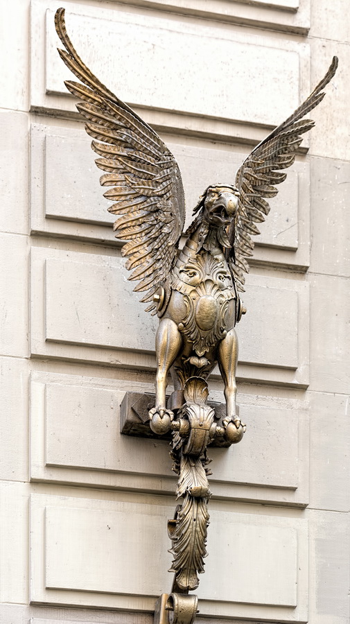
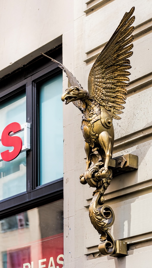
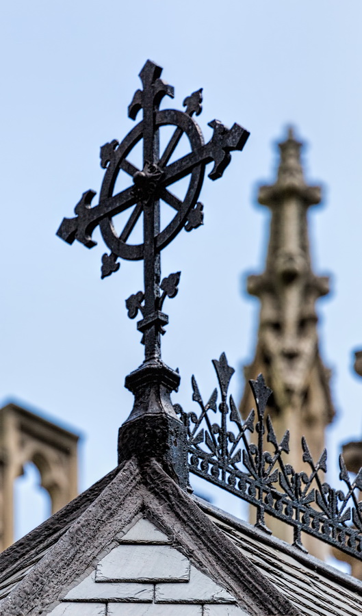
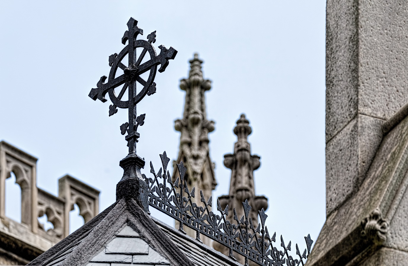
![Entry detail: Prada store [2] Entry detail: Prada store [2]](https://www.newyorkitecture.com/wp-content/gallery/random-may-2014/NO5A8638_resize.jpg)
![Entry detail: Prada store [1] Entry detail: Prada store [1]](https://www.newyorkitecture.com/wp-content/gallery/random-may-2014/NO5A8640_resize.jpg)
![Entry detail: Prada store [3] Entry detail: Prada store [3]](https://www.newyorkitecture.com/wp-content/gallery/random-may-2014/NO5A8646_resize.jpg)
![Entry detail: Prada store [4] Entry detail: Prada store [4]](https://www.newyorkitecture.com/wp-content/gallery/random-may-2014/NO5A8648_resize.jpg)
![Entry detail: Prada store [5] Entry detail: Prada store [5]](https://www.newyorkitecture.com/wp-content/gallery/random-may-2014/NO5A8649_resize.jpg)

You must be logged in to post a comment.