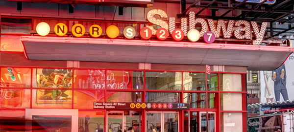
Crossroads of the world, heart of the city that never sleeps – the only place where there are crowds on a cold Sunday afternoon. And the only place where bright lights are part of the zoning regulations: You have to have a big electric display on your facade.
Bit by bit, the stately old-guard stone and terra cotta buildings of the early 1900s are being replaced by glass and steel towers, some with bizarre shapes and colors. The building that pretty much started it all – One Times Square, the one-time headquarters of The New York Times – is still there, but hardly in its 1905 form. Allied Chemical covered it in white marble in 1964, and it has since become a 25-story electric signboard. The Paramount Building also survives, along with some theater buildings between Seventh and Eighth Avenues and Bush Tower between Broadway and Sixth Avenue (Avenue of the Americas). Up and down the uptown side streets (43rd – 47th) are plenty of landmark-quality buildings, though – and not just theaters.
You’ll find several distinctive old clubs in the area, and the art deco treasure McGraw-Hill Building and the Port Authority Bus Terminal. You’re also just a hop, skip and a jump from Bryant Park and the main branch of the New York Public Library.
![TS_3906_7_8_fused [12/19/2011 9:37:15 AM] TS_3906_7_8_fused [12/19/2011 9:37:15 AM]](https://www.newyorkitecture.com/wp-content/gallery/times-square-vicinity/ts_3906_7_8_fused.jpg)
![IMG_3732_3_4_fused [12/18/2011 3:09:13 PM] IMG_3732_3_4_fused [12/18/2011 3:09:13 PM]](https://www.newyorkitecture.com/wp-content/gallery/times-square-vicinity/ts_3732_3_4_fused.jpg)
![IMG_3738_39_40_fused [12/18/2011 3:12:06 PM] IMG_3738_39_40_fused [12/18/2011 3:12:06 PM]](https://www.newyorkitecture.com/wp-content/gallery/times-square-vicinity/ts_3738_39_40_fused.jpg)
![IMG_3747_8_9_fused [12/18/2011 3:13:38 PM] IMG_3747_8_9_fused [12/18/2011 3:13:38 PM]](https://www.newyorkitecture.com/wp-content/gallery/times-square-vicinity/ts_3747_8_9_fused.jpg)
![IMG_3762_3_4_fused [12/18/2011 3:16:06 PM] IMG_3762_3_4_fused [12/18/2011 3:16:06 PM]](https://www.newyorkitecture.com/wp-content/gallery/times-square-vicinity/ts_3762_3_4_fused.jpg)
![IMG_3771_2_3_fused [12/18/2011 3:20:49 PM] IMG_3771_2_3_fused [12/18/2011 3:20:49 PM]](https://www.newyorkitecture.com/wp-content/gallery/times-square-vicinity/ts_3771_2_3_fused.jpg)
![IMG_3774_5_6_fused [12/18/2011 3:22:50 PM] IMG_3774_5_6_fused [12/18/2011 3:22:50 PM]](https://www.newyorkitecture.com/wp-content/gallery/times-square-vicinity/ts_3774_5_6_fused.jpg)
![IMG_3786_7_8_fused [12/18/2011 3:27:01 PM] IMG_3786_7_8_fused [12/18/2011 3:27:01 PM]](https://www.newyorkitecture.com/wp-content/gallery/times-square-vicinity/ts_3786_7_8_fused.jpg)
![TS_3792_3_4_fused [12/19/2011 9:09:11 AM] TS_3792_3_4_fused [12/19/2011 9:09:11 AM]](https://www.newyorkitecture.com/wp-content/gallery/times-square-vicinity/ts_3792_3_4_fused.jpg)
![TS_3798_799_800_fused [12/19/2011 9:11:10 AM] TS_3798_799_800_fused [12/19/2011 9:11:10 AM]](https://www.newyorkitecture.com/wp-content/gallery/times-square-vicinity/ts_3798_799_800_fused.jpg)
![TS_3813_4_5_fused [12/19/2011 9:15:07 AM] TS_3813_4_5_fused [12/19/2011 9:15:07 AM]](https://www.newyorkitecture.com/wp-content/gallery/times-square-vicinity/ts_3813_4_5_fused.jpg)
![TS_3825_6_7_fused [12/19/2011 9:18:06 AM] TS_3825_6_7_fused [12/19/2011 9:18:06 AM]](https://www.newyorkitecture.com/wp-content/gallery/times-square-vicinity/ts_3825_6_7_fused.jpg)
![TS_3834_5_6_fused [12/19/2011 9:19:00 AM] TS_3834_5_6_fused [12/19/2011 9:19:00 AM]](https://www.newyorkitecture.com/wp-content/gallery/times-square-vicinity/ts_3834_5_6_fused.jpg)
![TS_3849_50_51_fused [12/19/2011 9:20:59 AM] TS_3849_50_51_fused [12/19/2011 9:20:59 AM]](https://www.newyorkitecture.com/wp-content/gallery/times-square-vicinity/ts_3849_50_51_fused.jpg)
![TS_3864_5_6_fused [12/19/2011 9:23:41 AM] TS_3864_5_6_fused [12/19/2011 9:23:41 AM]](https://www.newyorkitecture.com/wp-content/gallery/times-square-vicinity/ts_3864_5_6_fused.jpg)
![TS_3867_8_9_fused [12/19/2011 9:24:53 AM] TS_3867_8_9_fused [12/19/2011 9:24:53 AM]](https://www.newyorkitecture.com/wp-content/gallery/times-square-vicinity/ts_3867_8_9_fused.jpg)
![IMG_3717_8_9_fused [12/18/2011 3:06:29 PM] IMG_3717_8_9_fused [12/18/2011 3:06:29 PM]](https://www.newyorkitecture.com/wp-content/gallery/times-square-vicinity/ts_3717_8_9_fused.jpg)
![TS_4299_300_301_fused [12/19/2011 11:17:21 AM] TS_4299_300_301_fused [12/19/2011 11:17:21 AM]](https://www.newyorkitecture.com/wp-content/gallery/times-square-vicinity/ts_4299_300_301_fused.jpg)
![TS_4338_39_40_fused [12/19/2011 11:29:33 AM] TS_4338_39_40_fused [12/19/2011 11:29:33 AM]](https://www.newyorkitecture.com/wp-content/gallery/times-square-vicinity/ts_4338_39_40_fused.jpg)
![TS_4356_7_8_fused [12/19/2011 11:34:52 AM] TS_4356_7_8_fused [12/19/2011 11:34:52 AM]](https://www.newyorkitecture.com/wp-content/gallery/times-square-vicinity/ts_4356_7_8_fused.jpg)
![TS_4374_5_6_fused [12/19/2011 11:38:24 AM] TS_4374_5_6_fused [12/19/2011 11:38:24 AM]](https://www.newyorkitecture.com/wp-content/gallery/times-square-vicinity/ts_4374_5_6_fused.jpg)
![TS_4386_7_8_fused [12/19/2011 11:41:59 AM] TS_4386_7_8_fused [12/19/2011 11:41:59 AM]](https://www.newyorkitecture.com/wp-content/gallery/times-square-vicinity/ts_4386_7_8_fused.jpg)
![TS_4407_8_9_fused [12/19/2011 11:49:44 AM] TS_4407_8_9_fused [12/19/2011 11:49:44 AM]](https://www.newyorkitecture.com/wp-content/gallery/times-square-vicinity/ts_4407_8_9_fused.jpg)
![TS_4419_20_21_fused [12/19/2011 11:53:14 AM] TS_4419_20_21_fused [12/19/2011 11:53:14 AM]](https://www.newyorkitecture.com/wp-content/gallery/times-square-vicinity/ts_4419_20_21_fused.jpg)
![TS_4434_5_6_fused [12/19/2011 11:58:26 AM] TS_4434_5_6_fused [12/19/2011 11:58:26 AM]](https://www.newyorkitecture.com/wp-content/gallery/times-square-vicinity/ts_4434_5_6_fused.jpg)
![TS_4464_5_6_fused [12/19/2011 12:05:02 PM] TS_4464_5_6_fused [12/19/2011 12:05:02 PM]](https://www.newyorkitecture.com/wp-content/gallery/times-square-vicinity/ts_4464_5_6_fused.jpg)
![TS_4485_6_7_fused [12/19/2011 12:10:49 PM] TS_4485_6_7_fused [12/19/2011 12:10:49 PM]](https://www.newyorkitecture.com/wp-content/gallery/times-square-vicinity/ts_4485_6_7_fused.jpg)
![TS_4497_8_9_fused [12/19/2011 12:13:36 PM] TS_4497_8_9_fused [12/19/2011 12:13:36 PM]](https://www.newyorkitecture.com/wp-content/gallery/times-square-vicinity/ts_4497_8_9_fused.jpg)
![TS_4515_6_7_fused [12/19/2011 12:20:53 PM] TS_4515_6_7_fused [12/19/2011 12:20:53 PM]](https://www.newyorkitecture.com/wp-content/gallery/times-square-vicinity/ts_4515_6_7_fused.jpg)
![TS_4530_1_2_fused [12/19/2011 12:24:17 PM] TS_4530_1_2_fused [12/19/2011 12:24:17 PM]](https://www.newyorkitecture.com/wp-content/gallery/times-square-vicinity/ts_4530_1_2_fused.jpg)
![TS_4539_40_41_fused [12/19/2011 12:26:57 PM] TS_4539_40_41_fused [12/19/2011 12:26:57 PM]](https://www.newyorkitecture.com/wp-content/gallery/times-square-vicinity/ts_4539_40_41_fused.jpg)
![IMG_3591_2_3_fused [12/18/2011 2:15:21 PM] IMG_3591_2_3_fused [12/18/2011 2:15:21 PM]](https://www.newyorkitecture.com/wp-content/gallery/times-square-vicinity/ts_3591_2_3_fused.jpg)
![IMG_3492_3_4_fused [12/18/2011 1:32:31 PM] IMG_3492_3_4_fused [12/18/2011 1:32:31 PM]](https://www.newyorkitecture.com/wp-content/gallery/times-square-vicinity/ts_3492_3_4_fused.jpg)
![IMG_3495_6_7_fused [12/18/2011 1:33:18 PM] IMG_3495_6_7_fused [12/18/2011 1:33:18 PM]](https://www.newyorkitecture.com/wp-content/gallery/times-square-vicinity/ts_3495_6_7_fused.jpg)
![IMG_3498_499_500_fused [12/18/2011 1:34:51 PM] IMG_3498_499_500_fused [12/18/2011 1:34:51 PM]](https://www.newyorkitecture.com/wp-content/gallery/times-square-vicinity/ts_3498_499_500_fused.jpg)
![IMG_3501_2_3_fused [12/18/2011 1:35:45 PM] IMG_3501_2_3_fused [12/18/2011 1:35:45 PM]](https://www.newyorkitecture.com/wp-content/gallery/times-square-vicinity/ts_3501_2_3_fused.jpg)
![IMG_3504_5_6_fused [12/18/2011 1:37:22 PM] IMG_3504_5_6_fused [12/18/2011 1:37:22 PM]](https://www.newyorkitecture.com/wp-content/gallery/times-square-vicinity/ts_3504_5_6_fused.jpg)
![IMG_3513_4_5_fused [12/18/2011 1:39:35 PM] IMG_3513_4_5_fused [12/18/2011 1:39:35 PM]](https://www.newyorkitecture.com/wp-content/gallery/times-square-vicinity/ts_3513_4_5_fused.jpg)
![IMG_3516_7_8_fused [12/18/2011 1:40:21 PM] IMG_3516_7_8_fused [12/18/2011 1:40:21 PM]](https://www.newyorkitecture.com/wp-content/gallery/times-square-vicinity/ts_3516_7_8_fused.jpg)
![IMG_3528_29_30_fused [12/18/2011 1:44:07 PM] IMG_3528_29_30_fused [12/18/2011 1:44:07 PM]](https://www.newyorkitecture.com/wp-content/gallery/times-square-vicinity/ts_3528_29_30_fused.jpg)
![IMG_3534_5_6_fused [12/18/2011 1:45:20 PM] IMG_3534_5_6_fused [12/18/2011 1:45:20 PM]](https://www.newyorkitecture.com/wp-content/gallery/times-square-vicinity/ts_3534_5_6_fused.jpg)
![IMG_3555_6_7_fused [12/18/2011 1:59:01 PM] IMG_3555_6_7_fused [12/18/2011 1:59:01 PM]](https://www.newyorkitecture.com/wp-content/gallery/times-square-vicinity/ts_3555_6_7_fused.jpg)
![IMG_3567_8_9_fused [12/18/2011 2:06:36 PM] IMG_3567_8_9_fused [12/18/2011 2:06:36 PM]](https://www.newyorkitecture.com/wp-content/gallery/times-square-vicinity/ts_3567_8_9_fused.jpg)
![IMG_3570_1_2_fused [12/18/2011 2:07:41 PM] IMG_3570_1_2_fused [12/18/2011 2:07:41 PM]](https://www.newyorkitecture.com/wp-content/gallery/times-square-vicinity/ts_3570_1_2_fused.jpg)
![IMG_3573_4_5_fused [12/18/2011 2:08:43 PM] IMG_3573_4_5_fused [12/18/2011 2:08:43 PM]](https://www.newyorkitecture.com/wp-content/gallery/times-square-vicinity/ts_3573_4_5_fused.jpg)
![IMG_3585_6_7_fused [12/18/2011 2:11:37 PM] IMG_3585_6_7_fused [12/18/2011 2:11:37 PM]](https://www.newyorkitecture.com/wp-content/gallery/times-square-vicinity/ts_3585_6_7_fused.jpg)
![IMG_3588_89_90_fused [12/18/2011 2:13:01 PM] IMG_3588_89_90_fused [12/18/2011 2:13:01 PM]](https://www.newyorkitecture.com/wp-content/gallery/times-square-vicinity/ts_3588_89_90_fused.jpg)
![IMG_3483_4_5_fused [12/18/2011 1:30:38 PM] IMG_3483_4_5_fused [12/18/2011 1:30:38 PM]](https://www.newyorkitecture.com/wp-content/gallery/times-square-vicinity/ts_3483_4_5_fused.jpg)
![IMG_3594_5_6_fused [12/18/2011 2:16:27 PM] IMG_3594_5_6_fused [12/18/2011 2:16:27 PM]](https://www.newyorkitecture.com/wp-content/gallery/times-square-vicinity/ts_3594_5_6_fused.jpg)
![IMG_3606_7_8_fused [12/18/2011 2:21:44 PM] IMG_3606_7_8_fused [12/18/2011 2:21:44 PM]](https://www.newyorkitecture.com/wp-content/gallery/times-square-vicinity/ts_3606_7_8_fused.jpg)
![IMG_3612_3_4_fused [12/18/2011 2:23:31 PM] IMG_3612_3_4_fused [12/18/2011 2:23:31 PM]](https://www.newyorkitecture.com/wp-content/gallery/times-square-vicinity/ts_3612_3_4_fused.jpg)
![IMG_3618_19_20_fused [12/18/2011 2:25:04 PM] IMG_3618_19_20_fused [12/18/2011 2:25:04 PM]](https://www.newyorkitecture.com/wp-content/gallery/times-square-vicinity/ts_3618_19_20_fused.jpg)
![IMG_3627_8_9_fused [12/18/2011 2:28:56 PM] IMG_3627_8_9_fused [12/18/2011 2:28:56 PM]](https://www.newyorkitecture.com/wp-content/gallery/times-square-vicinity/ts_3627_8_9_fused.jpg)
![IMG_3642_3_4_fused [12/18/2011 2:40:56 PM] IMG_3642_3_4_fused [12/18/2011 2:40:56 PM]](https://www.newyorkitecture.com/wp-content/gallery/times-square-vicinity/ts_3642_3_4_fused.jpg)
![IMG_3657_8_9_fused [12/18/2011 2:47:58 PM] IMG_3657_8_9_fused [12/18/2011 2:47:58 PM]](https://www.newyorkitecture.com/wp-content/gallery/times-square-vicinity/ts_3657_8_9_fused.jpg)
![IMG_3660_1_2_fused [12/18/2011 2:49:40 PM] IMG_3660_1_2_fused [12/18/2011 2:49:40 PM]](https://www.newyorkitecture.com/wp-content/gallery/times-square-vicinity/ts_3660_1_2_fused.jpg)
![IMG_3672_3_4_fused [12/18/2011 2:52:05 PM] IMG_3672_3_4_fused [12/18/2011 2:52:05 PM]](https://www.newyorkitecture.com/wp-content/gallery/times-square-vicinity/ts_3672_3_4_fused.jpg)
![IMG_3681_2_3_fused [12/18/2011 2:54:02 PM] IMG_3681_2_3_fused [12/18/2011 2:54:02 PM]](https://www.newyorkitecture.com/wp-content/gallery/times-square-vicinity/ts_3681_2_3_fused.jpg)
![IMG_3696_7_8_fused [12/18/2011 2:57:55 PM] IMG_3696_7_8_fused [12/18/2011 2:57:55 PM]](https://www.newyorkitecture.com/wp-content/gallery/times-square-vicinity/ts_3696_7_8_fused.jpg)
![IMG_3702_3_4_fused [12/18/2011 3:00:10 PM] IMG_3702_3_4_fused [12/18/2011 3:00:10 PM]](https://www.newyorkitecture.com/wp-content/gallery/times-square-vicinity/ts_3702_3_4_fused.jpg)
![IMG_3708_09_10_fused [12/18/2011 3:03:47 PM] IMG_3708_09_10_fused [12/18/2011 3:03:47 PM]](https://www.newyorkitecture.com/wp-content/gallery/times-square-vicinity/ts_3708_09_10_fused.jpg)
![IMG_3711_2_3_fused [12/18/2011 3:04:53 PM] IMG_3711_2_3_fused [12/18/2011 3:04:53 PM]](https://www.newyorkitecture.com/wp-content/gallery/times-square-vicinity/ts_3711_2_3_fused.jpg)
![IMG_5392_3_4 [1/1/2012 1:36:10 PM] IMG_5392_3_4 [1/1/2012 1:36:10 PM]](https://www.newyorkitecture.com/wp-content/gallery/maritime-buildings/img_5392_3_4.jpg)
![IMG_5404_5_6 [1/1/2012 1:45:08 PM] IMG_5404_5_6 [1/1/2012 1:45:08 PM]](https://www.newyorkitecture.com/wp-content/gallery/maritime-buildings/img_5404_5_6.jpg)
![IMG_5413_4_5 [1/1/2012 1:46:39 PM] IMG_5413_4_5 [1/1/2012 1:46:39 PM]](https://www.newyorkitecture.com/wp-content/gallery/maritime-buildings/img_5413_4_5.jpg)
![IMG_5419_20_21 [1/1/2012 1:48:47 PM] IMG_5419_20_21 [1/1/2012 1:48:47 PM]](https://www.newyorkitecture.com/wp-content/gallery/maritime-buildings/img_5419_20_21.jpg)
![IMG_5428_29_30 [1/1/2012 1:51:14 PM] IMG_5428_29_30 [1/1/2012 1:51:14 PM]](https://www.newyorkitecture.com/wp-content/gallery/maritime-buildings/img_5428_29_30.jpg)
![IMG_5455_6_7 [1/1/2012 1:58:24 PM] IMG_5455_6_7 [1/1/2012 1:58:24 PM]](https://www.newyorkitecture.com/wp-content/gallery/maritime-buildings/img_5455_6_7.jpg)
![IMG_5479_80_81 [1/1/2012 2:05:27 PM] IMG_5479_80_81 [1/1/2012 2:05:27 PM]](https://www.newyorkitecture.com/wp-content/gallery/maritime-buildings/img_5479_80_81.jpg)
![IMG_5482_3_4 [1/1/2012 2:06:04 PM] IMG_5482_3_4 [1/1/2012 2:06:04 PM]](https://www.newyorkitecture.com/wp-content/gallery/maritime-buildings/img_5482_3_4.jpg)
![IMG_5488_89_90 [1/1/2012 2:07:40 PM] IMG_5488_89_90 [1/1/2012 2:07:40 PM]](https://www.newyorkitecture.com/wp-content/gallery/maritime-buildings/img_5488_89_90.jpg)
![IMG_5503_4_5 [1/1/2012 2:11:14 PM] IMG_5503_4_5 [1/1/2012 2:11:14 PM]](https://www.newyorkitecture.com/wp-content/gallery/maritime-buildings/img_5503_4_5.jpg)
![IMG_5721_2_3 [1/3/2012 9:19:58 AM] IMG_5721_2_3 [1/3/2012 9:19:58 AM]](https://www.newyorkitecture.com/wp-content/gallery/maritime-buildings/img_5721_2_3.jpg)
![IMG_5730_1_2 [1/3/2012 9:21:29 AM] IMG_5730_1_2 [1/3/2012 9:21:29 AM]](https://www.newyorkitecture.com/wp-content/gallery/maritime-buildings/img_5730_1_2.jpg)
![IMG_5745_6_7 [1/3/2012 9:24:25 AM] IMG_5745_6_7 [1/3/2012 9:24:25 AM]](https://www.newyorkitecture.com/wp-content/gallery/maritime-buildings/img_5745_6_7.jpg)
![IMG_5751_2_3 [1/3/2012 9:26:00 AM] IMG_5751_2_3 [1/3/2012 9:26:00 AM]](https://www.newyorkitecture.com/wp-content/gallery/maritime-buildings/img_5751_2_3.jpg)
![IMG_5757_8_9 [1/3/2012 9:27:13 AM] IMG_5757_8_9 [1/3/2012 9:27:13 AM]](https://www.newyorkitecture.com/wp-content/gallery/maritime-buildings/img_5757_8_9.jpg)
![IMG_5760_1_2 [1/3/2012 9:27:48 AM] IMG_5760_1_2 [1/3/2012 9:27:48 AM]](https://www.newyorkitecture.com/wp-content/gallery/maritime-buildings/img_5760_1_2.jpg)
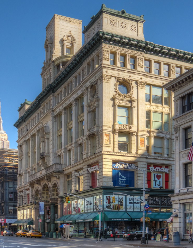
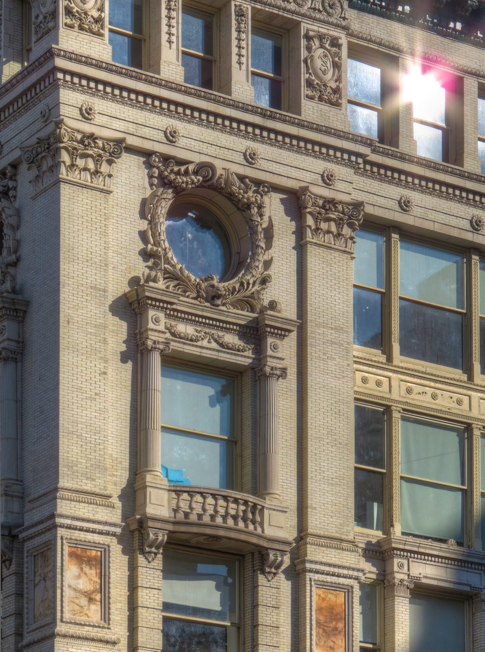
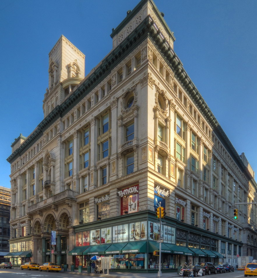
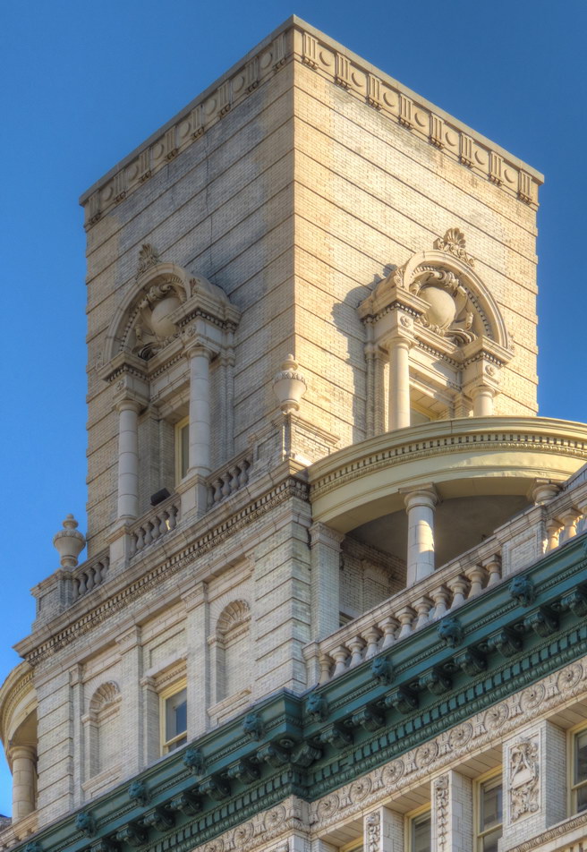
![IMG_6899_900_901Adjust [11/3/2011 10:04:08 AM] IMG_6899_900_901Adjust [11/3/2011 10:04:08 AM]](https://www.newyorkitecture.com/wp-content/gallery/upper-west-side-broadway/img_6899_900_901adjust.jpg)
![IMG_7019_20_21Adjust [11/3/2011 10:35:43 AM] IMG_7019_20_21Adjust [11/3/2011 10:35:43 AM]](https://www.newyorkitecture.com/wp-content/gallery/upper-west-side-broadway/img_7019_20_21adjust.jpg)
![IMG_7013_4_5Adjust [11/3/2011 10:33:58 AM] IMG_7013_4_5Adjust [11/3/2011 10:33:58 AM]](https://www.newyorkitecture.com/wp-content/gallery/upper-west-side-broadway/img_7013_4_5adjust.jpg)
![IMG_6995_6_7Adjust [11/3/2011 10:30:07 AM] IMG_6995_6_7Adjust [11/3/2011 10:30:07 AM]](https://www.newyorkitecture.com/wp-content/gallery/upper-west-side-broadway/img_6995_6_7adjust.jpg)
![IMG_6992_3_4Adjust [11/3/2011 10:27:24 AM] IMG_6992_3_4Adjust [11/3/2011 10:27:24 AM]](https://www.newyorkitecture.com/wp-content/gallery/upper-west-side-broadway/img_6992_3_4adjust.jpg)
![IMG_6989_90_91Adjust [11/3/2011 10:26:07 AM] IMG_6989_90_91Adjust [11/3/2011 10:26:07 AM]](https://www.newyorkitecture.com/wp-content/gallery/upper-west-side-broadway/img_6989_90_91adjust.jpg)
![IMG_6974_5_6Adjust [11/3/2011 10:22:13 AM] IMG_6974_5_6Adjust [11/3/2011 10:22:13 AM]](https://www.newyorkitecture.com/wp-content/gallery/upper-west-side-broadway/img_6974_5_6adjust.jpg)
![IMG_6935_6_7Adjust [11/3/2011 10:11:25 AM] IMG_6935_6_7Adjust [11/3/2011 10:11:25 AM]](https://www.newyorkitecture.com/wp-content/gallery/upper-west-side-broadway/img_6935_6_7adjust.jpg)
![IMG_6920_1_2Adjust [11/3/2011 10:07:25 AM] IMG_6920_1_2Adjust [11/3/2011 10:07:25 AM]](https://www.newyorkitecture.com/wp-content/gallery/upper-west-side-broadway/img_6920_1_2adjust.jpg)
![IMG_6917_8_9Adjust [11/3/2011 10:06:42 AM] IMG_6917_8_9Adjust [11/3/2011 10:06:42 AM]](https://www.newyorkitecture.com/wp-content/gallery/upper-west-side-broadway/img_6917_8_9adjust.jpg)
![IMG_6905_6_7Adjust [11/3/2011 10:04:49 AM] IMG_6905_6_7Adjust [11/3/2011 10:04:49 AM]](https://www.newyorkitecture.com/wp-content/gallery/upper-west-side-broadway/img_6905_6_7adjust.jpg)
![IMG_6902_3_4Adjust [11/3/2011 10:04:28 AM] IMG_6902_3_4Adjust [11/3/2011 10:04:28 AM]](https://www.newyorkitecture.com/wp-content/gallery/upper-west-side-broadway/img_6902_3_4adjust.jpg)
![IMG_7040_1_2Adjust [11/3/2011 10:49:15 AM] IMG_7040_1_2Adjust [11/3/2011 10:49:15 AM]](https://www.newyorkitecture.com/wp-content/gallery/upper-west-side-broadway/img_7040_1_2adjust.jpg)
![IMG_6896_7_8Adjust [11/3/2011 10:02:31 AM] IMG_6896_7_8Adjust [11/3/2011 10:02:31 AM]](https://www.newyorkitecture.com/wp-content/gallery/upper-west-side-broadway/img_6896_7_8adjust.jpg)
![IMG_6827_8_9Adjust [11/3/2011 9:46:53 AM] IMG_6827_8_9Adjust [11/3/2011 9:46:53 AM]](https://www.newyorkitecture.com/wp-content/gallery/upper-west-side-broadway/img_6827_8_9adjust.jpg)
![IMG_6815_6_7Adjust [11/3/2011 9:44:14 AM] IMG_6815_6_7Adjust [11/3/2011 9:44:14 AM]](https://www.newyorkitecture.com/wp-content/gallery/upper-west-side-broadway/img_6815_6_7adjust.jpg)
![IMG_5539_40_41Adjust [10/31/2011 1:46:58 PM] IMG_5539_40_41Adjust [10/31/2011 1:46:58 PM]](https://www.newyorkitecture.com/wp-content/gallery/upper-west-side-broadway/img_5539_40_41adjust.jpg)
![IMG_5509_10_11Adjust [10/31/2011 1:41:35 PM] IMG_5509_10_11Adjust [10/31/2011 1:41:35 PM]](https://www.newyorkitecture.com/wp-content/gallery/upper-west-side-broadway/img_5509_10_11adjust.jpg)
![IMG_5506_7_8Adjust [10/31/2011 1:40:53 PM] IMG_5506_7_8Adjust [10/31/2011 1:40:53 PM]](https://www.newyorkitecture.com/wp-content/gallery/upper-west-side-broadway/img_5506_7_8adjust.jpg)
![IMG_5500_1_2Adjust [10/31/2011 1:35:56 PM] IMG_5500_1_2Adjust [10/31/2011 1:35:56 PM]](https://www.newyorkitecture.com/wp-content/gallery/upper-west-side-broadway/img_5500_1_2adjust.jpg)
![IMG_5491_2_3Adjust [10/31/2011 1:29:57 PM] IMG_5491_2_3Adjust [10/31/2011 1:29:57 PM]](https://www.newyorkitecture.com/wp-content/gallery/upper-west-side-broadway/img_5491_2_3adjust.jpg)
![IMG_5488_89_90Adjust [10/31/2011 1:24:02 PM] IMG_5488_89_90Adjust [10/31/2011 1:24:02 PM]](https://www.newyorkitecture.com/wp-content/gallery/upper-west-side-broadway/img_5488_89_90adjust.jpg)
![IMG_5479_80_81Adjust [10/31/2011 1:21:49 PM] IMG_5479_80_81Adjust [10/31/2011 1:21:49 PM]](https://www.newyorkitecture.com/wp-content/gallery/upper-west-side-broadway/img_5479_80_81adjust.jpg)
![IMG_5476_7_8Adjust [10/31/2011 1:17:16 PM] IMG_5476_7_8Adjust [10/31/2011 1:17:16 PM]](https://www.newyorkitecture.com/wp-content/gallery/upper-west-side-broadway/img_5476_7_8adjust.jpg)
![IMG_7148_49_50Adjust [11/3/2011 11:15:38 AM] IMG_7148_49_50Adjust [11/3/2011 11:15:38 AM]](https://www.newyorkitecture.com/wp-content/gallery/upper-west-side-broadway/img_7148_49_50adjust.jpg)
![IMG_7340_1_2Adjust [11/4/2011 8:19:10 AM] IMG_7340_1_2Adjust [11/4/2011 8:19:10 AM]](https://www.newyorkitecture.com/wp-content/gallery/upper-west-side-broadway/img_7340_1_2adjust.jpg)
![IMG_7331_2_3Adjust [11/4/2011 8:18:12 AM] IMG_7331_2_3Adjust [11/4/2011 8:18:12 AM]](https://www.newyorkitecture.com/wp-content/gallery/upper-west-side-broadway/img_7331_2_3adjust.jpg)
![IMG_7328_29_30Adjust [11/4/2011 8:15:42 AM] IMG_7328_29_30Adjust [11/4/2011 8:15:42 AM]](https://www.newyorkitecture.com/wp-content/gallery/upper-west-side-broadway/img_7328_29_30adjust.jpg)
![IMG_7232_3_4Adjust [11/3/2011 11:46:40 AM] IMG_7232_3_4Adjust [11/3/2011 11:46:40 AM]](https://www.newyorkitecture.com/wp-content/gallery/upper-west-side-broadway/img_7232_3_4adjust.jpg)
![IMG_7205_6_7Adjust [11/3/2011 11:39:09 AM] IMG_7205_6_7Adjust [11/3/2011 11:39:09 AM]](https://www.newyorkitecture.com/wp-content/gallery/upper-west-side-broadway/img_7205_6_7adjust.jpg)
![IMG_7190_1_2Adjust [11/3/2011 11:30:00 AM] IMG_7190_1_2Adjust [11/3/2011 11:30:00 AM]](https://www.newyorkitecture.com/wp-content/gallery/upper-west-side-broadway/img_7190_1_2adjust.jpg)
![IMG_7181_2_3Adjust [11/3/2011 11:26:28 AM] IMG_7181_2_3Adjust [11/3/2011 11:26:28 AM]](https://www.newyorkitecture.com/wp-content/gallery/upper-west-side-broadway/img_7181_2_3adjust.jpg)
![IMG_7178_79_80Adjust [11/3/2011 11:25:27 AM] IMG_7178_79_80Adjust [11/3/2011 11:25:27 AM]](https://www.newyorkitecture.com/wp-content/gallery/upper-west-side-broadway/img_7178_79_80adjust.jpg)
![IMG_7172_3_4Adjust [11/3/2011 11:23:59 AM] IMG_7172_3_4Adjust [11/3/2011 11:23:59 AM]](https://www.newyorkitecture.com/wp-content/gallery/upper-west-side-broadway/img_7172_3_4adjust.jpg)
![IMG_7166_7_8Adjust [11/3/2011 11:20:04 AM] IMG_7166_7_8Adjust [11/3/2011 11:20:04 AM]](https://www.newyorkitecture.com/wp-content/gallery/upper-west-side-broadway/img_7166_7_8adjust.jpg)
![IMG_7151_2_3Adjust [11/3/2011 11:16:22 AM] IMG_7151_2_3Adjust [11/3/2011 11:16:22 AM]](https://www.newyorkitecture.com/wp-content/gallery/upper-west-side-broadway/img_7151_2_3adjust.jpg)
![IMG_5437_8_9Adjust [10/31/2011 1:08:28 PM] IMG_5437_8_9Adjust [10/31/2011 1:08:28 PM]](https://www.newyorkitecture.com/wp-content/gallery/upper-west-side-broadway/img_5437_8_9adjust.jpg)
![IMG_7145_6_7Adjust [11/3/2011 11:14:53 AM] IMG_7145_6_7Adjust [11/3/2011 11:14:53 AM]](https://www.newyorkitecture.com/wp-content/gallery/upper-west-side-broadway/img_7145_6_7adjust.jpg)
![IMG_7124_5_6Adjust [11/3/2011 11:04:54 AM] IMG_7124_5_6Adjust [11/3/2011 11:04:54 AM]](https://www.newyorkitecture.com/wp-content/gallery/upper-west-side-broadway/img_7124_5_6adjust.jpg)
![IMG_7106_7_8Adjust [11/3/2011 11:02:06 AM] IMG_7106_7_8Adjust [11/3/2011 11:02:06 AM]](https://www.newyorkitecture.com/wp-content/gallery/upper-west-side-broadway/img_7106_7_8adjust.jpg)
![IMG_7103_4_5Adjust [11/3/2011 11:01:09 AM] IMG_7103_4_5Adjust [11/3/2011 11:01:09 AM]](https://www.newyorkitecture.com/wp-content/gallery/upper-west-side-broadway/img_7103_4_5adjust.jpg)
![IMG_7100_1_2Adjust [11/3/2011 11:00:30 AM] IMG_7100_1_2Adjust [11/3/2011 11:00:30 AM]](https://www.newyorkitecture.com/wp-content/gallery/upper-west-side-broadway/img_7100_1_2adjust.jpg)
![IMG_7097_8_9Adjust [11/3/2011 10:59:31 AM] IMG_7097_8_9Adjust [11/3/2011 10:59:31 AM]](https://www.newyorkitecture.com/wp-content/gallery/upper-west-side-broadway/img_7097_8_9adjust.jpg)
![IMG_7082_3_4Adjust [11/3/2011 10:57:32 AM] IMG_7082_3_4Adjust [11/3/2011 10:57:32 AM]](https://www.newyorkitecture.com/wp-content/gallery/upper-west-side-broadway/img_7082_3_4adjust.jpg)
![IMG_7079_80_81Adjust [11/3/2011 10:56:34 AM] IMG_7079_80_81Adjust [11/3/2011 10:56:34 AM]](https://www.newyorkitecture.com/wp-content/gallery/upper-west-side-broadway/img_7079_80_81adjust.jpg)
![IMG_7067_8_9Adjust [11/3/2011 10:54:44 AM] IMG_7067_8_9Adjust [11/3/2011 10:54:44 AM]](https://www.newyorkitecture.com/wp-content/gallery/upper-west-side-broadway/img_7067_8_9adjust.jpg)
![IMG_7058_59_60Adjust [11/3/2011 10:53:32 AM] IMG_7058_59_60Adjust [11/3/2011 10:53:32 AM]](https://www.newyorkitecture.com/wp-content/gallery/upper-west-side-broadway/img_7058_59_60adjust.jpg)
![IMG_7052_3_4Adjust [11/3/2011 10:52:22 AM] IMG_7052_3_4Adjust [11/3/2011 10:52:22 AM]](https://www.newyorkitecture.com/wp-content/gallery/upper-west-side-broadway/img_7052_3_4adjust.jpg)
![IMG_3653_4_5Adjust [10/21/2011 11:38:33 AM] IMG_3653_4_5Adjust [10/21/2011 11:38:33 AM]](https://www.newyorkitecture.com/wp-content/gallery/upper-west-side-broadway/img_3653_4_5adjust.jpg)
![IMG_3768_69_70Adjust [10/21/2011 12:18:18 PM] IMG_3768_69_70Adjust [10/21/2011 12:18:18 PM]](https://www.newyorkitecture.com/wp-content/gallery/upper-west-side-broadway/img_3768_69_70adjust.jpg)
![IMG_3756_7_8Adjust [10/21/2011 12:16:44 PM] IMG_3756_7_8Adjust [10/21/2011 12:16:44 PM]](https://www.newyorkitecture.com/wp-content/gallery/upper-west-side-broadway/img_3756_7_8adjust.jpg)
![IMG_3750_1_2Adjust [10/21/2011 12:10:20 PM] IMG_3750_1_2Adjust [10/21/2011 12:10:20 PM]](https://www.newyorkitecture.com/wp-content/gallery/upper-west-side-broadway/img_3750_1_2adjust.jpg)
![IMG_3734_5_6Adjust [10/21/2011 12:04:06 PM] IMG_3734_5_6Adjust [10/21/2011 12:04:06 PM]](https://www.newyorkitecture.com/wp-content/gallery/upper-west-side-broadway/img_3734_5_6adjust.jpg)
![IMG_3725_6_7Adjust [10/21/2011 12:03:23 PM] IMG_3725_6_7Adjust [10/21/2011 12:03:23 PM]](https://www.newyorkitecture.com/wp-content/gallery/upper-west-side-broadway/img_3725_6_7adjust.jpg)
![IMG_3722_3_4Adjust [10/21/2011 11:59:16 AM] IMG_3722_3_4Adjust [10/21/2011 11:59:16 AM]](https://www.newyorkitecture.com/wp-content/gallery/upper-west-side-broadway/img_3722_3_4adjust.jpg)
![IMG_3719_20_21Adjust [10/21/2011 11:56:44 AM] IMG_3719_20_21Adjust [10/21/2011 11:56:44 AM]](https://www.newyorkitecture.com/wp-content/gallery/upper-west-side-broadway/img_3719_20_21adjust.jpg)
![IMG_3692_3_4Adjust [10/21/2011 11:46:30 AM] IMG_3692_3_4Adjust [10/21/2011 11:46:30 AM]](https://www.newyorkitecture.com/wp-content/gallery/upper-west-side-broadway/img_3692_3_4adjust.jpg)
![IMG_3686_7_8Adjust [10/21/2011 11:45:48 AM] IMG_3686_7_8Adjust [10/21/2011 11:45:48 AM]](https://www.newyorkitecture.com/wp-content/gallery/upper-west-side-broadway/img_3686_7_8adjust.jpg)
![IMG_3671_2_3Adjust [10/21/2011 11:41:58 AM] IMG_3671_2_3Adjust [10/21/2011 11:41:58 AM]](https://www.newyorkitecture.com/wp-content/gallery/upper-west-side-broadway/img_3671_2_3adjust.jpg)
![IMG_3665_6_7Adjust [10/21/2011 11:40:50 AM] IMG_3665_6_7Adjust [10/21/2011 11:40:50 AM]](https://www.newyorkitecture.com/wp-content/gallery/upper-west-side-broadway/img_3665_6_7adjust.jpg)
![IMG_3777_8_9Adjust [10/21/2011 12:21:09 PM] IMG_3777_8_9Adjust [10/21/2011 12:21:09 PM]](https://www.newyorkitecture.com/wp-content/gallery/upper-west-side-broadway/img_3777_8_9adjust.jpg)
![IMG_3641_2_3Adjust [10/21/2011 11:36:29 AM] IMG_3641_2_3Adjust [10/21/2011 11:36:29 AM]](https://www.newyorkitecture.com/wp-content/gallery/upper-west-side-broadway/img_3641_2_3adjust.jpg)
![IMG_3626_7_8Adjust [10/21/2011 11:29:28 AM] IMG_3626_7_8Adjust [10/21/2011 11:29:28 AM]](https://www.newyorkitecture.com/wp-content/gallery/upper-west-side-broadway/img_3626_7_8adjust.jpg)
![IMG_3620_1_2Adjust [10/21/2011 11:28:03 AM] IMG_3620_1_2Adjust [10/21/2011 11:28:03 AM]](https://www.newyorkitecture.com/wp-content/gallery/upper-west-side-broadway/img_3620_1_2adjust.jpg)
![IMG_3617_8_9Adjust [10/21/2011 11:26:55 AM] IMG_3617_8_9Adjust [10/21/2011 11:26:55 AM]](https://www.newyorkitecture.com/wp-content/gallery/upper-west-side-broadway/img_3617_8_9adjust.jpg)
![IMG_3614_5_6Adjust [10/21/2011 11:21:17 AM] IMG_3614_5_6Adjust [10/21/2011 11:21:17 AM]](https://www.newyorkitecture.com/wp-content/gallery/upper-west-side-broadway/img_3614_5_6adjust.jpg)
![IMG_3608_09_10Adjust [10/21/2011 11:20:20 AM] IMG_3608_09_10Adjust [10/21/2011 11:20:20 AM]](https://www.newyorkitecture.com/wp-content/gallery/upper-west-side-broadway/img_3608_09_10adjust.jpg)
![IMG_3602_3_4Adjust [10/21/2011 11:13:18 AM] IMG_3602_3_4Adjust [10/21/2011 11:13:18 AM]](https://www.newyorkitecture.com/wp-content/gallery/upper-west-side-broadway/img_3602_3_4adjust.jpg)
![IMG_3590_1_2Adjust [10/21/2011 11:05:51 AM] IMG_3590_1_2Adjust [10/21/2011 11:05:51 AM]](https://www.newyorkitecture.com/wp-content/gallery/upper-west-side-broadway/img_3590_1_2adjust.jpg)
![IMG_3587_8_9Adjust [10/21/2011 11:04:44 AM] IMG_3587_8_9Adjust [10/21/2011 11:04:44 AM]](https://www.newyorkitecture.com/wp-content/gallery/upper-west-side-broadway/img_3587_8_9adjust.jpg)
![IMG_3581_2_3Adjust [10/21/2011 11:03:36 AM] IMG_3581_2_3Adjust [10/21/2011 11:03:36 AM]](https://www.newyorkitecture.com/wp-content/gallery/upper-west-side-broadway/img_3581_2_3adjust.jpg)
![IMG_3575_6_7Adjust [10/21/2011 11:02:03 AM] IMG_3575_6_7Adjust [10/21/2011 11:02:03 AM]](https://www.newyorkitecture.com/wp-content/gallery/upper-west-side-broadway/img_3575_6_7adjust.jpg)
![IMG_3906_7_8Adjust [10/21/2011 1:02:23 PM] IMG_3906_7_8Adjust [10/21/2011 1:02:23 PM]](https://www.newyorkitecture.com/wp-content/gallery/upper-west-side-broadway/img_3906_7_8adjust.jpg)
![IMG_5431_2_3Adjust [10/31/2011 12:54:27 PM] IMG_5431_2_3Adjust [10/31/2011 12:54:27 PM]](https://www.newyorkitecture.com/wp-content/gallery/upper-west-side-broadway/img_5431_2_3adjust.jpg)
![IMG_5428_29_30Adjust [10/31/2011 12:53:21 PM] IMG_5428_29_30Adjust [10/31/2011 12:53:21 PM]](https://www.newyorkitecture.com/wp-content/gallery/upper-west-side-broadway/img_5428_29_30adjust.jpg)
![IMG_5425_6_7Adjust [10/31/2011 12:52:52 PM] IMG_5425_6_7Adjust [10/31/2011 12:52:52 PM]](https://www.newyorkitecture.com/wp-content/gallery/upper-west-side-broadway/img_5425_6_7adjust.jpg)
![IMG_5419_20_21Adjust [10/31/2011 12:51:05 PM] IMG_5419_20_21Adjust [10/31/2011 12:51:05 PM]](https://www.newyorkitecture.com/wp-content/gallery/upper-west-side-broadway/img_5419_20_21adjust.jpg)
![IMG_5413_4_5Adjust [10/31/2011 12:47:23 PM] IMG_5413_4_5Adjust [10/31/2011 12:47:23 PM]](https://www.newyorkitecture.com/wp-content/gallery/upper-west-side-broadway/img_5413_4_5adjust.jpg)
![IMG_5394_5_6Adjust [10/31/2011 12:43:01 PM] IMG_5394_5_6Adjust [10/31/2011 12:43:01 PM]](https://www.newyorkitecture.com/wp-content/gallery/upper-west-side-broadway/img_5394_5_6adjust.jpg)
![IMG_5391_2_3Adjust [10/31/2011 12:41:29 PM] IMG_5391_2_3Adjust [10/31/2011 12:41:29 PM]](https://www.newyorkitecture.com/wp-content/gallery/upper-west-side-broadway/img_5391_2_3adjust.jpg)
![IMG_5388_89_90Adjust [10/31/2011 12:40:26 PM] IMG_5388_89_90Adjust [10/31/2011 12:40:26 PM]](https://www.newyorkitecture.com/wp-content/gallery/upper-west-side-broadway/img_5388_89_90adjust.jpg)
![IMG_5382_3_4Adjust [10/31/2011 12:39:59 PM] IMG_5382_3_4Adjust [10/31/2011 12:39:59 PM]](https://www.newyorkitecture.com/wp-content/gallery/upper-west-side-broadway/img_5382_3_4adjust.jpg)
![IMG_5379_80_81Adjust [10/31/2011 12:39:37 PM] IMG_5379_80_81Adjust [10/31/2011 12:39:37 PM]](https://www.newyorkitecture.com/wp-content/gallery/upper-west-side-broadway/img_5379_80_81adjust.jpg)
![IMG_5376_7_8Adjust [10/31/2011 12:39:17 PM] IMG_5376_7_8Adjust [10/31/2011 12:39:17 PM]](https://www.newyorkitecture.com/wp-content/gallery/upper-west-side-broadway/img_5376_7_8adjust.jpg)
![IMG_3569_70_71Adjust [10/21/2011 11:01:06 AM] IMG_3569_70_71Adjust [10/21/2011 11:01:06 AM]](https://www.newyorkitecture.com/wp-content/gallery/upper-west-side-broadway/img_3569_70_71adjust.jpg)
![IMG_3897_8_9Adjust [10/21/2011 12:50:14 PM] IMG_3897_8_9Adjust [10/21/2011 12:50:14 PM]](https://www.newyorkitecture.com/wp-content/gallery/upper-west-side-broadway/img_3897_8_9adjust.jpg)
![IMG_3894_5_6Adjust [10/21/2011 12:49:26 PM] IMG_3894_5_6Adjust [10/21/2011 12:49:26 PM]](https://www.newyorkitecture.com/wp-content/gallery/upper-west-side-broadway/img_3894_5_6adjust.jpg)
![IMG_3888_89_90Adjust [10/21/2011 12:48:40 PM] IMG_3888_89_90Adjust [10/21/2011 12:48:40 PM]](https://www.newyorkitecture.com/wp-content/gallery/upper-west-side-broadway/img_3888_89_90adjust.jpg)
![IMG_3879_80_81Adjust [10/21/2011 12:47:48 PM] IMG_3879_80_81Adjust [10/21/2011 12:47:48 PM]](https://www.newyorkitecture.com/wp-content/gallery/upper-west-side-broadway/img_3879_80_81adjust.jpg)
![IMG_3831_2_3Adjust [10/21/2011 12:35:17 PM] IMG_3831_2_3Adjust [10/21/2011 12:35:17 PM]](https://www.newyorkitecture.com/wp-content/gallery/upper-west-side-broadway/img_3831_2_3adjust.jpg)
![IMG_3825_6_7Adjust [10/21/2011 12:32:56 PM] IMG_3825_6_7Adjust [10/21/2011 12:32:56 PM]](https://www.newyorkitecture.com/wp-content/gallery/upper-west-side-broadway/img_3825_6_7adjust.jpg)
![IMG_3813_4_5Adjust [10/21/2011 12:28:31 PM] IMG_3813_4_5Adjust [10/21/2011 12:28:31 PM]](https://www.newyorkitecture.com/wp-content/gallery/upper-west-side-broadway/img_3813_4_5adjust.jpg)
![IMG_3804_5_6Adjust [10/21/2011 12:26:25 PM] IMG_3804_5_6Adjust [10/21/2011 12:26:25 PM]](https://www.newyorkitecture.com/wp-content/gallery/upper-west-side-broadway/img_3804_5_6adjust.jpg)
![IMG_3801_2_3Adjust [10/21/2011 12:25:38 PM] IMG_3801_2_3Adjust [10/21/2011 12:25:38 PM]](https://www.newyorkitecture.com/wp-content/gallery/upper-west-side-broadway/img_3801_2_3adjust.jpg)
![IMG_3789_90_91Adjust [10/21/2011 12:23:23 PM] IMG_3789_90_91Adjust [10/21/2011 12:23:23 PM]](https://www.newyorkitecture.com/wp-content/gallery/upper-west-side-broadway/img_3789_90_91adjust.jpg)
![IMG_3783_4_5Adjust [10/21/2011 12:21:55 PM] IMG_3783_4_5Adjust [10/21/2011 12:21:55 PM]](https://www.newyorkitecture.com/wp-content/gallery/upper-west-side-broadway/img_3783_4_5adjust.jpg)
![IMG_6097_8_9Adjust [1/19/2012 12:40:12 PM] IMG_6097_8_9Adjust [1/19/2012 12:40:12 PM]](https://www.newyorkitecture.com/wp-content/gallery/central-park-west-62-96-street/k_6097_8_9adjust.jpg)
![M_2904 [10/15/2011 10:21:50 AM] M_2904 [10/15/2011 10:21:50 AM]](https://www.newyorkitecture.com/wp-content/gallery/central-park-west-62-96-street/m_2904.jpg)
![M_2903 [10/15/2011 10:21:28 AM] M_2903 [10/15/2011 10:21:28 AM]](https://www.newyorkitecture.com/wp-content/gallery/central-park-west-62-96-street/m_2903.jpg)
![M_2902 [10/15/2011 10:20:08 AM] M_2902 [10/15/2011 10:20:08 AM]](https://www.newyorkitecture.com/wp-content/gallery/central-park-west-62-96-street/m_2902.jpg)
![L_5596_7_8Adjust [10/31/2011 2:01:11 PM] L_5596_7_8Adjust [10/31/2011 2:01:11 PM]](https://www.newyorkitecture.com/wp-content/gallery/central-park-west-62-96-street/l_5596_7_8adjust.jpg)
![L_5578_79_80Adjust [10/31/2011 1:56:26 PM] L_5578_79_80Adjust [10/31/2011 1:56:26 PM]](https://www.newyorkitecture.com/wp-content/gallery/central-park-west-62-96-street/l_5578_79_80adjust.jpg)
![L_5572_3_4Adjust [10/31/2011 1:54:59 PM] L_5572_3_4Adjust [10/31/2011 1:54:59 PM]](https://www.newyorkitecture.com/wp-content/gallery/central-park-west-62-96-street/l_5572_3_4adjust.jpg)
![L_2894_5_6Adjust [10/15/2011 10:08:43 AM] L_2894_5_6Adjust [10/15/2011 10:08:43 AM]](https://www.newyorkitecture.com/wp-content/gallery/central-park-west-62-96-street/l_2894_5_6adjust.jpg)
![L_2888_89_90Adjust [10/15/2011 10:05:09 AM] L_2888_89_90Adjust [10/15/2011 10:05:09 AM]](https://www.newyorkitecture.com/wp-content/gallery/central-park-west-62-96-street/l_2888_89_90adjust.jpg)
![IMG_6136_7_8Adjust [1/19/2012 12:49:09 PM] IMG_6136_7_8Adjust [1/19/2012 12:49:09 PM]](https://www.newyorkitecture.com/wp-content/gallery/central-park-west-62-96-street/k_6136_7_8adjust.jpg)
![IMG_6112_3_4Adjust [1/19/2012 12:44:02 PM] IMG_6112_3_4Adjust [1/19/2012 12:44:02 PM]](https://www.newyorkitecture.com/wp-content/gallery/central-park-west-62-96-street/k_6112_3_4adjust.jpg)
![M_2909_10_11Adjust [10/15/2011 10:26:33 AM] M_2909_10_11Adjust [10/15/2011 10:26:33 AM]](https://www.newyorkitecture.com/wp-content/gallery/central-park-west-62-96-street/m_2909_10_11adjust.jpg)
![K_5560_1_2Adjust [10/31/2011 1:52:30 PM] K_5560_1_2Adjust [10/31/2011 1:52:30 PM]](https://www.newyorkitecture.com/wp-content/gallery/central-park-west-62-96-street/k_5560_1_2adjust.jpg)
![K_5551_2_3Adjust [10/31/2011 1:49:56 PM] K_5551_2_3Adjust [10/31/2011 1:49:56 PM]](https://www.newyorkitecture.com/wp-content/gallery/central-park-west-62-96-street/k_5551_2_3adjust.jpg)
![IMG_6214_5_6Adjust [1/19/2012 1:18:08 PM] IMG_6214_5_6Adjust [1/19/2012 1:18:08 PM]](https://www.newyorkitecture.com/wp-content/gallery/central-park-west-62-96-street/j_6214_5_6adjust.jpg)
![IMG_6178_79_80Adjust [1/19/2012 1:06:05 PM] IMG_6178_79_80Adjust [1/19/2012 1:06:05 PM]](https://www.newyorkitecture.com/wp-content/gallery/central-park-west-62-96-street/j_6178_79_80adjust.jpg)
![IMG_6160_1_2Adjust [1/19/2012 12:56:57 PM] IMG_6160_1_2Adjust [1/19/2012 12:56:57 PM]](https://www.newyorkitecture.com/wp-content/gallery/central-park-west-62-96-street/j_6160_1_2adjust.jpg)
![IMG_6139_40_41Adjust [1/19/2012 12:50:49 PM] IMG_6139_40_41Adjust [1/19/2012 12:50:49 PM]](https://www.newyorkitecture.com/wp-content/gallery/central-park-west-62-96-street/j_6139_40_41adjust.jpg)
![J_2179_80_81Adjust [10/7/2011 10:14:39 AM] J_2179_80_81Adjust [10/7/2011 10:14:39 AM]](https://www.newyorkitecture.com/wp-content/gallery/central-park-west-62-96-street/j_2179_80_81adjust.jpg)
![J_2173_4_5Adjust [10/7/2011 10:12:56 AM] J_2173_4_5Adjust [10/7/2011 10:12:56 AM]](https://www.newyorkitecture.com/wp-content/gallery/central-park-west-62-96-street/j_2173_4_5adjust.jpg)
![IMG_6325_6_7Adjust [1/19/2012 1:51:14 PM] IMG_6325_6_7Adjust [1/19/2012 1:51:14 PM]](https://www.newyorkitecture.com/wp-content/gallery/central-park-west-62-96-street/i_6325_6_7adjust.jpg)
![P_2939_40_41Adjust [10/15/2011 10:40:46 AM] P_2939_40_41Adjust [10/15/2011 10:40:46 AM]](https://www.newyorkitecture.com/wp-content/gallery/central-park-west-62-96-street/p_2939_40_41adjust.jpg)
![R_3014_5_6Adjust [10/15/2011 11:16:24 AM] R_3014_5_6Adjust [10/15/2011 11:16:24 AM]](https://www.newyorkitecture.com/wp-content/gallery/central-park-west-62-96-street/r_3014_5_6adjust.jpg)
![R_2987_8_9Adjust [10/15/2011 11:07:19 AM] R_2987_8_9Adjust [10/15/2011 11:07:19 AM]](https://www.newyorkitecture.com/wp-content/gallery/central-park-west-62-96-street/r_2987_8_9adjust.jpg)
![Q_2981_2_3Adjust [10/15/2011 11:00:36 AM] Q_2981_2_3Adjust [10/15/2011 11:00:36 AM]](https://www.newyorkitecture.com/wp-content/gallery/central-park-west-62-96-street/q_2981_2_3adjust.jpg)
![Q_2969_70_71Adjust [10/15/2011 10:49:10 AM] Q_2969_70_71Adjust [10/15/2011 10:49:10 AM]](https://www.newyorkitecture.com/wp-content/gallery/central-park-west-62-96-street/q_2969_70_71adjust.jpg)
![P_2978_79_80Adjust [10/15/2011 10:51:10 AM] P_2978_79_80Adjust [10/15/2011 10:51:10 AM]](https://www.newyorkitecture.com/wp-content/gallery/central-park-west-62-96-street/p_2978_79_80adjust.jpg)
![P_2963_4_5Adjust [10/15/2011 10:47:23 AM] P_2963_4_5Adjust [10/15/2011 10:47:23 AM]](https://www.newyorkitecture.com/wp-content/gallery/central-park-west-62-96-street/p_2963_4_5adjust.jpg)
![P_2960_1_2Adjust [10/15/2011 10:46:12 AM] P_2960_1_2Adjust [10/15/2011 10:46:12 AM]](https://www.newyorkitecture.com/wp-content/gallery/central-park-west-62-96-street/p_2960_1_2adjust.jpg)
![P_2957_8_9Adjust [10/15/2011 10:44:59 AM] P_2957_8_9Adjust [10/15/2011 10:44:59 AM]](https://www.newyorkitecture.com/wp-content/gallery/central-park-west-62-96-street/p_2957_8_9adjust.jpg)
![P_2948_49_50Adjust [10/15/2011 10:43:41 AM] P_2948_49_50Adjust [10/15/2011 10:43:41 AM]](https://www.newyorkitecture.com/wp-content/gallery/central-park-west-62-96-street/p_2948_49_50adjust.jpg)
![P_2942_3_4Adjust [10/15/2011 10:42:02 AM] P_2942_3_4Adjust [10/15/2011 10:42:02 AM]](https://www.newyorkitecture.com/wp-content/gallery/central-park-west-62-96-street/p_2942_3_4adjust.jpg)
![IMG_6307_8_9Adjust [1/19/2012 1:45:11 PM] IMG_6307_8_9Adjust [1/19/2012 1:45:11 PM]](https://www.newyorkitecture.com/wp-content/gallery/central-park-west-62-96-street/i_6307_8_9adjust.jpg)
![O_2936_7_8Adjust [10/15/2011 10:34:42 AM] O_2936_7_8Adjust [10/15/2011 10:34:42 AM]](https://www.newyorkitecture.com/wp-content/gallery/central-park-west-62-96-street/o_2936_7_8adjust.jpg)
![N_2930_1_2Adjust [10/15/2011 10:33:20 AM] N_2930_1_2Adjust [10/15/2011 10:33:20 AM]](https://www.newyorkitecture.com/wp-content/gallery/central-park-west-62-96-street/n_2930_1_2adjust.jpg)
![N_2924_5_6Adjust [10/15/2011 10:32:41 AM] N_2924_5_6Adjust [10/15/2011 10:32:41 AM]](https://www.newyorkitecture.com/wp-content/gallery/central-park-west-62-96-street/n_2924_5_6adjust.jpg)
![N_2921_2_3Adjust [10/15/2011 10:31:23 AM] N_2921_2_3Adjust [10/15/2011 10:31:23 AM]](https://www.newyorkitecture.com/wp-content/gallery/central-park-west-62-96-street/n_2921_2_3adjust.jpg)
![N_2915_6_7Adjust [10/15/2011 10:28:49 AM] N_2915_6_7Adjust [10/15/2011 10:28:49 AM]](https://www.newyorkitecture.com/wp-content/gallery/central-park-west-62-96-street/n_2915_6_7adjust.jpg)
![IMG_5977_8_9Adjust [1/19/2012 11:34:47 AM] IMG_5977_8_9Adjust [1/19/2012 11:34:47 AM]](https://www.newyorkitecture.com/wp-content/gallery/central-park-west-62-96-street/m_5977_8_9adjust.jpg)
![IMG_5971_2_3Adjust [1/19/2012 11:31:43 AM] IMG_5971_2_3Adjust [1/19/2012 11:31:43 AM]](https://www.newyorkitecture.com/wp-content/gallery/central-park-west-62-96-street/m_5971_2_3adjust.jpg)
![IMG_5965_6_7Adjust [1/19/2012 11:30:24 AM] IMG_5965_6_7Adjust [1/19/2012 11:30:24 AM]](https://www.newyorkitecture.com/wp-content/gallery/central-park-west-62-96-street/m_5965_6_7adjust.jpg)
![IMG_5956_7_8Adjust [1/19/2012 11:25:14 AM] IMG_5956_7_8Adjust [1/19/2012 11:25:14 AM]](https://www.newyorkitecture.com/wp-content/gallery/central-park-west-62-96-street/m_5956_7_8adjust.jpg)
![B_2676_7_8Adjust [10/10/2011 10:47:58 AM] B_2676_7_8Adjust [10/10/2011 10:47:58 AM]](https://www.newyorkitecture.com/wp-content/gallery/central-park-west-62-96-street/b_2676_7_8adjust.jpg)
![D_2702_3_4Adjust [10/10/2011 11:09:00 AM] D_2702_3_4Adjust [10/10/2011 11:09:00 AM]](https://www.newyorkitecture.com/wp-content/gallery/central-park-west-62-96-street/d_2702_3_4adjust.jpg)
![D_2699_700_701Adjust [10/10/2011 11:06:37 AM] D_2699_700_701Adjust [10/10/2011 11:06:37 AM]](https://www.newyorkitecture.com/wp-content/gallery/central-park-west-62-96-street/d_2699_700_701adjust.jpg)
![D_2693_4_5Adjust [10/10/2011 11:03:50 AM] D_2693_4_5Adjust [10/10/2011 11:03:50 AM]](https://www.newyorkitecture.com/wp-content/gallery/central-park-west-62-96-street/d_2693_4_5adjust.jpg)
![C_4932_3_4Adjust [10/28/2011 12:50:50 PM] C_4932_3_4Adjust [10/28/2011 12:50:50 PM]](https://www.newyorkitecture.com/wp-content/gallery/central-park-west-62-96-street/c_4932_3_4adjust.jpg)
![C_4929_30_31Adjust [10/28/2011 12:50:25 PM] C_4929_30_31Adjust [10/28/2011 12:50:25 PM]](https://www.newyorkitecture.com/wp-content/gallery/central-park-west-62-96-street/c_4929_30_31adjust.jpg)
![C_4926_7_8Adjust [10/28/2011 12:49:22 PM] C_4926_7_8Adjust [10/28/2011 12:49:22 PM]](https://www.newyorkitecture.com/wp-content/gallery/central-park-west-62-96-street/c_4926_7_8adjust.jpg)
![C_4923_4_5Adjust [10/28/2011 12:48:32 PM] C_4923_4_5Adjust [10/28/2011 12:48:32 PM]](https://www.newyorkitecture.com/wp-content/gallery/central-park-west-62-96-street/c_4923_4_5adjust.jpg)
![C_4920_1_2Adjust [10/28/2011 12:48:00 PM] C_4920_1_2Adjust [10/28/2011 12:48:00 PM]](https://www.newyorkitecture.com/wp-content/gallery/central-park-west-62-96-street/c_4920_1_2adjust.jpg)
![C_4917_8_9Adjust [10/28/2011 12:43:17 PM] C_4917_8_9Adjust [10/28/2011 12:43:17 PM]](https://www.newyorkitecture.com/wp-content/gallery/central-park-west-62-96-street/c_4917_8_9adjust.jpg)
![C_4908_09_10Adjust [10/28/2011 12:39:20 PM] C_4908_09_10Adjust [10/28/2011 12:39:20 PM]](https://www.newyorkitecture.com/wp-content/gallery/central-park-west-62-96-street/c_4908_09_10adjust.jpg)
![D_4884_5_6Adjust [10/28/2011 12:30:37 PM] D_4884_5_6Adjust [10/28/2011 12:30:37 PM]](https://www.newyorkitecture.com/wp-content/gallery/central-park-west-62-96-street/d_4884_5_6adjust.jpg)
![B_2671_2_3Adjust [10/10/2011 10:44:00 AM] B_2671_2_3Adjust [10/10/2011 10:44:00 AM]](https://www.newyorkitecture.com/wp-content/gallery/central-park-west-62-96-street/b_2671_2_3adjust.jpg)
![B_2659_60_61Adjust [10/10/2011 10:40:57 AM] B_2659_60_61Adjust [10/10/2011 10:40:57 AM]](https://www.newyorkitecture.com/wp-content/gallery/central-park-west-62-96-street/b_2659_60_61adjust.jpg)
![B_2653_4_5Adjust [10/10/2011 10:39:59 AM] B_2653_4_5Adjust [10/10/2011 10:39:59 AM]](https://www.newyorkitecture.com/wp-content/gallery/central-park-west-62-96-street/b_2653_4_5adjust.jpg)
![B_2650_1_2Adjust [10/10/2011 10:38:44 AM] B_2650_1_2Adjust [10/10/2011 10:38:44 AM]](https://www.newyorkitecture.com/wp-content/gallery/central-park-west-62-96-street/b_2650_1_2adjust.jpg)
![B_2647_8_9Adjust [10/10/2011 10:38:00 AM] B_2647_8_9Adjust [10/10/2011 10:38:00 AM]](https://www.newyorkitecture.com/wp-content/gallery/central-park-west-62-96-street/b_2647_8_9adjust.jpg)
![A_4911_2_3Adjust [10/28/2011 12:41:05 PM] A_4911_2_3Adjust [10/28/2011 12:41:05 PM]](https://www.newyorkitecture.com/wp-content/gallery/central-park-west-62-96-street/a_4911_2_3adjust.jpg)
![A_2644_5_6Adjust [10/10/2011 10:36:27 AM] A_2644_5_6Adjust [10/10/2011 10:36:27 AM]](https://www.newyorkitecture.com/wp-content/gallery/central-park-west-62-96-street/a_2644_5_6adjust.jpg)
![A_2638_39_40Adjust [10/10/2011 10:34:47 AM] A_2638_39_40Adjust [10/10/2011 10:34:47 AM]](https://www.newyorkitecture.com/wp-content/gallery/central-park-west-62-96-street/a_2638_39_40adjust.jpg)
![A_2635_6_7Adjust [10/10/2011 10:32:09 AM] A_2635_6_7Adjust [10/10/2011 10:32:09 AM]](https://www.newyorkitecture.com/wp-content/gallery/central-park-west-62-96-street/a_2635_6_7adjust.jpg)
![E_2726 [10/10/2011 11:26:57 AM] E_2726 [10/10/2011 11:26:57 AM]](https://www.newyorkitecture.com/wp-content/gallery/central-park-west-62-96-street/e_2726.jpg)
![I_2883_4_5Adjust [10/10/2011 1:09:21 PM] I_2883_4_5Adjust [10/10/2011 1:09:21 PM]](https://www.newyorkitecture.com/wp-content/gallery/central-park-west-62-96-street/i_2883_4_5adjust.jpg)
![I_2877_8_9Adjust [10/10/2011 1:07:31 PM] I_2877_8_9Adjust [10/10/2011 1:07:31 PM]](https://www.newyorkitecture.com/wp-content/gallery/central-park-west-62-96-street/i_2877_8_9adjust.jpg)
![I_2859 [10/10/2011 12:45:40 PM] I_2859 [10/10/2011 12:45:40 PM]](https://www.newyorkitecture.com/wp-content/gallery/central-park-west-62-96-street/i_2859.jpg)
![H_2864 [10/10/2011 12:54:36 PM] H_2864 [10/10/2011 12:54:36 PM]](https://www.newyorkitecture.com/wp-content/gallery/central-park-west-62-96-street/h_2864.jpg)
![H_2861 [10/10/2011 12:52:20 PM] H_2861 [10/10/2011 12:52:20 PM]](https://www.newyorkitecture.com/wp-content/gallery/central-park-west-62-96-street/h_2861.jpg)
![G_2858 [10/10/2011 12:44:18 PM] G_2858 [10/10/2011 12:44:18 PM]](https://www.newyorkitecture.com/wp-content/gallery/central-park-west-62-96-street/g_2858.jpg)
![G_2849_50_51Adjust [10/10/2011 12:37:43 PM] G_2849_50_51Adjust [10/10/2011 12:37:43 PM]](https://www.newyorkitecture.com/wp-content/gallery/central-park-west-62-96-street/g_2849_50_51adjust.jpg)
![F_2828_29_30Adjust [10/10/2011 12:29:35 PM] F_2828_29_30Adjust [10/10/2011 12:29:35 PM]](https://www.newyorkitecture.com/wp-content/gallery/central-park-west-62-96-street/f_2828_29_30adjust.jpg)
![F_2750_1_2Adjust [10/10/2011 11:39:29 AM] F_2750_1_2Adjust [10/10/2011 11:39:29 AM]](https://www.newyorkitecture.com/wp-content/gallery/central-park-west-62-96-street/f_2750_1_2adjust.jpg)
![E_2727 [10/10/2011 11:27:17 AM] E_2727 [10/10/2011 11:27:17 AM]](https://www.newyorkitecture.com/wp-content/gallery/central-park-west-62-96-street/e_2727.jpg)
![A_2623_4_5Adjust [10/10/2011 10:28:26 AM] A_2623_4_5Adjust [10/10/2011 10:28:26 AM]](https://www.newyorkitecture.com/wp-content/gallery/central-park-west-62-96-street/a_2623_4_5adjust.jpg)
![E_2725 [10/10/2011 11:26:39 AM] E_2725 [10/10/2011 11:26:39 AM]](https://www.newyorkitecture.com/wp-content/gallery/central-park-west-62-96-street/e_2725.jpg)
![E_2724 [10/10/2011 11:26:06 AM] E_2724 [10/10/2011 11:26:06 AM]](https://www.newyorkitecture.com/wp-content/gallery/central-park-west-62-96-street/e_2724.jpg)
![E_2722 [10/10/2011 11:23:32 AM] E_2722 [10/10/2011 11:23:32 AM]](https://www.newyorkitecture.com/wp-content/gallery/central-park-west-62-96-street/e_2722.jpg)
![E_2718 [10/10/2011 11:21:07 AM] E_2718 [10/10/2011 11:21:07 AM]](https://www.newyorkitecture.com/wp-content/gallery/central-park-west-62-96-street/e_2718.jpg)
![E_2714 [10/10/2011 11:16:43 AM] E_2714 [10/10/2011 11:16:43 AM]](https://www.newyorkitecture.com/wp-content/gallery/central-park-west-62-96-street/e_2714.jpg)
![D_4905_6_7Adjust [10/28/2011 12:36:34 PM] D_4905_6_7Adjust [10/28/2011 12:36:34 PM]](https://www.newyorkitecture.com/wp-content/gallery/central-park-west-62-96-street/d_4905_6_7adjust.jpg)
![D_4896_7_8Adjust [10/28/2011 12:34:10 PM] D_4896_7_8Adjust [10/28/2011 12:34:10 PM]](https://www.newyorkitecture.com/wp-content/gallery/central-park-west-62-96-street/d_4896_7_8adjust.jpg)
![D_4893_4_5Adjust [10/28/2011 12:33:44 PM] D_4893_4_5Adjust [10/28/2011 12:33:44 PM]](https://www.newyorkitecture.com/wp-content/gallery/central-park-west-62-96-street/d_4893_4_5adjust.jpg)
![D_4887_8_9Adjust [10/28/2011 12:31:20 PM] D_4887_8_9Adjust [10/28/2011 12:31:20 PM]](https://www.newyorkitecture.com/wp-content/gallery/central-park-west-62-96-street/d_4887_8_9adjust.jpg)
![IMG_0623_4_5Adjust [12/1/2011 12:12:53 PM] IMG_0623_4_5Adjust [12/1/2011 12:12:53 PM]](https://www.newyorkitecture.com/wp-content/gallery/financial-district/img_0623_4_5adjust.jpg)
![IMG_0689_90_91Adjust [12/1/2011 12:37:53 PM] IMG_0689_90_91Adjust [12/1/2011 12:37:53 PM]](https://www.newyorkitecture.com/wp-content/gallery/financial-district/img_0689_90_91adjust.jpg)
![IMG_0701_2_3Adjust [12/1/2011 12:41:31 PM] IMG_0701_2_3Adjust [12/1/2011 12:41:31 PM]](https://www.newyorkitecture.com/wp-content/gallery/financial-district/img_0701_2_3adjust.jpg)
![IMG_0707_8_9Adjust [12/1/2011 12:43:17 PM] IMG_0707_8_9Adjust [12/1/2011 12:43:17 PM]](https://www.newyorkitecture.com/wp-content/gallery/financial-district/img_0707_8_9adjust.jpg)
![IMG_0713_4_5Adjust [12/1/2011 12:44:05 PM] IMG_0713_4_5Adjust [12/1/2011 12:44:05 PM]](https://www.newyorkitecture.com/wp-content/gallery/financial-district/img_0713_4_5adjust.jpg)
![IMG_0716_7_8Adjust [12/1/2011 12:44:18 PM] IMG_0716_7_8Adjust [12/1/2011 12:44:18 PM]](https://www.newyorkitecture.com/wp-content/gallery/financial-district/img_0716_7_8adjust.jpg)
![IMG_0719_20_21Adjust [12/1/2011 12:46:44 PM] IMG_0719_20_21Adjust [12/1/2011 12:46:44 PM]](https://www.newyorkitecture.com/wp-content/gallery/financial-district/img_0719_20_21adjust.jpg)
![IMG_0728_29_30Adjust [12/1/2011 12:48:23 PM] IMG_0728_29_30Adjust [12/1/2011 12:48:23 PM]](https://www.newyorkitecture.com/wp-content/gallery/financial-district/img_0728_29_30adjust.jpg)
![IMG_0740_1_2Adjust [12/1/2011 12:55:13 PM] IMG_0740_1_2Adjust [12/1/2011 12:55:13 PM]](https://www.newyorkitecture.com/wp-content/gallery/financial-district/img_0740_1_2adjust.jpg)
![IMG_0746_7_8Adjust [12/1/2011 12:58:23 PM] IMG_0746_7_8Adjust [12/1/2011 12:58:23 PM]](https://www.newyorkitecture.com/wp-content/gallery/financial-district/img_0746_7_8adjust.jpg)
![IMG_0755_6_7Adjust [12/1/2011 1:00:40 PM] IMG_0755_6_7Adjust [12/1/2011 1:00:40 PM]](https://www.newyorkitecture.com/wp-content/gallery/financial-district/img_0755_6_7adjust.jpg)
![IMG_0767_8_9Adjust [12/1/2011 1:03:37 PM] IMG_0767_8_9Adjust [12/1/2011 1:03:37 PM]](https://www.newyorkitecture.com/wp-content/gallery/financial-district/img_0767_8_9adjust.jpg)
![IMG_0770_1_2Adjust [12/1/2011 1:05:19 PM] IMG_0770_1_2Adjust [12/1/2011 1:05:19 PM]](https://www.newyorkitecture.com/wp-content/gallery/financial-district/img_0770_1_2adjust.jpg)
![IMG_0785_6_7Adjust [12/1/2011 1:08:46 PM] IMG_0785_6_7Adjust [12/1/2011 1:08:46 PM]](https://www.newyorkitecture.com/wp-content/gallery/financial-district/img_0785_6_7adjust.jpg)
![IMG_0788_89_90Adjust [12/1/2011 1:10:11 PM] IMG_0788_89_90Adjust [12/1/2011 1:10:11 PM]](https://www.newyorkitecture.com/wp-content/gallery/financial-district/img_0788_89_90adjust.jpg)
![IMG_0791_2_3Adjust [12/1/2011 1:11:19 PM] IMG_0791_2_3Adjust [12/1/2011 1:11:19 PM]](https://www.newyorkitecture.com/wp-content/gallery/financial-district/img_0791_2_3adjust.jpg)
![IMG_0794_5_6Adjust [12/1/2011 1:13:28 PM] IMG_0794_5_6Adjust [12/1/2011 1:13:28 PM]](https://www.newyorkitecture.com/wp-content/gallery/financial-district/img_0794_5_6adjust.jpg)
![IMG_0803_4_5Adjust [12/1/2011 1:18:59 PM] IMG_0803_4_5Adjust [12/1/2011 1:18:59 PM]](https://www.newyorkitecture.com/wp-content/gallery/financial-district/img_0803_4_5adjust.jpg)
![IMG_0812_3_4Adjust [12/1/2011 1:22:17 PM] IMG_0812_3_4Adjust [12/1/2011 1:22:17 PM]](https://www.newyorkitecture.com/wp-content/gallery/financial-district/img_0812_3_4adjust.jpg)
![IMG_0818_19_20Adjust [12/1/2011 1:24:31 PM] IMG_0818_19_20Adjust [12/1/2011 1:24:31 PM]](https://www.newyorkitecture.com/wp-content/gallery/financial-district/img_0818_19_20adjust.jpg)
![IMG_0821_2_3Adjust [12/1/2011 1:27:26 PM] IMG_0821_2_3Adjust [12/1/2011 1:27:26 PM]](https://www.newyorkitecture.com/wp-content/gallery/financial-district/img_0821_2_3adjust.jpg)
![IMG_0827_8_9Adjust [12/1/2011 1:30:57 PM] IMG_0827_8_9Adjust [12/1/2011 1:30:57 PM]](https://www.newyorkitecture.com/wp-content/gallery/financial-district/img_0827_8_9adjust.jpg)
![IMG_0833_4_5Adjust [12/1/2011 1:34:14 PM] IMG_0833_4_5Adjust [12/1/2011 1:34:14 PM]](https://www.newyorkitecture.com/wp-content/gallery/financial-district/img_0833_4_5adjust.jpg)
![IMG_0857_8_9Adjust [12/1/2011 1:38:32 PM] IMG_0857_8_9Adjust [12/1/2011 1:38:32 PM]](https://www.newyorkitecture.com/wp-content/gallery/financial-district/img_0857_8_9adjust.jpg)
![IMG_0872_3_4Adjust [12/1/2011 1:42:31 PM] IMG_0872_3_4Adjust [12/1/2011 1:42:31 PM]](https://www.newyorkitecture.com/wp-content/gallery/financial-district/img_0872_3_4adjust.jpg)
![IMG_0881_2_3Adjust [12/1/2011 1:44:10 PM] IMG_0881_2_3Adjust [12/1/2011 1:44:10 PM]](https://www.newyorkitecture.com/wp-content/gallery/financial-district/img_0881_2_3adjust.jpg)
![IMG_0884_5_6Adjust [12/1/2011 1:49:39 PM] IMG_0884_5_6Adjust [12/1/2011 1:49:39 PM]](https://www.newyorkitecture.com/wp-content/gallery/financial-district/img_0884_5_6adjust.jpg)
![IMG_0902_3_4Adjust [12/1/2011 1:57:03 PM] IMG_0902_3_4Adjust [12/1/2011 1:57:03 PM]](https://www.newyorkitecture.com/wp-content/gallery/financial-district/img_0902_3_4adjust.jpg)
![IMG_0911_2_3Adjust [12/1/2011 1:58:45 PM] IMG_0911_2_3Adjust [12/1/2011 1:58:45 PM]](https://www.newyorkitecture.com/wp-content/gallery/financial-district/img_0911_2_3adjust.jpg)
![IMG_0920_1_2Adjust [12/1/2011 2:02:33 PM] IMG_0920_1_2Adjust [12/1/2011 2:02:33 PM]](https://www.newyorkitecture.com/wp-content/gallery/financial-district/img_0920_1_2adjust.jpg)
![IMG_0923_4_5Adjust [12/1/2011 2:04:58 PM] IMG_0923_4_5Adjust [12/1/2011 2:04:58 PM]](https://www.newyorkitecture.com/wp-content/gallery/financial-district/img_0923_4_5adjust.jpg)
![IMG_0929_30_31Adjust [12/1/2011 2:08:23 PM] IMG_0929_30_31Adjust [12/1/2011 2:08:23 PM]](https://www.newyorkitecture.com/wp-content/gallery/financial-district/img_0929_30_31adjust.jpg)
![IMG_0935_6_7Adjust [12/1/2011 2:11:43 PM] IMG_0935_6_7Adjust [12/1/2011 2:11:43 PM]](https://www.newyorkitecture.com/wp-content/gallery/financial-district/img_0935_6_7adjust.jpg)
![IMG_0944_5_6Adjust [12/1/2011 2:21:48 PM] IMG_0944_5_6Adjust [12/1/2011 2:21:48 PM]](https://www.newyorkitecture.com/wp-content/gallery/financial-district/img_0944_5_6adjust.jpg)
![IMG_0959_60_61Adjust [12/1/2011 2:25:54 PM] IMG_0959_60_61Adjust [12/1/2011 2:25:54 PM]](https://www.newyorkitecture.com/wp-content/gallery/financial-district/img_0959_60_61adjust.jpg)
![IMG_0986_7_8Adjust [12/1/2011 2:34:38 PM] IMG_0986_7_8Adjust [12/1/2011 2:34:38 PM]](https://www.newyorkitecture.com/wp-content/gallery/financial-district/img_0986_7_8adjust.jpg)
![IMG_1007_8_9Adjust [12/1/2011 2:45:13 PM] IMG_1007_8_9Adjust [12/1/2011 2:45:13 PM]](https://www.newyorkitecture.com/wp-content/gallery/financial-district/img_1007_8_9adjust.jpg)
![IMG_1034_5_6Adjust [12/1/2011 2:52:05 PM] IMG_1034_5_6Adjust [12/1/2011 2:52:05 PM]](https://www.newyorkitecture.com/wp-content/gallery/financial-district/img_1034_5_6adjust.jpg)
![IMG_1052_3_4Adjust [12/1/2011 2:59:34 PM] IMG_1052_3_4Adjust [12/1/2011 2:59:34 PM]](https://www.newyorkitecture.com/wp-content/gallery/financial-district/img_1052_3_4adjust.jpg)
![IMG_1064_5_6Adjust [12/1/2011 3:03:41 PM] IMG_1064_5_6Adjust [12/1/2011 3:03:41 PM]](https://www.newyorkitecture.com/wp-content/gallery/financial-district/img_1064_5_6adjust.jpg)
![IMG_1085_6_7Adjust [12/1/2011 3:14:07 PM] IMG_1085_6_7Adjust [12/1/2011 3:14:07 PM]](https://www.newyorkitecture.com/wp-content/gallery/financial-district/img_1085_6_7adjust.jpg)
![IMG_1091_2_3Adjust [12/1/2011 3:16:00 PM] IMG_1091_2_3Adjust [12/1/2011 3:16:00 PM]](https://www.newyorkitecture.com/wp-content/gallery/financial-district/img_1091_2_3adjust.jpg)
![IMG_1094_5_6Adjust [12/1/2011 3:17:22 PM] IMG_1094_5_6Adjust [12/1/2011 3:17:22 PM]](https://www.newyorkitecture.com/wp-content/gallery/financial-district/img_1094_5_6adjust.jpg)
![IMG_1112_3_4Adjust [12/1/2011 3:23:04 PM] IMG_1112_3_4Adjust [12/1/2011 3:23:04 PM]](https://www.newyorkitecture.com/wp-content/gallery/financial-district/img_1112_3_4adjust.jpg)
![IMG_1127_8_9Adjust [12/1/2011 3:30:03 PM] IMG_1127_8_9Adjust [12/1/2011 3:30:03 PM]](https://www.newyorkitecture.com/wp-content/gallery/financial-district/img_1127_8_9adjust.jpg)
![IMG_1157_8_9Adjust [12/1/2011 3:35:00 PM] IMG_1157_8_9Adjust [12/1/2011 3:35:00 PM]](https://www.newyorkitecture.com/wp-content/gallery/financial-district/img_1157_8_9adjust.jpg)
![IMG_1181_2_3Adjust [12/1/2011 3:37:48 PM] IMG_1181_2_3Adjust [12/1/2011 3:37:48 PM]](https://www.newyorkitecture.com/wp-content/gallery/financial-district/img_1181_2_3adjust.jpg)
![IMG_1187_8_9Adjust [12/1/2011 3:38:21 PM] IMG_1187_8_9Adjust [12/1/2011 3:38:21 PM]](https://www.newyorkitecture.com/wp-content/gallery/financial-district/img_1187_8_9adjust.jpg)
![IMG_1208_09_10Adjust [12/1/2011 3:43:53 PM] IMG_1208_09_10Adjust [12/1/2011 3:43:53 PM]](https://www.newyorkitecture.com/wp-content/gallery/financial-district/img_1208_09_10adjust.jpg)
![IMG_1223_4_5Adjust [12/1/2011 3:48:52 PM] IMG_1223_4_5Adjust [12/1/2011 3:48:52 PM]](https://www.newyorkitecture.com/wp-content/gallery/financial-district/img_1223_4_5adjust.jpg)
![IMG_1241_2_3Adjust [12/1/2011 3:50:34 PM] IMG_1241_2_3Adjust [12/1/2011 3:50:34 PM]](https://www.newyorkitecture.com/wp-content/gallery/financial-district/img_1241_2_3adjust.jpg)
![IMG_1250_1_2Adjust [12/1/2011 3:52:24 PM] IMG_1250_1_2Adjust [12/1/2011 3:52:24 PM]](https://www.newyorkitecture.com/wp-content/gallery/financial-district/img_1250_1_2adjust.jpg)
![IMG_1256_7_8Adjust [12/1/2011 3:53:15 PM] IMG_1256_7_8Adjust [12/1/2011 3:53:15 PM]](https://www.newyorkitecture.com/wp-content/gallery/financial-district/img_1256_7_8adjust.jpg)
![IMG_1274_5_6Adjust [12/1/2011 3:58:11 PM] IMG_1274_5_6Adjust [12/1/2011 3:58:11 PM]](https://www.newyorkitecture.com/wp-content/gallery/financial-district/img_1274_5_6adjust.jpg)
![IMG_1289_90_91Adjust [12/1/2011 4:00:13 PM] IMG_1289_90_91Adjust [12/1/2011 4:00:13 PM]](https://www.newyorkitecture.com/wp-content/gallery/financial-district/img_1289_90_91adjust.jpg)
![IMG_1295_6_7Adjust [12/1/2011 4:00:29 PM] IMG_1295_6_7Adjust [12/1/2011 4:00:29 PM]](https://www.newyorkitecture.com/wp-content/gallery/financial-district/img_1295_6_7adjust.jpg)
![IMG_1298_299_300Adjust [12/2/2011 11:22:42 AM] IMG_1298_299_300Adjust [12/2/2011 11:22:42 AM]](https://www.newyorkitecture.com/wp-content/gallery/financial-district/img_1298_299_300adjust.jpg)
![IMG_1301_2_3Adjust [12/2/2011 11:27:42 AM] IMG_1301_2_3Adjust [12/2/2011 11:27:42 AM]](https://www.newyorkitecture.com/wp-content/gallery/financial-district/img_1301_2_3adjust.jpg)
![IMG_1307_8_9Adjust [12/2/2011 11:34:06 AM] IMG_1307_8_9Adjust [12/2/2011 11:34:06 AM]](https://www.newyorkitecture.com/wp-content/gallery/financial-district/img_1307_8_9adjust.jpg)
![IMG_1310_1_2Adjust [12/2/2011 11:34:35 AM] IMG_1310_1_2Adjust [12/2/2011 11:34:35 AM]](https://www.newyorkitecture.com/wp-content/gallery/financial-district/img_1310_1_2adjust.jpg)
![IMG_1319_20_21Adjust [12/2/2011 11:38:50 AM] IMG_1319_20_21Adjust [12/2/2011 11:38:50 AM]](https://www.newyorkitecture.com/wp-content/gallery/financial-district/img_1319_20_21adjust.jpg)
![IMG_1322_3_4Adjust [12/2/2011 11:41:44 AM] IMG_1322_3_4Adjust [12/2/2011 11:41:44 AM]](https://www.newyorkitecture.com/wp-content/gallery/financial-district/img_1322_3_4adjust.jpg)
![IMG_1328_29_30Adjust [12/2/2011 11:43:16 AM] IMG_1328_29_30Adjust [12/2/2011 11:43:16 AM]](https://www.newyorkitecture.com/wp-content/gallery/financial-district/img_1328_29_30adjust.jpg)
![IMG_1355_6_7Adjust [12/2/2011 11:52:37 AM] IMG_1355_6_7Adjust [12/2/2011 11:52:37 AM]](https://www.newyorkitecture.com/wp-content/gallery/financial-district/img_1355_6_7adjust.jpg)
![IMG_1358_59_60Adjust [12/2/2011 11:54:41 AM] IMG_1358_59_60Adjust [12/2/2011 11:54:41 AM]](https://www.newyorkitecture.com/wp-content/gallery/financial-district/img_1358_59_60adjust.jpg)
![IMG_1367_8_9Adjust [12/2/2011 11:56:54 AM] IMG_1367_8_9Adjust [12/2/2011 11:56:54 AM]](https://www.newyorkitecture.com/wp-content/gallery/financial-district/img_1367_8_9adjust.jpg)
![IMG_1376_7_8Adjust [12/2/2011 11:58:14 AM] IMG_1376_7_8Adjust [12/2/2011 11:58:14 AM]](https://www.newyorkitecture.com/wp-content/gallery/financial-district/img_1376_7_8adjust.jpg)
![IMG_1379_80_81Adjust [12/2/2011 11:59:06 AM] IMG_1379_80_81Adjust [12/2/2011 11:59:06 AM]](https://www.newyorkitecture.com/wp-content/gallery/financial-district/img_1379_80_81adjust.jpg)
![IMG_1385_6_7Adjust [12/2/2011 12:00:29 PM] IMG_1385_6_7Adjust [12/2/2011 12:00:29 PM]](https://www.newyorkitecture.com/wp-content/gallery/financial-district/img_1385_6_7adjust.jpg)
![IMG_1391_2_3Adjust [12/2/2011 12:03:09 PM] IMG_1391_2_3Adjust [12/2/2011 12:03:09 PM]](https://www.newyorkitecture.com/wp-content/gallery/financial-district/img_1391_2_3adjust.jpg)
![IMG_1400_1_2Adjust [12/2/2011 12:07:52 PM] IMG_1400_1_2Adjust [12/2/2011 12:07:52 PM]](https://www.newyorkitecture.com/wp-content/gallery/financial-district/img_1400_1_2adjust.jpg)
![IMG_1415_6_7Adjust [12/2/2011 12:19:05 PM] IMG_1415_6_7Adjust [12/2/2011 12:19:05 PM]](https://www.newyorkitecture.com/wp-content/gallery/financial-district/img_1415_6_7adjust.jpg)
![IMG_1424_5_6Adjust [12/2/2011 12:23:09 PM] IMG_1424_5_6Adjust [12/2/2011 12:23:09 PM]](https://www.newyorkitecture.com/wp-content/gallery/financial-district/img_1424_5_6adjust.jpg)
![IMG_1427_8_9Adjust [12/2/2011 12:23:38 PM] IMG_1427_8_9Adjust [12/2/2011 12:23:38 PM]](https://www.newyorkitecture.com/wp-content/gallery/financial-district/img_1427_8_9adjust.jpg)
![IMG_1433_4_5Adjust [12/2/2011 12:24:32 PM] IMG_1433_4_5Adjust [12/2/2011 12:24:32 PM]](https://www.newyorkitecture.com/wp-content/gallery/financial-district/img_1433_4_5adjust.jpg)
![IMG_1442_3_4Adjust [12/2/2011 12:28:07 PM] IMG_1442_3_4Adjust [12/2/2011 12:28:07 PM]](https://www.newyorkitecture.com/wp-content/gallery/financial-district/img_1442_3_4adjust.jpg)
![IMG_1454_5_6Adjust [12/2/2011 12:30:04 PM] IMG_1454_5_6Adjust [12/2/2011 12:30:04 PM]](https://www.newyorkitecture.com/wp-content/gallery/financial-district/img_1454_5_6adjust.jpg)
![IMG_1457_8_9Adjust [12/2/2011 12:30:57 PM] IMG_1457_8_9Adjust [12/2/2011 12:30:57 PM]](https://www.newyorkitecture.com/wp-content/gallery/financial-district/img_1457_8_9adjust.jpg)
![IMG_1481_2_3Adjust [12/2/2011 12:44:31 PM] IMG_1481_2_3Adjust [12/2/2011 12:44:31 PM]](https://www.newyorkitecture.com/wp-content/gallery/financial-district/img_1481_2_3adjust.jpg)
![IMG_1508_09_10Adjust [12/2/2011 12:48:25 PM] IMG_1508_09_10Adjust [12/2/2011 12:48:25 PM]](https://www.newyorkitecture.com/wp-content/gallery/financial-district/img_1508_09_10adjust.jpg)
![IMG_1514_5_6Adjust [12/2/2011 12:52:43 PM] IMG_1514_5_6Adjust [12/2/2011 12:52:43 PM]](https://www.newyorkitecture.com/wp-content/gallery/financial-district/img_1514_5_6adjust.jpg)
![IMG_1559_60_61Adjust [12/2/2011 1:07:09 PM] IMG_1559_60_61Adjust [12/2/2011 1:07:09 PM]](https://www.newyorkitecture.com/wp-content/gallery/financial-district/img_1559_60_61adjust.jpg)
![IMG_1562_3_4Adjust [12/2/2011 1:07:51 PM] IMG_1562_3_4Adjust [12/2/2011 1:07:51 PM]](https://www.newyorkitecture.com/wp-content/gallery/financial-district/img_1562_3_4adjust.jpg)
![IMG_1571_2_3Adjust [12/2/2011 1:09:42 PM] IMG_1571_2_3Adjust [12/2/2011 1:09:42 PM]](https://www.newyorkitecture.com/wp-content/gallery/financial-district/img_1571_2_3adjust.jpg)
![IMG_1574_5_6Adjust [12/2/2011 1:12:04 PM] IMG_1574_5_6Adjust [12/2/2011 1:12:04 PM]](https://www.newyorkitecture.com/wp-content/gallery/financial-district/img_1574_5_6adjust.jpg)
![IMG_1580_1_2Adjust [12/2/2011 1:17:33 PM] IMG_1580_1_2Adjust [12/2/2011 1:17:33 PM]](https://www.newyorkitecture.com/wp-content/gallery/financial-district/img_1580_1_2adjust.jpg)
![IMG_1586_7_8Adjust [12/2/2011 1:19:22 PM] IMG_1586_7_8Adjust [12/2/2011 1:19:22 PM]](https://www.newyorkitecture.com/wp-content/gallery/financial-district/img_1586_7_8adjust.jpg)
![IMG_1589_90_91Adjust [12/2/2011 1:20:46 PM] IMG_1589_90_91Adjust [12/2/2011 1:20:46 PM]](https://www.newyorkitecture.com/wp-content/gallery/financial-district/img_1589_90_91adjust.jpg)
![IMG_1598_599_600Adjust [12/2/2011 1:24:10 PM] IMG_1598_599_600Adjust [12/2/2011 1:24:10 PM]](https://www.newyorkitecture.com/wp-content/gallery/financial-district/img_1598_599_600adjust.jpg)
![IMG_1613_4_5Adjust [12/2/2011 1:28:10 PM] IMG_1613_4_5Adjust [12/2/2011 1:28:10 PM]](https://www.newyorkitecture.com/wp-content/gallery/financial-district/img_1613_4_5adjust.jpg)
![IMG_1628_29_30Adjust [12/3/2011 9:55:30 AM] IMG_1628_29_30Adjust [12/3/2011 9:55:30 AM]](https://www.newyorkitecture.com/wp-content/gallery/financial-district/img_1628_29_30adjust.jpg)
![IMG_1634_5_6Adjust [12/3/2011 9:57:09 AM] IMG_1634_5_6Adjust [12/3/2011 9:57:09 AM]](https://www.newyorkitecture.com/wp-content/gallery/financial-district/img_1634_5_6adjust.jpg)
![IMG_1649_50_51Adjust [12/3/2011 10:00:54 AM] IMG_1649_50_51Adjust [12/3/2011 10:00:54 AM]](https://www.newyorkitecture.com/wp-content/gallery/financial-district/img_1649_50_51adjust.jpg)
![IMG_1683_4_5Adjust [12/3/2011 10:11:02 AM] IMG_1683_4_5Adjust [12/3/2011 10:11:02 AM]](https://www.newyorkitecture.com/wp-content/gallery/financial-district/img_1683_4_5adjust.jpg)
![IMG_1689_90_91Adjust [12/3/2011 10:11:22 AM] IMG_1689_90_91Adjust [12/3/2011 10:11:22 AM]](https://www.newyorkitecture.com/wp-content/gallery/financial-district/img_1689_90_91adjust.jpg)
![IMG_1695_6_7Adjust [12/3/2011 10:12:10 AM] IMG_1695_6_7Adjust [12/3/2011 10:12:10 AM]](https://www.newyorkitecture.com/wp-content/gallery/financial-district/img_1695_6_7adjust.jpg)
![IMG_1707_8_9Adjust [12/3/2011 10:14:53 AM] IMG_1707_8_9Adjust [12/3/2011 10:14:53 AM]](https://www.newyorkitecture.com/wp-content/gallery/financial-district/img_1707_8_9adjust.jpg)
![IMG_1743_4_5Adjust [12/3/2011 10:20:15 AM] IMG_1743_4_5Adjust [12/3/2011 10:20:15 AM]](https://www.newyorkitecture.com/wp-content/gallery/financial-district/img_1743_4_5adjust.jpg)
![IMG_1749_50_51Adjust [12/3/2011 10:22:06 AM] IMG_1749_50_51Adjust [12/3/2011 10:22:06 AM]](https://www.newyorkitecture.com/wp-content/gallery/financial-district/img_1749_50_51adjust.jpg)
![IMG_1755_6_7Adjust [12/3/2011 10:22:54 AM] IMG_1755_6_7Adjust [12/3/2011 10:22:54 AM]](https://www.newyorkitecture.com/wp-content/gallery/financial-district/img_1755_6_7adjust.jpg)
![IMG_1779_80_81Adjust [12/3/2011 10:34:40 AM] IMG_1779_80_81Adjust [12/3/2011 10:34:40 AM]](https://www.newyorkitecture.com/wp-content/gallery/financial-district/img_1779_80_81adjust.jpg)
![IMG_1782_3_4Adjust [12/3/2011 10:35:32 AM] IMG_1782_3_4Adjust [12/3/2011 10:35:32 AM]](https://www.newyorkitecture.com/wp-content/gallery/financial-district/img_1782_3_4adjust.jpg)
![IMG_1791_2_3Adjust [12/3/2011 10:37:58 AM] IMG_1791_2_3Adjust [12/3/2011 10:37:58 AM]](https://www.newyorkitecture.com/wp-content/gallery/financial-district/img_1791_2_3adjust.jpg)
![IMG_1797_8_9Adjust [12/3/2011 10:41:12 AM] IMG_1797_8_9Adjust [12/3/2011 10:41:12 AM]](https://www.newyorkitecture.com/wp-content/gallery/financial-district/img_1797_8_9adjust.jpg)
![IMG_1800_1_2Adjust [12/3/2011 10:42:08 AM] IMG_1800_1_2Adjust [12/3/2011 10:42:08 AM]](https://www.newyorkitecture.com/wp-content/gallery/financial-district/img_1800_1_2adjust.jpg)
![IMG_1815_6_7Adjust [12/3/2011 10:45:00 AM] IMG_1815_6_7Adjust [12/3/2011 10:45:00 AM]](https://www.newyorkitecture.com/wp-content/gallery/financial-district/img_1815_6_7adjust.jpg)
![IMG_1824_5_6Adjust [12/3/2011 10:47:52 AM] IMG_1824_5_6Adjust [12/3/2011 10:47:52 AM]](https://www.newyorkitecture.com/wp-content/gallery/financial-district/img_1824_5_6adjust.jpg)
![IMG_1827_8_9Adjust [12/3/2011 10:48:38 AM] IMG_1827_8_9Adjust [12/3/2011 10:48:38 AM]](https://www.newyorkitecture.com/wp-content/gallery/financial-district/img_1827_8_9adjust.jpg)
![IMG_1836_7_8Adjust [12/3/2011 10:50:22 AM] IMG_1836_7_8Adjust [12/3/2011 10:50:22 AM]](https://www.newyorkitecture.com/wp-content/gallery/financial-district/img_1836_7_8adjust.jpg)
![IMG_1839_40_41Adjust [12/3/2011 10:51:05 AM] IMG_1839_40_41Adjust [12/3/2011 10:51:05 AM]](https://www.newyorkitecture.com/wp-content/gallery/financial-district/img_1839_40_41adjust.jpg)
![IMG_1842_3_4Adjust [12/3/2011 10:51:56 AM] IMG_1842_3_4Adjust [12/3/2011 10:51:56 AM]](https://www.newyorkitecture.com/wp-content/gallery/financial-district/img_1842_3_4adjust.jpg)
![IMG_1845_6_7Adjust [12/3/2011 10:52:38 AM] IMG_1845_6_7Adjust [12/3/2011 10:52:38 AM]](https://www.newyorkitecture.com/wp-content/gallery/financial-district/img_1845_6_7adjust.jpg)
![IMG_1857_8_9Adjust [12/3/2011 10:57:23 AM] IMG_1857_8_9Adjust [12/3/2011 10:57:23 AM]](https://www.newyorkitecture.com/wp-content/gallery/financial-district/img_1857_8_9adjust.jpg)
![IMG_1863_4_5Adjust [12/4/2011 11:48:16 AM] IMG_1863_4_5Adjust [12/4/2011 11:48:16 AM]](https://www.newyorkitecture.com/wp-content/gallery/financial-district/img_1863_4_5adjust.jpg)
![IMG_1869_70_71Adjust [12/4/2011 11:49:47 AM] IMG_1869_70_71Adjust [12/4/2011 11:49:47 AM]](https://www.newyorkitecture.com/wp-content/gallery/financial-district/img_1869_70_71adjust.jpg)
![IMG_1872_3_4Adjust [12/4/2011 11:51:06 AM] IMG_1872_3_4Adjust [12/4/2011 11:51:06 AM]](https://www.newyorkitecture.com/wp-content/gallery/financial-district/img_1872_3_4adjust.jpg)
![IMG_1875_6_7Adjust [12/4/2011 11:52:35 AM] IMG_1875_6_7Adjust [12/4/2011 11:52:35 AM]](https://www.newyorkitecture.com/wp-content/gallery/financial-district/img_1875_6_7adjust.jpg)
![IMG_1878_79_80Adjust [12/4/2011 11:53:25 AM] IMG_1878_79_80Adjust [12/4/2011 11:53:25 AM]](https://www.newyorkitecture.com/wp-content/gallery/financial-district/img_1878_79_80adjust.jpg)
![IMG_1884_5_6Adjust [12/4/2011 11:57:00 AM] IMG_1884_5_6Adjust [12/4/2011 11:57:00 AM]](https://www.newyorkitecture.com/wp-content/gallery/financial-district/img_1884_5_6adjust.jpg)
![IMG_1893_4_5Adjust [12/4/2011 11:58:20 AM] IMG_1893_4_5Adjust [12/4/2011 11:58:20 AM]](https://www.newyorkitecture.com/wp-content/gallery/financial-district/img_1893_4_5adjust.jpg)
![IMG_1926_7_8Adjust [12/4/2011 12:07:35 PM] IMG_1926_7_8Adjust [12/4/2011 12:07:35 PM]](https://www.newyorkitecture.com/wp-content/gallery/financial-district/img_1926_7_8adjust.jpg)
![IMG_1935_6_7Adjust [12/4/2011 12:12:20 PM] IMG_1935_6_7Adjust [12/4/2011 12:12:20 PM]](https://www.newyorkitecture.com/wp-content/gallery/financial-district/img_1935_6_7adjust.jpg)
![IMG_1938_39_40Adjust [12/4/2011 12:13:57 PM] IMG_1938_39_40Adjust [12/4/2011 12:13:57 PM]](https://www.newyorkitecture.com/wp-content/gallery/financial-district/img_1938_39_40adjust.jpg)
![IMG_1950_1_2Adjust [12/4/2011 12:20:53 PM] IMG_1950_1_2Adjust [12/4/2011 12:20:53 PM]](https://www.newyorkitecture.com/wp-content/gallery/financial-district/img_1950_1_2adjust.jpg)
![IMG_1953_4_5Adjust [12/4/2011 12:21:28 PM] IMG_1953_4_5Adjust [12/4/2011 12:21:28 PM]](https://www.newyorkitecture.com/wp-content/gallery/financial-district/img_1953_4_5adjust.jpg)
![IMG_1959_60_61Adjust [12/4/2011 12:23:36 PM] IMG_1959_60_61Adjust [12/4/2011 12:23:36 PM]](https://www.newyorkitecture.com/wp-content/gallery/financial-district/img_1959_60_61adjust.jpg)
![IMG_1962_3_4Adjust [12/4/2011 12:24:42 PM] IMG_1962_3_4Adjust [12/4/2011 12:24:42 PM]](https://www.newyorkitecture.com/wp-content/gallery/financial-district/img_1962_3_4adjust.jpg)
![IMG_1965_6_7Adjust [12/4/2011 12:27:16 PM] IMG_1965_6_7Adjust [12/4/2011 12:27:16 PM]](https://www.newyorkitecture.com/wp-content/gallery/financial-district/img_1965_6_7adjust.jpg)
![IMG_1977_8_9Adjust [12/4/2011 12:30:49 PM] IMG_1977_8_9Adjust [12/4/2011 12:30:49 PM]](https://www.newyorkitecture.com/wp-content/gallery/financial-district/img_1977_8_9adjust.jpg)
![IMG_1980_1_2Adjust [12/4/2011 12:32:42 PM] IMG_1980_1_2Adjust [12/4/2011 12:32:42 PM]](https://www.newyorkitecture.com/wp-content/gallery/financial-district/img_1980_1_2adjust.jpg)
![IMG_1983_4_5Adjust [12/4/2011 12:33:48 PM] IMG_1983_4_5Adjust [12/4/2011 12:33:48 PM]](https://www.newyorkitecture.com/wp-content/gallery/financial-district/img_1983_4_5adjust.jpg)
![IMG_1989_90_91Adjust [12/4/2011 12:36:17 PM] IMG_1989_90_91Adjust [12/4/2011 12:36:17 PM]](https://www.newyorkitecture.com/wp-content/gallery/financial-district/img_1989_90_91adjust.jpg)
![IMG_1995_6_7Adjust [12/4/2011 12:38:02 PM] IMG_1995_6_7Adjust [12/4/2011 12:38:02 PM]](https://www.newyorkitecture.com/wp-content/gallery/financial-district/img_1995_6_7adjust.jpg)
![IMG_2004_5_6Adjust [12/4/2011 12:39:06 PM] IMG_2004_5_6Adjust [12/4/2011 12:39:06 PM]](https://www.newyorkitecture.com/wp-content/gallery/financial-district/img_2004_5_6adjust.jpg)
![IMG_2007_8_9Adjust [12/4/2011 12:39:55 PM] IMG_2007_8_9Adjust [12/4/2011 12:39:55 PM]](https://www.newyorkitecture.com/wp-content/gallery/financial-district/img_2007_8_9adjust.jpg)
![IMG_2010_1_2Adjust [12/4/2011 12:41:31 PM] IMG_2010_1_2Adjust [12/4/2011 12:41:31 PM]](https://www.newyorkitecture.com/wp-content/gallery/financial-district/img_2010_1_2adjust.jpg)
![IMG_2013_4_5Adjust [12/4/2011 12:42:16 PM] IMG_2013_4_5Adjust [12/4/2011 12:42:16 PM]](https://www.newyorkitecture.com/wp-content/gallery/financial-district/img_2013_4_5adjust.jpg)
![IMG_2016_7_8Adjust [12/4/2011 12:43:10 PM] IMG_2016_7_8Adjust [12/4/2011 12:43:10 PM]](https://www.newyorkitecture.com/wp-content/gallery/financial-district/img_2016_7_8adjust.jpg)
![IMG_2019_20_21Adjust [12/4/2011 12:43:58 PM] IMG_2019_20_21Adjust [12/4/2011 12:43:58 PM]](https://www.newyorkitecture.com/wp-content/gallery/financial-district/img_2019_20_21adjust.jpg)
![IMG_2022_3_4Adjust [12/4/2011 12:44:34 PM] IMG_2022_3_4Adjust [12/4/2011 12:44:34 PM]](https://www.newyorkitecture.com/wp-content/gallery/financial-district/img_2022_3_4adjust.jpg)
![IMG_2034_5_6Adjust [12/4/2011 12:48:45 PM] IMG_2034_5_6Adjust [12/4/2011 12:48:45 PM]](https://www.newyorkitecture.com/wp-content/gallery/financial-district/img_2034_5_6adjust.jpg)
![IMG_2037_8_9Adjust [12/4/2011 12:49:46 PM] IMG_2037_8_9Adjust [12/4/2011 12:49:46 PM]](https://www.newyorkitecture.com/wp-content/gallery/financial-district/img_2037_8_9adjust.jpg)
![IMG_2040_1_2Adjust [12/4/2011 12:50:53 PM] IMG_2040_1_2Adjust [12/4/2011 12:50:53 PM]](https://www.newyorkitecture.com/wp-content/gallery/financial-district/img_2040_1_2adjust.jpg)
![IMG_2046_7_8Adjust [12/4/2011 12:52:05 PM] IMG_2046_7_8Adjust [12/4/2011 12:52:05 PM]](https://www.newyorkitecture.com/wp-content/gallery/financial-district/img_2046_7_8adjust.jpg)
![IMG_2055_6_7Adjust [12/4/2011 12:54:46 PM] IMG_2055_6_7Adjust [12/4/2011 12:54:46 PM]](https://www.newyorkitecture.com/wp-content/gallery/financial-district/img_2055_6_7adjust.jpg)
![IMG_2058_59_60Adjust [12/4/2011 12:55:40 PM] IMG_2058_59_60Adjust [12/4/2011 12:55:40 PM]](https://www.newyorkitecture.com/wp-content/gallery/financial-district/img_2058_59_60adjust.jpg)
![IMG_2061_2_3Adjust [12/4/2011 12:57:16 PM] IMG_2061_2_3Adjust [12/4/2011 12:57:16 PM]](https://www.newyorkitecture.com/wp-content/gallery/financial-district/img_2061_2_3adjust.jpg)
![IMG_2070_1_2Adjust [12/4/2011 12:59:13 PM] IMG_2070_1_2Adjust [12/4/2011 12:59:13 PM]](https://www.newyorkitecture.com/wp-content/gallery/financial-district/img_2070_1_2adjust.jpg)
![IMG_2079_80_81Adjust [12/4/2011 1:04:03 PM] IMG_2079_80_81Adjust [12/4/2011 1:04:03 PM]](https://www.newyorkitecture.com/wp-content/gallery/financial-district/img_2079_80_81adjust.jpg)
![IMG_2088_89_90Adjust [12/4/2011 1:07:45 PM] IMG_2088_89_90Adjust [12/4/2011 1:07:45 PM]](https://www.newyorkitecture.com/wp-content/gallery/financial-district/img_2088_89_90adjust.jpg)
![IMG_2094_5_6Adjust [12/4/2011 1:09:32 PM] IMG_2094_5_6Adjust [12/4/2011 1:09:32 PM]](https://www.newyorkitecture.com/wp-content/gallery/financial-district/img_2094_5_6adjust.jpg)
![IMG_2097_8_9Adjust [12/4/2011 1:10:09 PM] IMG_2097_8_9Adjust [12/4/2011 1:10:09 PM]](https://www.newyorkitecture.com/wp-content/gallery/financial-district/img_2097_8_9adjust.jpg)
![IMG_2103_4_5Adjust [12/4/2011 1:14:03 PM] IMG_2103_4_5Adjust [12/4/2011 1:14:03 PM]](https://www.newyorkitecture.com/wp-content/gallery/financial-district/img_2103_4_5adjust.jpg)
![IMG_2112_3_4Adjust [12/4/2011 1:16:45 PM] IMG_2112_3_4Adjust [12/4/2011 1:16:45 PM]](https://www.newyorkitecture.com/wp-content/gallery/financial-district/img_2112_3_4adjust.jpg)
![IMG_2118_19_20Adjust [12/4/2011 1:19:40 PM] IMG_2118_19_20Adjust [12/4/2011 1:19:40 PM]](https://www.newyorkitecture.com/wp-content/gallery/financial-district/img_2118_19_20adjust.jpg)
![IMG_2130_1_2Adjust [12/4/2011 1:21:31 PM] IMG_2130_1_2Adjust [12/4/2011 1:21:31 PM]](https://www.newyorkitecture.com/wp-content/gallery/financial-district/img_2130_1_2adjust.jpg)
![IMG_2142_3_4Adjust [12/4/2011 1:25:17 PM] IMG_2142_3_4Adjust [12/4/2011 1:25:17 PM]](https://www.newyorkitecture.com/wp-content/gallery/financial-district/img_2142_3_4adjust.jpg)
![IMG_2145_6_7Adjust [12/4/2011 1:26:06 PM] IMG_2145_6_7Adjust [12/4/2011 1:26:06 PM]](https://www.newyorkitecture.com/wp-content/gallery/financial-district/img_2145_6_7adjust.jpg)
![IMG_2154_5_6Adjust [12/4/2011 1:28:34 PM] IMG_2154_5_6Adjust [12/4/2011 1:28:34 PM]](https://www.newyorkitecture.com/wp-content/gallery/financial-district/img_2154_5_6adjust.jpg)
![IMG_2163_4_5Adjust [12/4/2011 1:32:54 PM] IMG_2163_4_5Adjust [12/4/2011 1:32:54 PM]](https://www.newyorkitecture.com/wp-content/gallery/financial-district/img_2163_4_5adjust.jpg)
![IMG_2166_7_8Adjust [12/4/2011 1:33:37 PM] IMG_2166_7_8Adjust [12/4/2011 1:33:37 PM]](https://www.newyorkitecture.com/wp-content/gallery/financial-district/img_2166_7_8adjust.jpg)
![IMG_2172_3_4Adjust [12/4/2011 1:35:07 PM] IMG_2172_3_4Adjust [12/4/2011 1:35:07 PM]](https://www.newyorkitecture.com/wp-content/gallery/financial-district/img_2172_3_4adjust.jpg)
![IMG_2181_2_3Adjust [12/4/2011 1:37:18 PM] IMG_2181_2_3Adjust [12/4/2011 1:37:18 PM]](https://www.newyorkitecture.com/wp-content/gallery/financial-district/img_2181_2_3adjust.jpg)
![IMG_2184_5_6Adjust [12/4/2011 1:38:00 PM] IMG_2184_5_6Adjust [12/4/2011 1:38:00 PM]](https://www.newyorkitecture.com/wp-content/gallery/financial-district/img_2184_5_6adjust.jpg)
![IMG_2190_1_2Adjust [12/4/2011 1:38:44 PM] IMG_2190_1_2Adjust [12/4/2011 1:38:44 PM]](https://www.newyorkitecture.com/wp-content/gallery/financial-district/img_2190_1_2adjust.jpg)
![IMG_2196_7_8Adjust [12/4/2011 1:40:28 PM] IMG_2196_7_8Adjust [12/4/2011 1:40:28 PM]](https://www.newyorkitecture.com/wp-content/gallery/financial-district/img_2196_7_8adjust.jpg)
![IMG_2205_6_7Adjust [12/4/2011 1:43:05 PM] IMG_2205_6_7Adjust [12/4/2011 1:43:05 PM]](https://www.newyorkitecture.com/wp-content/gallery/financial-district/img_2205_6_7adjust.jpg)
![IMG_2214_5_6Adjust [12/4/2011 1:45:25 PM] IMG_2214_5_6Adjust [12/4/2011 1:45:25 PM]](https://www.newyorkitecture.com/wp-content/gallery/financial-district/img_2214_5_6adjust.jpg)
![IMG_2226_7_8Adjust [12/4/2011 1:48:58 PM] IMG_2226_7_8Adjust [12/4/2011 1:48:58 PM]](https://www.newyorkitecture.com/wp-content/gallery/financial-district/img_2226_7_8adjust.jpg)
![IMG_2232_3_4Adjust [12/4/2011 1:51:42 PM] IMG_2232_3_4Adjust [12/4/2011 1:51:42 PM]](https://www.newyorkitecture.com/wp-content/gallery/financial-district/img_2232_3_4adjust.jpg)
![IMG_2238_39_40Adjust [12/4/2011 1:53:01 PM] IMG_2238_39_40Adjust [12/4/2011 1:53:01 PM]](https://www.newyorkitecture.com/wp-content/gallery/financial-district/img_2238_39_40adjust.jpg)
![IMG_2247_8_9Adjust [12/4/2011 1:56:30 PM] IMG_2247_8_9Adjust [12/4/2011 1:56:30 PM]](https://www.newyorkitecture.com/wp-content/gallery/financial-district/img_2247_8_9adjust.jpg)
![IMG_2262_3_4Adjust [12/4/2011 2:00:41 PM] IMG_2262_3_4Adjust [12/4/2011 2:00:41 PM]](https://www.newyorkitecture.com/wp-content/gallery/financial-district/img_2262_3_4adjust.jpg)
![IMG_2274_5_6Adjust [12/4/2011 2:04:48 PM] IMG_2274_5_6Adjust [12/4/2011 2:04:48 PM]](https://www.newyorkitecture.com/wp-content/gallery/financial-district/img_2274_5_6adjust.jpg)
![IMG_2289_90_91Adjust [12/4/2011 2:08:56 PM] IMG_2289_90_91Adjust [12/4/2011 2:08:56 PM]](https://www.newyorkitecture.com/wp-content/gallery/financial-district/img_2289_90_91adjust.jpg)
![IMG_2304_5_6Adjust [12/4/2011 2:15:04 PM] IMG_2304_5_6Adjust [12/4/2011 2:15:04 PM]](https://www.newyorkitecture.com/wp-content/gallery/financial-district/img_2304_5_6adjust.jpg)
![IMG_2313_4_5Adjust [12/4/2011 2:17:58 PM] IMG_2313_4_5Adjust [12/4/2011 2:17:58 PM]](https://www.newyorkitecture.com/wp-content/gallery/financial-district/img_2313_4_5adjust.jpg)
![IMG_2316_7_8Adjust [12/4/2011 2:18:39 PM] IMG_2316_7_8Adjust [12/4/2011 2:18:39 PM]](https://www.newyorkitecture.com/wp-content/gallery/financial-district/img_2316_7_8adjust.jpg)
![IMG_2325_6_7Adjust [12/4/2011 2:20:40 PM] IMG_2325_6_7Adjust [12/4/2011 2:20:40 PM]](https://www.newyorkitecture.com/wp-content/gallery/financial-district/img_2325_6_7adjust.jpg)
![IMG_2367_8_9Adjust [12/4/2011 2:29:29 PM] IMG_2367_8_9Adjust [12/4/2011 2:29:29 PM]](https://www.newyorkitecture.com/wp-content/gallery/financial-district/img_2367_8_9adjust.jpg)
![IMG_2370_1_2Adjust [12/4/2011 2:30:55 PM] IMG_2370_1_2Adjust [12/4/2011 2:30:55 PM]](https://www.newyorkitecture.com/wp-content/gallery/financial-district/img_2370_1_2adjust.jpg)
![IMG_2379_80_81Adjust [12/4/2011 2:33:42 PM] IMG_2379_80_81Adjust [12/4/2011 2:33:42 PM]](https://www.newyorkitecture.com/wp-content/gallery/financial-district/img_2379_80_81adjust.jpg)
![IMG_2382_3_4Adjust [12/4/2011 2:35:28 PM] IMG_2382_3_4Adjust [12/4/2011 2:35:28 PM]](https://www.newyorkitecture.com/wp-content/gallery/financial-district/img_2382_3_4adjust.jpg)
![IMG_2388_89_90Adjust [12/4/2011 2:38:23 PM] IMG_2388_89_90Adjust [12/4/2011 2:38:23 PM]](https://www.newyorkitecture.com/wp-content/gallery/financial-district/img_2388_89_90adjust.jpg)
![IMG_2406_7_8Adjust [12/4/2011 2:44:02 PM] IMG_2406_7_8Adjust [12/4/2011 2:44:02 PM]](https://www.newyorkitecture.com/wp-content/gallery/financial-district/img_2406_7_8adjust.jpg)
![IMG_2427_8_9Adjust [12/4/2011 2:51:18 PM] IMG_2427_8_9Adjust [12/4/2011 2:51:18 PM]](https://www.newyorkitecture.com/wp-content/gallery/financial-district/img_2427_8_9adjust.jpg)
![IMG_2433_4_5Adjust [12/4/2011 2:54:55 PM] IMG_2433_4_5Adjust [12/4/2011 2:54:55 PM]](https://www.newyorkitecture.com/wp-content/gallery/financial-district/img_2433_4_5adjust.jpg)
![IMG_2460_1_2Adjust [12/4/2011 2:59:23 PM] IMG_2460_1_2Adjust [12/4/2011 2:59:23 PM]](https://www.newyorkitecture.com/wp-content/gallery/financial-district/img_2460_1_2adjust.jpg)
![IMG_2463_4_5Adjust [12/4/2011 3:00:16 PM] IMG_2463_4_5Adjust [12/4/2011 3:00:16 PM]](https://www.newyorkitecture.com/wp-content/gallery/financial-district/img_2463_4_5adjust.jpg)
![IMG_2472_3_4Adjust [12/4/2011 3:02:23 PM] IMG_2472_3_4Adjust [12/4/2011 3:02:23 PM]](https://www.newyorkitecture.com/wp-content/gallery/financial-district/img_2472_3_4adjust.jpg)
![IMG_2475_6_7Adjust [12/4/2011 3:04:26 PM] IMG_2475_6_7Adjust [12/4/2011 3:04:26 PM]](https://www.newyorkitecture.com/wp-content/gallery/financial-district/img_2475_6_7adjust.jpg)
![IMG_2478_79_80Adjust [12/4/2011 3:04:47 PM] IMG_2478_79_80Adjust [12/4/2011 3:04:47 PM]](https://www.newyorkitecture.com/wp-content/gallery/financial-district/img_2478_79_80adjust.jpg)
![IMG_2487_8_9Adjust [12/4/2011 3:07:06 PM] IMG_2487_8_9Adjust [12/4/2011 3:07:06 PM]](https://www.newyorkitecture.com/wp-content/gallery/financial-district/img_2487_8_9adjust.jpg)
![IMG_2496_7_8Adjust [12/4/2011 3:10:47 PM] IMG_2496_7_8Adjust [12/4/2011 3:10:47 PM]](https://www.newyorkitecture.com/wp-content/gallery/financial-district/img_2496_7_8adjust.jpg)
![IMG_2499_500_501Adjust [12/4/2011 3:11:41 PM] IMG_2499_500_501Adjust [12/4/2011 3:11:41 PM]](https://www.newyorkitecture.com/wp-content/gallery/financial-district/img_2499_500_501adjust.jpg)
![IMG_2505_6_7Adjust [12/4/2011 3:15:52 PM] IMG_2505_6_7Adjust [12/4/2011 3:15:52 PM]](https://www.newyorkitecture.com/wp-content/gallery/financial-district/img_2505_6_7adjust.jpg)
![IMG_2523_4_5Adjust [12/4/2011 3:20:41 PM] IMG_2523_4_5Adjust [12/4/2011 3:20:41 PM]](https://www.newyorkitecture.com/wp-content/gallery/financial-district/img_2523_4_5adjust.jpg)
![IMG_2526_7_8Adjust [12/4/2011 3:21:34 PM] IMG_2526_7_8Adjust [12/4/2011 3:21:34 PM]](https://www.newyorkitecture.com/wp-content/gallery/financial-district/img_2526_7_8adjust.jpg)
![IMG_2529_30_31Adjust [12/4/2011 3:22:02 PM] IMG_2529_30_31Adjust [12/4/2011 3:22:02 PM]](https://www.newyorkitecture.com/wp-content/gallery/financial-district/img_2529_30_31adjust.jpg)
![IMG_2532_3_4Adjust [12/4/2011 3:29:17 PM] IMG_2532_3_4Adjust [12/4/2011 3:29:17 PM]](https://www.newyorkitecture.com/wp-content/gallery/financial-district/img_2532_3_4adjust.jpg)
![IMG_2538_39_40Adjust [12/4/2011 3:30:34 PM] IMG_2538_39_40Adjust [12/4/2011 3:30:34 PM]](https://www.newyorkitecture.com/wp-content/gallery/financial-district/img_2538_39_40adjust.jpg)
![IMG_2544_5_6Adjust [12/4/2011 3:31:24 PM] IMG_2544_5_6Adjust [12/4/2011 3:31:24 PM]](https://www.newyorkitecture.com/wp-content/gallery/financial-district/img_2544_5_6adjust.jpg)
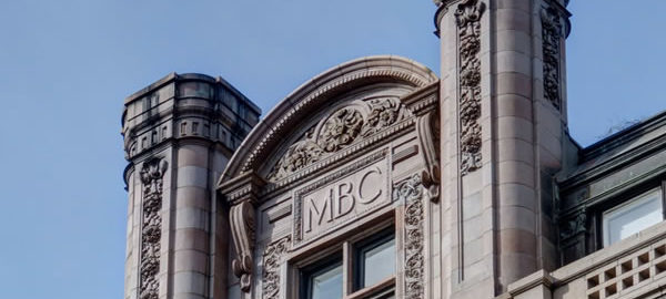
![IMG_6961_2_3Adjust [2/4/2012 12:53:08 PM] IMG_6961_2_3Adjust [2/4/2012 12:53:08 PM]](https://www.newyorkitecture.com/wp-content/gallery/ladies-mile/img_6961_2_3adjust.jpg)
![IMG_6874_5_6Adjust [2/4/2012 12:30:36 PM] IMG_6874_5_6Adjust [2/4/2012 12:30:36 PM]](https://www.newyorkitecture.com/wp-content/gallery/ladies-mile/img_6874_5_6adjust.jpg)
![IMG_6877_8_9Adjust [2/4/2012 12:31:25 PM] IMG_6877_8_9Adjust [2/4/2012 12:31:25 PM]](https://www.newyorkitecture.com/wp-content/gallery/ladies-mile/img_6877_8_9adjust.jpg)
![IMG_6883_4_5Adjust [2/4/2012 12:32:27 PM] IMG_6883_4_5Adjust [2/4/2012 12:32:27 PM]](https://www.newyorkitecture.com/wp-content/gallery/ladies-mile/img_6883_4_5adjust.jpg)
![IMG_6892_3_4Adjust [2/4/2012 12:34:50 PM] IMG_6892_3_4Adjust [2/4/2012 12:34:50 PM]](https://www.newyorkitecture.com/wp-content/gallery/ladies-mile/img_6892_3_4adjust.jpg)
![IMG_6898_899_900Adjust [2/4/2012 12:36:20 PM] IMG_6898_899_900Adjust [2/4/2012 12:36:20 PM]](https://www.newyorkitecture.com/wp-content/gallery/ladies-mile/img_6898_899_900adjust.jpg)
![IMG_6907_8_9Adjust [2/4/2012 12:37:52 PM] IMG_6907_8_9Adjust [2/4/2012 12:37:52 PM]](https://www.newyorkitecture.com/wp-content/gallery/ladies-mile/img_6907_8_9adjust.jpg)
![IMG_6913_4_5Adjust [2/4/2012 12:39:29 PM] IMG_6913_4_5Adjust [2/4/2012 12:39:29 PM]](https://www.newyorkitecture.com/wp-content/gallery/ladies-mile/img_6913_4_5adjust.jpg)
![IMG_6916_7_8Adjust [2/4/2012 12:41:06 PM] IMG_6916_7_8Adjust [2/4/2012 12:41:06 PM]](https://www.newyorkitecture.com/wp-content/gallery/ladies-mile/img_6916_7_8adjust.jpg)
![IMG_6925_6_7Adjust [2/4/2012 12:43:53 PM] IMG_6925_6_7Adjust [2/4/2012 12:43:53 PM]](https://www.newyorkitecture.com/wp-content/gallery/ladies-mile/img_6925_6_7adjust.jpg)
![IMG_6931_2_3Adjust [2/4/2012 12:45:23 PM] IMG_6931_2_3Adjust [2/4/2012 12:45:23 PM]](https://www.newyorkitecture.com/wp-content/gallery/ladies-mile/img_6931_2_3adjust.jpg)
![IMG_6937_8_9Adjust [2/4/2012 12:48:08 PM] IMG_6937_8_9Adjust [2/4/2012 12:48:08 PM]](https://www.newyorkitecture.com/wp-content/gallery/ladies-mile/img_6937_8_9adjust.jpg)
![IMG_6952_3_4Adjust [2/4/2012 12:50:27 PM] IMG_6952_3_4Adjust [2/4/2012 12:50:27 PM]](https://www.newyorkitecture.com/wp-content/gallery/ladies-mile/img_6952_3_4adjust.jpg)
![IMG_6958_59_60Adjust [2/4/2012 12:52:28 PM] IMG_6958_59_60Adjust [2/4/2012 12:52:28 PM]](https://www.newyorkitecture.com/wp-content/gallery/ladies-mile/img_6958_59_60adjust.jpg)
![IMG_6859_60_61Adjust [2/4/2012 12:28:01 PM] IMG_6859_60_61Adjust [2/4/2012 12:28:01 PM]](https://www.newyorkitecture.com/wp-content/gallery/ladies-mile/img_6859_60_61adjust.jpg)
![IMG_6976_7_8Adjust [2/4/2012 12:57:04 PM] IMG_6976_7_8Adjust [2/4/2012 12:57:04 PM]](https://www.newyorkitecture.com/wp-content/gallery/ladies-mile/img_6976_7_8adjust.jpg)
![IMG_6988_89_90Adjust [2/4/2012 12:59:22 PM] IMG_6988_89_90Adjust [2/4/2012 12:59:22 PM]](https://www.newyorkitecture.com/wp-content/gallery/ladies-mile/img_6988_89_90adjust.jpg)
![IMG_7003_4_5Adjust [2/4/2012 1:07:39 PM] IMG_7003_4_5Adjust [2/4/2012 1:07:39 PM]](https://www.newyorkitecture.com/wp-content/gallery/ladies-mile/img_7003_4_5adjust.jpg)
![IMG_7012_3_4Adjust [2/4/2012 1:14:51 PM] IMG_7012_3_4Adjust [2/4/2012 1:14:51 PM]](https://www.newyorkitecture.com/wp-content/gallery/ladies-mile/img_7012_3_4adjust.jpg)
![IMG_7018_19_20Adjust [2/4/2012 1:18:02 PM] IMG_7018_19_20Adjust [2/4/2012 1:18:02 PM]](https://www.newyorkitecture.com/wp-content/gallery/ladies-mile/img_7018_19_20adjust.jpg)
![IMG_7024_5_6Adjust [2/4/2012 1:19:58 PM] IMG_7024_5_6Adjust [2/4/2012 1:19:58 PM]](https://www.newyorkitecture.com/wp-content/gallery/ladies-mile/img_7024_5_6adjust.jpg)
![IMG_7027_8_9Adjust [2/4/2012 1:21:59 PM] IMG_7027_8_9Adjust [2/4/2012 1:21:59 PM]](https://www.newyorkitecture.com/wp-content/gallery/ladies-mile/img_7027_8_9adjust.jpg)
![IMG_7063_4_5Adjust [2/4/2012 1:29:19 PM] IMG_7063_4_5Adjust [2/4/2012 1:29:19 PM]](https://www.newyorkitecture.com/wp-content/gallery/ladies-mile/img_7063_4_5adjust.jpg)
![IMG_7069_70_71Adjust [2/4/2012 1:30:55 PM] IMG_7069_70_71Adjust [2/4/2012 1:30:55 PM]](https://www.newyorkitecture.com/wp-content/gallery/ladies-mile/img_7069_70_71adjust.jpg)
![IMG_7084_5_6Adjust [2/4/2012 1:37:34 PM] IMG_7084_5_6Adjust [2/4/2012 1:37:34 PM]](https://www.newyorkitecture.com/wp-content/gallery/ladies-mile/img_7084_5_6adjust.jpg)
![IMG_7111_2_3Adjust [2/4/2012 1:47:20 PM] IMG_7111_2_3Adjust [2/4/2012 1:47:20 PM]](https://www.newyorkitecture.com/wp-content/gallery/ladies-mile/img_7111_2_3adjust.jpg)
![IMG_7129_30_31Adjust [2/4/2012 1:55:14 PM] IMG_7129_30_31Adjust [2/4/2012 1:55:14 PM]](https://www.newyorkitecture.com/wp-content/gallery/ladies-mile/img_7129_30_31adjust.jpg)
![IMG_6754_5_6Adjust [2/4/2012 11:58:40 AM] IMG_6754_5_6Adjust [2/4/2012 11:58:40 AM]](https://www.newyorkitecture.com/wp-content/gallery/ladies-mile/img_6754_5_6adjust.jpg)
![IMG_5209_10_11 [1/1/2012 12:30:53 PM] IMG_5209_10_11 [1/1/2012 12:30:53 PM]](https://www.newyorkitecture.com/wp-content/gallery/ladies-mile/img_5209_10_11.jpg)
![IMG_6670_1_2Adjust [2/4/2012 11:37:24 AM] IMG_6670_1_2Adjust [2/4/2012 11:37:24 AM]](https://www.newyorkitecture.com/wp-content/gallery/ladies-mile/img_6670_1_2adjust.jpg)
![IMG_6682_3_4Adjust [2/4/2012 11:40:18 AM] IMG_6682_3_4Adjust [2/4/2012 11:40:18 AM]](https://www.newyorkitecture.com/wp-content/gallery/ladies-mile/img_6682_3_4adjust.jpg)
![IMG_6694_5_6Adjust [2/4/2012 11:43:06 AM] IMG_6694_5_6Adjust [2/4/2012 11:43:06 AM]](https://www.newyorkitecture.com/wp-content/gallery/ladies-mile/img_6694_5_6adjust.jpg)
![IMG_6697_8_9Adjust [2/4/2012 11:44:04 AM] IMG_6697_8_9Adjust [2/4/2012 11:44:04 AM]](https://www.newyorkitecture.com/wp-content/gallery/ladies-mile/img_6697_8_9adjust.jpg)
![IMG_6706_7_8Adjust [2/4/2012 11:45:48 AM] IMG_6706_7_8Adjust [2/4/2012 11:45:48 AM]](https://www.newyorkitecture.com/wp-content/gallery/ladies-mile/img_6706_7_8adjust.jpg)
![IMG_6709_10_11Adjust [2/4/2012 11:46:24 AM] IMG_6709_10_11Adjust [2/4/2012 11:46:24 AM]](https://www.newyorkitecture.com/wp-content/gallery/ladies-mile/img_6709_10_11adjust.jpg)
![IMG_6718_19_20Adjust [2/4/2012 11:47:56 AM] IMG_6718_19_20Adjust [2/4/2012 11:47:56 AM]](https://www.newyorkitecture.com/wp-content/gallery/ladies-mile/img_6718_19_20adjust.jpg)
![IMG_6724_5_6Adjust [2/4/2012 11:49:35 AM] IMG_6724_5_6Adjust [2/4/2012 11:49:35 AM]](https://www.newyorkitecture.com/wp-content/gallery/ladies-mile/img_6724_5_6adjust.jpg)
![IMG_6736_7_8Adjust [2/4/2012 11:52:53 AM] IMG_6736_7_8Adjust [2/4/2012 11:52:53 AM]](https://www.newyorkitecture.com/wp-content/gallery/ladies-mile/img_6736_7_8adjust.jpg)
![IMG_6745_6_7Adjust [2/4/2012 11:55:22 AM] IMG_6745_6_7Adjust [2/4/2012 11:55:22 AM]](https://www.newyorkitecture.com/wp-content/gallery/ladies-mile/img_6745_6_7adjust.jpg)
![IMG_6751_2_3Adjust [2/4/2012 11:57:19 AM] IMG_6751_2_3Adjust [2/4/2012 11:57:19 AM]](https://www.newyorkitecture.com/wp-content/gallery/ladies-mile/img_6751_2_3adjust.jpg)
![IMG_5197_8_9 [1/1/2012 12:27:00 PM] IMG_5197_8_9 [1/1/2012 12:27:00 PM]](https://www.newyorkitecture.com/wp-content/gallery/ladies-mile/img_5197_8_9.jpg)
![IMG_6760_1_2Adjust [2/4/2012 11:59:52 AM] IMG_6760_1_2Adjust [2/4/2012 11:59:52 AM]](https://www.newyorkitecture.com/wp-content/gallery/ladies-mile/img_6760_1_2adjust.jpg)
![IMG_6769_70_71Adjust [2/4/2012 12:01:20 PM] IMG_6769_70_71Adjust [2/4/2012 12:01:20 PM]](https://www.newyorkitecture.com/wp-content/gallery/ladies-mile/img_6769_70_71adjust.jpg)
![IMG_6772_3_4Adjust [2/4/2012 12:02:17 PM] IMG_6772_3_4Adjust [2/4/2012 12:02:17 PM]](https://www.newyorkitecture.com/wp-content/gallery/ladies-mile/img_6772_3_4adjust.jpg)
![IMG_6778_79_80Adjust [2/4/2012 12:04:28 PM] IMG_6778_79_80Adjust [2/4/2012 12:04:28 PM]](https://www.newyorkitecture.com/wp-content/gallery/ladies-mile/img_6778_79_80adjust.jpg)
![IMG_6787_8_9Adjust [2/4/2012 12:06:35 PM] IMG_6787_8_9Adjust [2/4/2012 12:06:35 PM]](https://www.newyorkitecture.com/wp-content/gallery/ladies-mile/img_6787_8_9adjust.jpg)
![IMG_6796_7_8Adjust [2/4/2012 12:09:52 PM] IMG_6796_7_8Adjust [2/4/2012 12:09:52 PM]](https://www.newyorkitecture.com/wp-content/gallery/ladies-mile/img_6796_7_8adjust.jpg)
![IMG_6802_3_4Adjust [2/4/2012 12:12:12 PM] IMG_6802_3_4Adjust [2/4/2012 12:12:12 PM]](https://www.newyorkitecture.com/wp-content/gallery/ladies-mile/img_6802_3_4adjust.jpg)
![IMG_6805_6_7Adjust [2/4/2012 12:13:24 PM] IMG_6805_6_7Adjust [2/4/2012 12:13:24 PM]](https://www.newyorkitecture.com/wp-content/gallery/ladies-mile/img_6805_6_7adjust.jpg)
![IMG_6817_8_9Adjust [2/4/2012 12:18:08 PM] IMG_6817_8_9Adjust [2/4/2012 12:18:08 PM]](https://www.newyorkitecture.com/wp-content/gallery/ladies-mile/img_6817_8_9adjust.jpg)
![IMG_6829_30_31Adjust [2/4/2012 12:21:27 PM] IMG_6829_30_31Adjust [2/4/2012 12:21:27 PM]](https://www.newyorkitecture.com/wp-content/gallery/ladies-mile/img_6829_30_31adjust.jpg)
![IMG_6841_2_3Adjust [2/4/2012 12:23:21 PM] IMG_6841_2_3Adjust [2/4/2012 12:23:21 PM]](https://www.newyorkitecture.com/wp-content/gallery/ladies-mile/img_6841_2_3adjust.jpg)
![IMG_6847_8_9Adjust [2/4/2012 12:26:00 PM] IMG_6847_8_9Adjust [2/4/2012 12:26:00 PM]](https://www.newyorkitecture.com/wp-content/gallery/ladies-mile/img_6847_8_9adjust.jpg)
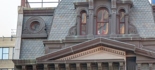
![A_IMG_7186_7_8Adjust [2/5/2012 11:39:27 AM] A_IMG_7186_7_8Adjust [2/5/2012 11:39:27 AM]](https://www.newyorkitecture.com/wp-content/gallery/tribeca-tour/a_img_7186_7_8adjust.jpg)
![A_IMG_9337_8_9Adjust [2/9/2012 12:11:45 PM] A_IMG_9337_8_9Adjust [2/9/2012 12:11:45 PM]](https://www.newyorkitecture.com/wp-content/gallery/tribeca-tour/a_img_9337_8_9adjust.jpg)
![A_IMG_9340_1_2Adjust [2/9/2012 12:12:35 PM] A_IMG_9340_1_2Adjust [2/9/2012 12:12:35 PM]](https://www.newyorkitecture.com/wp-content/gallery/tribeca-tour/a_img_9340_1_2adjust.jpg)
![A_IMG_9391_2_3Adjust [2/9/2012 12:28:29 PM] A_IMG_9391_2_3Adjust [2/9/2012 12:28:29 PM]](https://www.newyorkitecture.com/wp-content/gallery/tribeca-tour/a_img_9391_2_3adjust.jpg)
![B_IMG_7213_4_5Adjust [2/5/2012 11:49:06 AM] B_IMG_7213_4_5Adjust [2/5/2012 11:49:06 AM]](https://www.newyorkitecture.com/wp-content/gallery/tribeca-tour/b_img_7213_4_5adjust.jpg)
![B_IMG_7255_6_7Adjust [2/5/2012 12:00:51 PM] B_IMG_7255_6_7Adjust [2/5/2012 12:00:51 PM]](https://www.newyorkitecture.com/wp-content/gallery/tribeca-tour/b_img_7255_6_7adjust.jpg)
![B_IMG_7261_2_3Adjust [2/5/2012 12:02:22 PM] B_IMG_7261_2_3Adjust [2/5/2012 12:02:22 PM]](https://www.newyorkitecture.com/wp-content/gallery/tribeca-tour/b_img_7261_2_3adjust.jpg)
![B_IMG_7279_80_81Adjust [2/5/2012 12:09:27 PM] B_IMG_7279_80_81Adjust [2/5/2012 12:09:27 PM]](https://www.newyorkitecture.com/wp-content/gallery/tribeca-tour/b_img_7279_80_81adjust.jpg)
![C_IMG_7387_8_9Adjust [2/5/2012 12:42:57 PM] C_IMG_7387_8_9Adjust [2/5/2012 12:42:57 PM]](https://www.newyorkitecture.com/wp-content/gallery/tribeca-tour/c_img_7387_8_9adjust.jpg)
![C_IMG_7486_7_8Adjust [2/5/2012 1:10:14 PM] C_IMG_7486_7_8Adjust [2/5/2012 1:10:14 PM]](https://www.newyorkitecture.com/wp-content/gallery/tribeca-tour/c_img_7486_7_8adjust.jpg)
![C_IMG_7492_3_4Adjust [2/5/2012 1:11:56 PM] C_IMG_7492_3_4Adjust [2/5/2012 1:11:56 PM]](https://www.newyorkitecture.com/wp-content/gallery/tribeca-tour/c_img_7492_3_4adjust.jpg)
![C_IMG_7513_4_5Adjust [2/5/2012 1:15:40 PM] C_IMG_7513_4_5Adjust [2/5/2012 1:15:40 PM]](https://www.newyorkitecture.com/wp-content/gallery/tribeca-tour/c_img_7513_4_5adjust.jpg)
![C_IMG_8314_5_6Adjust [2/6/2012 2:11:45 PM] C_IMG_8314_5_6Adjust [2/6/2012 2:11:45 PM]](https://www.newyorkitecture.com/wp-content/gallery/tribeca-tour/c_img_8314_5_6adjust.jpg)
![C_IMG_8689_90_91Adjust [2/7/2012 11:54:02 AM] C_IMG_8689_90_91Adjust [2/7/2012 11:54:02 AM]](https://www.newyorkitecture.com/wp-content/gallery/tribeca-tour/c_img_8689_90_91adjust.jpg)
![C_IMG_8752_3_4Adjust [2/7/2012 12:14:50 PM] C_IMG_8752_3_4Adjust [2/7/2012 12:14:50 PM]](https://www.newyorkitecture.com/wp-content/gallery/tribeca-tour/c_img_8752_3_4adjust.jpg)
![C_IMG_8758_59_60Adjust [2/7/2012 12:17:32 PM] C_IMG_8758_59_60Adjust [2/7/2012 12:17:32 PM]](https://www.newyorkitecture.com/wp-content/gallery/tribeca-tour/c_img_8758_59_60adjust.jpg)
![C_IMG_8887_8_9Adjust [2/7/2012 12:59:37 PM] C_IMG_8887_8_9Adjust [2/7/2012 12:59:37 PM]](https://www.newyorkitecture.com/wp-content/gallery/tribeca-tour/c_img_8887_8_9adjust.jpg)
![C_IMG_8896_7_8Adjust [2/7/2012 1:00:54 PM] C_IMG_8896_7_8Adjust [2/7/2012 1:00:54 PM]](https://www.newyorkitecture.com/wp-content/gallery/tribeca-tour/c_img_8896_7_8adjust.jpg)
![C_IMG_8899_900_901Adjust [2/7/2012 1:02:04 PM] C_IMG_8899_900_901Adjust [2/7/2012 1:02:04 PM]](https://www.newyorkitecture.com/wp-content/gallery/tribeca-tour/c_img_8899_900_901adjust.jpg)
![D_IMG_8131_2_3Adjust [2/6/2012 1:05:50 PM] D_IMG_8131_2_3Adjust [2/6/2012 1:05:50 PM]](https://www.newyorkitecture.com/wp-content/gallery/tribeca-tour/d_img_8131_2_3adjust.jpg)
![D_IMG_8362_3_4Adjust [2/6/2012 2:33:58 PM] D_IMG_8362_3_4Adjust [2/6/2012 2:33:58 PM]](https://www.newyorkitecture.com/wp-content/gallery/tribeca-tour/d_img_8362_3_4adjust.jpg)
![D_IMG_8374_5_6Adjust [2/6/2012 2:38:39 PM] D_IMG_8374_5_6Adjust [2/6/2012 2:38:39 PM]](https://www.newyorkitecture.com/wp-content/gallery/tribeca-tour/d_img_8374_5_6adjust.jpg)
![D_IMG_8401_2_3Adjust [2/7/2012 10:01:28 AM] D_IMG_8401_2_3Adjust [2/7/2012 10:01:28 AM]](https://www.newyorkitecture.com/wp-content/gallery/tribeca-tour/d_img_8401_2_3adjust.jpg)
![D_IMG_8413_4_5Adjust [2/7/2012 10:07:54 AM] D_IMG_8413_4_5Adjust [2/7/2012 10:07:54 AM]](https://www.newyorkitecture.com/wp-content/gallery/tribeca-tour/d_img_8413_4_5adjust.jpg)
![D_IMG_8428_29_30Adjust [2/7/2012 10:10:05 AM] D_IMG_8428_29_30Adjust [2/7/2012 10:10:05 AM]](https://www.newyorkitecture.com/wp-content/gallery/tribeca-tour/d_img_8428_29_30adjust.jpg)
![D_IMG_8431_2_3Adjust [2/7/2012 10:10:51 AM] D_IMG_8431_2_3Adjust [2/7/2012 10:10:51 AM]](https://www.newyorkitecture.com/wp-content/gallery/tribeca-tour/d_img_8431_2_3adjust.jpg)
![D_IMG_9037_8_9Adjust [2/9/2012 10:16:22 AM] D_IMG_9037_8_9Adjust [2/9/2012 10:16:22 AM]](https://www.newyorkitecture.com/wp-content/gallery/tribeca-tour/d_img_9037_8_9adjust.jpg)
![D_IMG_9043_4_5Adjust [2/9/2012 10:17:02 AM] D_IMG_9043_4_5Adjust [2/9/2012 10:17:02 AM]](https://www.newyorkitecture.com/wp-content/gallery/tribeca-tour/d_img_9043_4_5adjust.jpg)
![D_IMG_9097_8_9Adjust [2/9/2012 10:31:35 AM] D_IMG_9097_8_9Adjust [2/9/2012 10:31:35 AM]](https://www.newyorkitecture.com/wp-content/gallery/tribeca-tour/d_img_9097_8_9adjust.jpg)
![D_IMG_9151_2_3Adjust [2/9/2012 10:59:35 AM] D_IMG_9151_2_3Adjust [2/9/2012 10:59:35 AM]](https://www.newyorkitecture.com/wp-content/gallery/tribeca-tour/d_img_9151_2_3adjust.jpg)
![D_IMG_9220_1_2Adjust [2/9/2012 11:28:58 AM] D_IMG_9220_1_2Adjust [2/9/2012 11:28:58 AM]](https://www.newyorkitecture.com/wp-content/gallery/tribeca-tour/d_img_9220_1_2adjust.jpg)
![E_IMG_7408_09_10Adjust [2/5/2012 12:48:10 PM] E_IMG_7408_09_10Adjust [2/5/2012 12:48:10 PM]](https://www.newyorkitecture.com/wp-content/gallery/tribeca-tour/e_img_7408_09_10adjust.jpg)
![E_IMG_7483_4_5Adjust [2/5/2012 1:08:44 PM] E_IMG_7483_4_5Adjust [2/5/2012 1:08:44 PM]](https://www.newyorkitecture.com/wp-content/gallery/tribeca-tour/e_img_7483_4_5adjust.jpg)
![E_IMG_7561_2_3Adjust [2/5/2012 1:32:24 PM] E_IMG_7561_2_3Adjust [2/5/2012 1:32:24 PM]](https://www.newyorkitecture.com/wp-content/gallery/tribeca-tour/e_img_7561_2_3adjust.jpg)
![E_IMG_8920_1_2Adjust [2/7/2012 1:06:35 PM] E_IMG_8920_1_2Adjust [2/7/2012 1:06:35 PM]](https://www.newyorkitecture.com/wp-content/gallery/tribeca-tour/e_img_8920_1_2adjust.jpg)
![E_IMG_8929_30_31Adjust [2/7/2012 1:08:23 PM] E_IMG_8929_30_31Adjust [2/7/2012 1:08:23 PM]](https://www.newyorkitecture.com/wp-content/gallery/tribeca-tour/e_img_8929_30_31adjust.jpg)
![E_IMG_8941_2_3Adjust [2/7/2012 1:12:54 PM] E_IMG_8941_2_3Adjust [2/7/2012 1:12:54 PM]](https://www.newyorkitecture.com/wp-content/gallery/tribeca-tour/e_img_8941_2_3adjust.jpg)
![F_IMG_7807_8_9Adjust [2/6/2012 10:26:56 AM] F_IMG_7807_8_9Adjust [2/6/2012 10:26:56 AM]](https://www.newyorkitecture.com/wp-content/gallery/tribeca-tour/f_img_7807_8_9adjust.jpg)
![F_IMG_7816_7_8Adjust [2/6/2012 10:30:05 AM] F_IMG_7816_7_8Adjust [2/6/2012 10:30:05 AM]](https://www.newyorkitecture.com/wp-content/gallery/tribeca-tour/f_img_7816_7_8adjust.jpg)
![F_IMG_7822_3_4Adjust [2/6/2012 10:31:58 AM] F_IMG_7822_3_4Adjust [2/6/2012 10:31:58 AM]](https://www.newyorkitecture.com/wp-content/gallery/tribeca-tour/f_img_7822_3_4adjust.jpg)
![F_IMG_7927_8_9Adjust [2/6/2012 11:45:19 AM] F_IMG_7927_8_9Adjust [2/6/2012 11:45:19 AM]](https://www.newyorkitecture.com/wp-content/gallery/tribeca-tour/f_img_7927_8_9adjust.jpg)
![G_IMG_7987_8_9Adjust [2/6/2012 12:16:30 PM] G_IMG_7987_8_9Adjust [2/6/2012 12:16:30 PM]](https://www.newyorkitecture.com/wp-content/gallery/tribeca-tour/g_img_7987_8_9adjust.jpg)
![G_IMG_7993_4_5Adjust [2/6/2012 12:20:04 PM] G_IMG_7993_4_5Adjust [2/6/2012 12:20:04 PM]](https://www.newyorkitecture.com/wp-content/gallery/tribeca-tour/g_img_7993_4_5adjust.jpg)
![G_IMG_7996_7_8Adjust [2/6/2012 12:20:32 PM] G_IMG_7996_7_8Adjust [2/6/2012 12:20:32 PM]](https://www.newyorkitecture.com/wp-content/gallery/tribeca-tour/g_img_7996_7_8adjust.jpg)
![G_IMG_8008_09_10Adjust [2/6/2012 12:23:16 PM] G_IMG_8008_09_10Adjust [2/6/2012 12:23:16 PM]](https://www.newyorkitecture.com/wp-content/gallery/tribeca-tour/g_img_8008_09_10adjust.jpg)
![G_IMG_8011_2_3Adjust [2/6/2012 12:23:49 PM] G_IMG_8011_2_3Adjust [2/6/2012 12:23:49 PM]](https://www.newyorkitecture.com/wp-content/gallery/tribeca-tour/g_img_8011_2_3adjust.jpg)
![H_IMG_8149_50_51Adjust [2/6/2012 1:11:42 PM] H_IMG_8149_50_51Adjust [2/6/2012 1:11:42 PM]](https://www.newyorkitecture.com/wp-content/gallery/tribeca-tour/h_img_8149_50_51adjust.jpg)
![H_IMG_8335_6_7Adjust [2/6/2012 2:22:51 PM] H_IMG_8335_6_7Adjust [2/6/2012 2:22:51 PM]](https://www.newyorkitecture.com/wp-content/gallery/tribeca-tour/h_img_8335_6_7adjust.jpg)
![H_IMG_8587_8_9Adjust [2/7/2012 11:06:25 AM] H_IMG_8587_8_9Adjust [2/7/2012 11:06:25 AM]](https://www.newyorkitecture.com/wp-content/gallery/tribeca-tour/h_img_8587_8_9adjust.jpg)
![I_IMG_8170_1_2Adjust [2/6/2012 1:23:35 PM] I_IMG_8170_1_2Adjust [2/6/2012 1:23:35 PM]](https://www.newyorkitecture.com/wp-content/gallery/tribeca-tour/i_img_8170_1_2adjust.jpg)
![I_IMG_8317_8_9Adjust [2/6/2012 2:15:40 PM] I_IMG_8317_8_9Adjust [2/6/2012 2:15:40 PM]](https://www.newyorkitecture.com/wp-content/gallery/tribeca-tour/i_img_8317_8_9adjust.jpg)
![I_IMG_8836_7_8Adjust [2/7/2012 12:44:09 PM] I_IMG_8836_7_8Adjust [2/7/2012 12:44:09 PM]](https://www.newyorkitecture.com/wp-content/gallery/tribeca-tour/i_img_8836_7_8adjust.jpg)
![J_IMG_8284_5_6Adjust [2/6/2012 2:00:17 PM] J_IMG_8284_5_6Adjust [2/6/2012 2:00:17 PM]](https://www.newyorkitecture.com/wp-content/gallery/tribeca-tour/j_img_8284_5_6adjust.jpg)
![J_IMG_8287_8_9Adjust [2/6/2012 2:01:27 PM] J_IMG_8287_8_9Adjust [2/6/2012 2:01:27 PM]](https://www.newyorkitecture.com/wp-content/gallery/tribeca-tour/j_img_8287_8_9adjust.jpg)
![J_IMG_8845_6_7Adjust [2/7/2012 12:48:51 PM] J_IMG_8845_6_7Adjust [2/7/2012 12:48:51 PM]](https://www.newyorkitecture.com/wp-content/gallery/tribeca-tour/j_img_8845_6_7adjust.jpg)
![J_IMG_8860_1_2Adjust [2/7/2012 12:53:15 PM] J_IMG_8860_1_2Adjust [2/7/2012 12:53:15 PM]](https://www.newyorkitecture.com/wp-content/gallery/tribeca-tour/j_img_8860_1_2adjust.jpg)
![J_IMG_8869_70_71Adjust [2/7/2012 12:54:44 PM] J_IMG_8869_70_71Adjust [2/7/2012 12:54:44 PM]](https://www.newyorkitecture.com/wp-content/gallery/tribeca-tour/j_img_8869_70_71adjust.jpg)
![K_IMG_8776_7_8Adjust [2/7/2012 12:27:15 PM] K_IMG_8776_7_8Adjust [2/7/2012 12:27:15 PM]](https://www.newyorkitecture.com/wp-content/gallery/tribeca-tour/k_img_8776_7_8adjust.jpg)
![K_IMG_8779_80_81Adjust [2/7/2012 12:28:03 PM] K_IMG_8779_80_81Adjust [2/7/2012 12:28:03 PM]](https://www.newyorkitecture.com/wp-content/gallery/tribeca-tour/k_img_8779_80_81adjust.jpg)
![K_IMG_8809_10_11Adjust [2/7/2012 12:37:17 PM] K_IMG_8809_10_11Adjust [2/7/2012 12:37:17 PM]](https://www.newyorkitecture.com/wp-content/gallery/tribeca-tour/k_img_8809_10_11adjust.jpg)
![L_IMG_8380_1_2Adjust [2/6/2012 2:43:08 PM] L_IMG_8380_1_2Adjust [2/6/2012 2:43:08 PM]](https://www.newyorkitecture.com/wp-content/gallery/tribeca-tour/l_img_8380_1_2adjust.jpg)
![L_IMG_8452_3_4Adjust [2/7/2012 10:22:13 AM] L_IMG_8452_3_4Adjust [2/7/2012 10:22:13 AM]](https://www.newyorkitecture.com/wp-content/gallery/tribeca-tour/l_img_8452_3_4adjust.jpg)
![L_IMG_8473_4_5Adjust [2/7/2012 10:26:14 AM] L_IMG_8473_4_5Adjust [2/7/2012 10:26:14 AM]](https://www.newyorkitecture.com/wp-content/gallery/tribeca-tour/l_img_8473_4_5adjust.jpg)
![M_IMG_8365_6_7Adjust [2/6/2012 2:35:52 PM] M_IMG_8365_6_7Adjust [2/6/2012 2:35:52 PM]](https://www.newyorkitecture.com/wp-content/gallery/tribeca-tour/m_img_8365_6_7adjust.jpg)
![M_IMG_8371_2_3Adjust [2/6/2012 2:37:37 PM] M_IMG_8371_2_3Adjust [2/6/2012 2:37:37 PM]](https://www.newyorkitecture.com/wp-content/gallery/tribeca-tour/m_img_8371_2_3adjust.jpg)
![M_IMG_8389_90_91Adjust [2/7/2012 9:55:26 AM] M_IMG_8389_90_91Adjust [2/7/2012 9:55:26 AM]](https://www.newyorkitecture.com/wp-content/gallery/tribeca-tour/m_img_8389_90_91adjust.jpg)
![M_IMG_8398_399_400Adjust [2/7/2012 9:59:46 AM] M_IMG_8398_399_400Adjust [2/7/2012 9:59:46 AM]](https://www.newyorkitecture.com/wp-content/gallery/tribeca-tour/m_img_8398_399_400adjust.jpg)
![N_IMG_8434_5_6Adjust [2/7/2012 10:13:49 AM] N_IMG_8434_5_6Adjust [2/7/2012 10:13:49 AM]](https://www.newyorkitecture.com/wp-content/gallery/tribeca-tour/n_img_8434_5_6adjust.jpg)
![N_IMG_9016_7_8Adjust [2/9/2012 10:13:27 AM] N_IMG_9016_7_8Adjust [2/9/2012 10:13:27 AM]](https://www.newyorkitecture.com/wp-content/gallery/tribeca-tour/n_img_9016_7_8adjust.jpg)
![N_IMG_9052_3_4Adjust [2/9/2012 10:19:54 AM] N_IMG_9052_3_4Adjust [2/9/2012 10:19:54 AM]](https://www.newyorkitecture.com/wp-content/gallery/tribeca-tour/n_img_9052_3_4adjust.jpg)
![Z_IMG_7180_1_2Adjust [2/5/2012 11:36:56 AM] Z_IMG_7180_1_2Adjust [2/5/2012 11:36:56 AM]](https://www.newyorkitecture.com/wp-content/gallery/tribeca-tour/z_img_7180_1_2adjust.jpg)
![Z_IMG_7183_4_5Adjust [2/5/2012 11:38:16 AM] Z_IMG_7183_4_5Adjust [2/5/2012 11:38:16 AM]](https://www.newyorkitecture.com/wp-content/gallery/tribeca-tour/z_img_7183_4_5adjust.jpg)
![Z_IMG_7198_199_200Adjust [2/5/2012 11:41:56 AM] Z_IMG_7198_199_200Adjust [2/5/2012 11:41:56 AM]](https://www.newyorkitecture.com/wp-content/gallery/tribeca-tour/z_img_7198_199_200adjust.jpg)
![Z_IMG_7228_29_30Adjust [2/5/2012 11:52:41 AM] Z_IMG_7228_29_30Adjust [2/5/2012 11:52:41 AM]](https://www.newyorkitecture.com/wp-content/gallery/tribeca-tour/z_img_7228_29_30adjust.jpg)
![Z_IMG_7237_8_9Adjust [2/5/2012 11:55:19 AM] Z_IMG_7237_8_9Adjust [2/5/2012 11:55:19 AM]](https://www.newyorkitecture.com/wp-content/gallery/tribeca-tour/z_img_7237_8_9adjust.jpg)
![Z_IMG_7240_1_2Adjust [2/5/2012 11:56:58 AM] Z_IMG_7240_1_2Adjust [2/5/2012 11:56:58 AM]](https://www.newyorkitecture.com/wp-content/gallery/tribeca-tour/z_img_7240_1_2adjust.jpg)
![Z_IMG_7252_3_4Adjust [2/5/2012 12:00:27 PM] Z_IMG_7252_3_4Adjust [2/5/2012 12:00:27 PM]](https://www.newyorkitecture.com/wp-content/gallery/tribeca-tour/z_img_7252_3_4adjust.jpg)
![Z_IMG_7264_5_6Adjust [2/5/2012 12:04:34 PM] Z_IMG_7264_5_6Adjust [2/5/2012 12:04:34 PM]](https://www.newyorkitecture.com/wp-content/gallery/tribeca-tour/z_img_7264_5_6adjust.jpg)
![Z_IMG_7270_1_2Adjust [2/5/2012 12:07:45 PM] Z_IMG_7270_1_2Adjust [2/5/2012 12:07:45 PM]](https://www.newyorkitecture.com/wp-content/gallery/tribeca-tour/z_img_7270_1_2adjust.jpg)
![Z_IMG_7282_3_4Adjust [2/5/2012 12:12:27 PM] Z_IMG_7282_3_4Adjust [2/5/2012 12:12:27 PM]](https://www.newyorkitecture.com/wp-content/gallery/tribeca-tour/z_img_7282_3_4adjust.jpg)
![Z_IMG_7303_4_5Adjust [2/5/2012 12:18:13 PM] Z_IMG_7303_4_5Adjust [2/5/2012 12:18:13 PM]](https://www.newyorkitecture.com/wp-content/gallery/tribeca-tour/z_img_7303_4_5adjust.jpg)
![Z_IMG_7309_10_11Adjust [2/5/2012 12:19:24 PM] Z_IMG_7309_10_11Adjust [2/5/2012 12:19:24 PM]](https://www.newyorkitecture.com/wp-content/gallery/tribeca-tour/z_img_7309_10_11adjust.jpg)
![Z_IMG_7318_19_20Adjust [2/5/2012 12:20:58 PM] Z_IMG_7318_19_20Adjust [2/5/2012 12:20:58 PM]](https://www.newyorkitecture.com/wp-content/gallery/tribeca-tour/z_img_7318_19_20adjust.jpg)
![Z_IMG_7321_2_3Adjust [2/5/2012 12:23:08 PM] Z_IMG_7321_2_3Adjust [2/5/2012 12:23:08 PM]](https://www.newyorkitecture.com/wp-content/gallery/tribeca-tour/z_img_7321_2_3adjust.jpg)
![Z_IMG_7327_8_9Adjust [2/5/2012 12:25:58 PM] Z_IMG_7327_8_9Adjust [2/5/2012 12:25:58 PM]](https://www.newyorkitecture.com/wp-content/gallery/tribeca-tour/z_img_7327_8_9adjust.jpg)
![Z_IMG_7333_4_5Adjust [2/5/2012 12:27:45 PM] Z_IMG_7333_4_5Adjust [2/5/2012 12:27:45 PM]](https://www.newyorkitecture.com/wp-content/gallery/tribeca-tour/z_img_7333_4_5adjust.jpg)
![Z_IMG_7336_7_8Adjust [2/5/2012 12:28:21 PM] Z_IMG_7336_7_8Adjust [2/5/2012 12:28:21 PM]](https://www.newyorkitecture.com/wp-content/gallery/tribeca-tour/z_img_7336_7_8adjust.jpg)
![Z_IMG_7345_6_7Adjust [2/5/2012 12:31:07 PM] Z_IMG_7345_6_7Adjust [2/5/2012 12:31:07 PM]](https://www.newyorkitecture.com/wp-content/gallery/tribeca-tour/z_img_7345_6_7adjust.jpg)
![Z_IMG_7357_8_9Adjust [2/5/2012 12:32:59 PM] Z_IMG_7357_8_9Adjust [2/5/2012 12:32:59 PM]](https://www.newyorkitecture.com/wp-content/gallery/tribeca-tour/z_img_7357_8_9adjust.jpg)
![Z_IMG_7360_1_2Adjust [2/5/2012 12:34:47 PM] Z_IMG_7360_1_2Adjust [2/5/2012 12:34:47 PM]](https://www.newyorkitecture.com/wp-content/gallery/tribeca-tour/z_img_7360_1_2adjust.jpg)
![Z_IMG_7399_400_401Adjust [2/5/2012 12:46:23 PM] Z_IMG_7399_400_401Adjust [2/5/2012 12:46:23 PM]](https://www.newyorkitecture.com/wp-content/gallery/tribeca-tour/z_img_7399_400_401adjust.jpg)
![Z_IMG_7405_6_7Adjust [2/5/2012 12:47:17 PM] Z_IMG_7405_6_7Adjust [2/5/2012 12:47:17 PM]](https://www.newyorkitecture.com/wp-content/gallery/tribeca-tour/z_img_7405_6_7adjust.jpg)
![Z_IMG_7420_1_2Adjust [2/5/2012 12:50:34 PM] Z_IMG_7420_1_2Adjust [2/5/2012 12:50:34 PM]](https://www.newyorkitecture.com/wp-content/gallery/tribeca-tour/z_img_7420_1_2adjust.jpg)
![Z_IMG_7426_7_8Adjust [2/5/2012 12:51:29 PM] Z_IMG_7426_7_8Adjust [2/5/2012 12:51:29 PM]](https://www.newyorkitecture.com/wp-content/gallery/tribeca-tour/z_img_7426_7_8adjust.jpg)
![Z_IMG_7441_2_3Adjust [2/5/2012 12:54:18 PM] Z_IMG_7441_2_3Adjust [2/5/2012 12:54:18 PM]](https://www.newyorkitecture.com/wp-content/gallery/tribeca-tour/z_img_7441_2_3adjust.jpg)
![Z_IMG_7447_8_9Adjust [2/5/2012 12:56:15 PM] Z_IMG_7447_8_9Adjust [2/5/2012 12:56:15 PM]](https://www.newyorkitecture.com/wp-content/gallery/tribeca-tour/z_img_7447_8_9adjust.jpg)
![Z_IMG_7453_4_5Adjust [2/5/2012 12:58:05 PM] Z_IMG_7453_4_5Adjust [2/5/2012 12:58:05 PM]](https://www.newyorkitecture.com/wp-content/gallery/tribeca-tour/z_img_7453_4_5adjust.jpg)
![Z_IMG_7468_69_70Adjust [2/5/2012 1:04:14 PM] Z_IMG_7468_69_70Adjust [2/5/2012 1:04:14 PM]](https://www.newyorkitecture.com/wp-content/gallery/tribeca-tour/z_img_7468_69_70adjust.jpg)
![Z_IMG_7474_5_6Adjust [2/5/2012 1:05:39 PM] Z_IMG_7474_5_6Adjust [2/5/2012 1:05:39 PM]](https://www.newyorkitecture.com/wp-content/gallery/tribeca-tour/z_img_7474_5_6adjust.jpg)
![Z_IMG_7480_1_2Adjust [2/5/2012 1:06:59 PM] Z_IMG_7480_1_2Adjust [2/5/2012 1:06:59 PM]](https://www.newyorkitecture.com/wp-content/gallery/tribeca-tour/z_img_7480_1_2adjust.jpg)
![Z_IMG_7519_20_21Adjust [2/5/2012 1:16:54 PM] Z_IMG_7519_20_21Adjust [2/5/2012 1:16:54 PM]](https://www.newyorkitecture.com/wp-content/gallery/tribeca-tour/z_img_7519_20_21adjust.jpg)
![Z_IMG_7525_6_7Adjust [2/5/2012 1:18:35 PM] Z_IMG_7525_6_7Adjust [2/5/2012 1:18:35 PM]](https://www.newyorkitecture.com/wp-content/gallery/tribeca-tour/z_img_7525_6_7adjust.jpg)
![Z_IMG_7537_8_9Adjust [2/5/2012 1:24:35 PM] Z_IMG_7537_8_9Adjust [2/5/2012 1:24:35 PM]](https://www.newyorkitecture.com/wp-content/gallery/tribeca-tour/z_img_7537_8_9adjust.jpg)
![Z_IMG_7543_4_5Adjust [2/5/2012 1:28:58 PM] Z_IMG_7543_4_5Adjust [2/5/2012 1:28:58 PM]](https://www.newyorkitecture.com/wp-content/gallery/tribeca-tour/z_img_7543_4_5adjust.jpg)
![Z_IMG_7570_1_2Adjust [2/5/2012 1:38:19 PM] Z_IMG_7570_1_2Adjust [2/5/2012 1:38:19 PM]](https://www.newyorkitecture.com/wp-content/gallery/tribeca-tour/z_img_7570_1_2adjust.jpg)
![Z_IMG_7576_7_8Adjust [2/5/2012 1:41:16 PM] Z_IMG_7576_7_8Adjust [2/5/2012 1:41:16 PM]](https://www.newyorkitecture.com/wp-content/gallery/tribeca-tour/z_img_7576_7_8adjust.jpg)
![Z_IMG_7612_3_4Adjust [2/5/2012 1:49:53 PM] Z_IMG_7612_3_4Adjust [2/5/2012 1:49:53 PM]](https://www.newyorkitecture.com/wp-content/gallery/tribeca-tour/z_img_7612_3_4adjust.jpg)
![Z_IMG_7786_7_8Adjust [2/6/2012 10:16:25 AM] Z_IMG_7786_7_8Adjust [2/6/2012 10:16:25 AM]](https://www.newyorkitecture.com/wp-content/gallery/tribeca-tour/z_img_7786_7_8adjust.jpg)
![Z_IMG_7789_90_91Adjust [2/6/2012 10:20:11 AM] Z_IMG_7789_90_91Adjust [2/6/2012 10:20:11 AM]](https://www.newyorkitecture.com/wp-content/gallery/tribeca-tour/z_img_7789_90_91adjust.jpg)
![Z_IMG_7804_5_6Adjust [2/6/2012 10:25:17 AM] Z_IMG_7804_5_6Adjust [2/6/2012 10:25:17 AM]](https://www.newyorkitecture.com/wp-content/gallery/tribeca-tour/z_img_7804_5_6adjust.jpg)
![Z_IMG_7834_5_6Adjust [2/6/2012 10:39:11 AM] Z_IMG_7834_5_6Adjust [2/6/2012 10:39:11 AM]](https://www.newyorkitecture.com/wp-content/gallery/tribeca-tour/z_img_7834_5_6adjust.jpg)
![Z_IMG_7837_8_9Adjust [2/6/2012 10:46:21 AM] Z_IMG_7837_8_9Adjust [2/6/2012 10:46:21 AM]](https://www.newyorkitecture.com/wp-content/gallery/tribeca-tour/z_img_7837_8_9adjust.jpg)
![Z_IMG_7861_2_3Adjust [2/6/2012 11:01:57 AM] Z_IMG_7861_2_3Adjust [2/6/2012 11:01:57 AM]](https://www.newyorkitecture.com/wp-content/gallery/tribeca-tour/z_img_7861_2_3adjust.jpg)
![Z_IMG_7939_40_41Adjust [2/6/2012 11:53:23 AM] Z_IMG_7939_40_41Adjust [2/6/2012 11:53:23 AM]](https://www.newyorkitecture.com/wp-content/gallery/tribeca-tour/z_img_7939_40_41adjust.jpg)
![Z_IMG_7957_8_9Adjust [2/6/2012 11:59:58 AM] Z_IMG_7957_8_9Adjust [2/6/2012 11:59:58 AM]](https://www.newyorkitecture.com/wp-content/gallery/tribeca-tour/z_img_7957_8_9adjust.jpg)
![Z_IMG_7966_7_8Adjust [2/6/2012 12:03:59 PM] Z_IMG_7966_7_8Adjust [2/6/2012 12:03:59 PM]](https://www.newyorkitecture.com/wp-content/gallery/tribeca-tour/z_img_7966_7_8adjust.jpg)
![Z_IMG_7978_79_80Adjust [2/6/2012 12:08:32 PM] Z_IMG_7978_79_80Adjust [2/6/2012 12:08:32 PM]](https://www.newyorkitecture.com/wp-content/gallery/tribeca-tour/z_img_7978_79_80adjust.jpg)
![Z_IMG_7984_5_6Adjust [2/6/2012 12:13:25 PM] Z_IMG_7984_5_6Adjust [2/6/2012 12:13:25 PM]](https://www.newyorkitecture.com/wp-content/gallery/tribeca-tour/z_img_7984_5_6adjust.jpg)
![Z_IMG_8005_6_7Adjust [2/6/2012 12:22:09 PM] Z_IMG_8005_6_7Adjust [2/6/2012 12:22:09 PM]](https://www.newyorkitecture.com/wp-content/gallery/tribeca-tour/z_img_8005_6_7adjust.jpg)
![Z_IMG_8017_8_9Adjust [2/6/2012 12:25:38 PM] Z_IMG_8017_8_9Adjust [2/6/2012 12:25:38 PM]](https://www.newyorkitecture.com/wp-content/gallery/tribeca-tour/z_img_8017_8_9adjust.jpg)
![Z_IMG_8020_1_2Adjust [2/6/2012 12:27:00 PM] Z_IMG_8020_1_2Adjust [2/6/2012 12:27:00 PM]](https://www.newyorkitecture.com/wp-content/gallery/tribeca-tour/z_img_8020_1_2adjust.jpg)
![Z_IMG_8023_4_5Adjust [2/6/2012 12:27:37 PM] Z_IMG_8023_4_5Adjust [2/6/2012 12:27:37 PM]](https://www.newyorkitecture.com/wp-content/gallery/tribeca-tour/z_img_8023_4_5adjust.jpg)
![Z_IMG_8035_6_7Adjust [2/6/2012 12:38:12 PM] Z_IMG_8035_6_7Adjust [2/6/2012 12:38:12 PM]](https://www.newyorkitecture.com/wp-content/gallery/tribeca-tour/z_img_8035_6_7adjust.jpg)
![Z_IMG_8044_5_6Adjust [2/6/2012 12:39:45 PM] Z_IMG_8044_5_6Adjust [2/6/2012 12:39:45 PM]](https://www.newyorkitecture.com/wp-content/gallery/tribeca-tour/z_img_8044_5_6adjust.jpg)
![Z_IMG_8053_4_5Adjust [2/6/2012 12:41:43 PM] Z_IMG_8053_4_5Adjust [2/6/2012 12:41:43 PM]](https://www.newyorkitecture.com/wp-content/gallery/tribeca-tour/z_img_8053_4_5adjust.jpg)
![Z_IMG_8080_1_2Adjust [2/6/2012 12:48:08 PM] Z_IMG_8080_1_2Adjust [2/6/2012 12:48:08 PM]](https://www.newyorkitecture.com/wp-content/gallery/tribeca-tour/z_img_8080_1_2adjust.jpg)
![Z_IMG_8083_4_5Adjust [2/6/2012 12:49:19 PM] Z_IMG_8083_4_5Adjust [2/6/2012 12:49:19 PM]](https://www.newyorkitecture.com/wp-content/gallery/tribeca-tour/z_img_8083_4_5adjust.jpg)
![Z_IMG_8089_90_91Adjust [2/6/2012 12:50:54 PM] Z_IMG_8089_90_91Adjust [2/6/2012 12:50:54 PM]](https://www.newyorkitecture.com/wp-content/gallery/tribeca-tour/z_img_8089_90_91adjust.jpg)
![Z_IMG_8104_5_6Adjust [2/6/2012 12:54:28 PM] Z_IMG_8104_5_6Adjust [2/6/2012 12:54:28 PM]](https://www.newyorkitecture.com/wp-content/gallery/tribeca-tour/z_img_8104_5_6adjust.jpg)
![Z_IMG_8113_4_5Adjust [2/6/2012 1:00:11 PM] Z_IMG_8113_4_5Adjust [2/6/2012 1:00:11 PM]](https://www.newyorkitecture.com/wp-content/gallery/tribeca-tour/z_img_8113_4_5adjust.jpg)
![Z_IMG_8119_20_21Adjust [2/6/2012 1:01:54 PM] Z_IMG_8119_20_21Adjust [2/6/2012 1:01:54 PM]](https://www.newyorkitecture.com/wp-content/gallery/tribeca-tour/z_img_8119_20_21adjust.jpg)
![Z_IMG_8125_6_7Adjust [2/6/2012 1:03:57 PM] Z_IMG_8125_6_7Adjust [2/6/2012 1:03:57 PM]](https://www.newyorkitecture.com/wp-content/gallery/tribeca-tour/z_img_8125_6_7adjust.jpg)
![Z_IMG_8143_4_5Adjust [2/6/2012 1:09:03 PM] Z_IMG_8143_4_5Adjust [2/6/2012 1:09:03 PM]](https://www.newyorkitecture.com/wp-content/gallery/tribeca-tour/z_img_8143_4_5adjust.jpg)
![Z_IMG_8152_3_4Adjust [2/6/2012 1:19:07 PM] Z_IMG_8152_3_4Adjust [2/6/2012 1:19:07 PM]](https://www.newyorkitecture.com/wp-content/gallery/tribeca-tour/z_img_8152_3_4adjust.jpg)
![Z_IMG_8158_59_60Adjust [2/6/2012 1:20:32 PM] Z_IMG_8158_59_60Adjust [2/6/2012 1:20:32 PM]](https://www.newyorkitecture.com/wp-content/gallery/tribeca-tour/z_img_8158_59_60adjust.jpg)
![Z_IMG_8161_2_3Adjust [2/6/2012 1:22:09 PM] Z_IMG_8161_2_3Adjust [2/6/2012 1:22:09 PM]](https://www.newyorkitecture.com/wp-content/gallery/tribeca-tour/z_img_8161_2_3adjust.jpg)
![Z_IMG_8176_7_8Adjust [2/6/2012 1:25:10 PM] Z_IMG_8176_7_8Adjust [2/6/2012 1:25:10 PM]](https://www.newyorkitecture.com/wp-content/gallery/tribeca-tour/z_img_8176_7_8adjust.jpg)
![Z_IMG_8182_3_4Adjust [2/6/2012 1:27:52 PM] Z_IMG_8182_3_4Adjust [2/6/2012 1:27:52 PM]](https://www.newyorkitecture.com/wp-content/gallery/tribeca-tour/z_img_8182_3_4adjust.jpg)
![Z_IMG_8197_8_9Adjust [2/6/2012 1:32:39 PM] Z_IMG_8197_8_9Adjust [2/6/2012 1:32:39 PM]](https://www.newyorkitecture.com/wp-content/gallery/tribeca-tour/z_img_8197_8_9adjust.jpg)
![Z_IMG_8209_10_11Adjust [2/6/2012 1:38:33 PM] Z_IMG_8209_10_11Adjust [2/6/2012 1:38:33 PM]](https://www.newyorkitecture.com/wp-content/gallery/tribeca-tour/z_img_8209_10_11adjust.jpg)
![Z_IMG_8221_2_3Adjust [2/6/2012 1:40:50 PM] Z_IMG_8221_2_3Adjust [2/6/2012 1:40:50 PM]](https://www.newyorkitecture.com/wp-content/gallery/tribeca-tour/z_img_8221_2_3adjust.jpg)
![Z_IMG_8239_40_41Adjust [2/6/2012 1:45:00 PM] Z_IMG_8239_40_41Adjust [2/6/2012 1:45:00 PM]](https://www.newyorkitecture.com/wp-content/gallery/tribeca-tour/z_img_8239_40_41adjust.jpg)
![Z_IMG_8248_49_50Adjust [2/6/2012 1:48:25 PM] Z_IMG_8248_49_50Adjust [2/6/2012 1:48:25 PM]](https://www.newyorkitecture.com/wp-content/gallery/tribeca-tour/z_img_8248_49_50adjust.jpg)
![Z_IMG_8254_5_6Adjust [2/6/2012 1:51:22 PM] Z_IMG_8254_5_6Adjust [2/6/2012 1:51:22 PM]](https://www.newyorkitecture.com/wp-content/gallery/tribeca-tour/z_img_8254_5_6adjust.jpg)
![Z_IMG_8296_7_8Adjust [2/6/2012 2:06:02 PM] Z_IMG_8296_7_8Adjust [2/6/2012 2:06:02 PM]](https://www.newyorkitecture.com/wp-content/gallery/tribeca-tour/z_img_8296_7_8adjust.jpg)
![Z_IMG_8329_30_31Adjust [2/6/2012 2:20:07 PM] Z_IMG_8329_30_31Adjust [2/6/2012 2:20:07 PM]](https://www.newyorkitecture.com/wp-content/gallery/tribeca-tour/z_img_8329_30_31adjust.jpg)
![Z_IMG_8338_39_40Adjust [2/6/2012 2:24:47 PM] Z_IMG_8338_39_40Adjust [2/6/2012 2:24:47 PM]](https://www.newyorkitecture.com/wp-content/gallery/tribeca-tour/z_img_8338_39_40adjust.jpg)
![Z_IMG_8497_8_9Adjust [2/7/2012 10:34:52 AM] Z_IMG_8497_8_9Adjust [2/7/2012 10:34:52 AM]](https://www.newyorkitecture.com/wp-content/gallery/tribeca-tour/z_img_8497_8_9adjust.jpg)
![Z_IMG_8521_2_3Adjust [2/7/2012 10:39:37 AM] Z_IMG_8521_2_3Adjust [2/7/2012 10:39:37 AM]](https://www.newyorkitecture.com/wp-content/gallery/tribeca-tour/z_img_8521_2_3adjust.jpg)
![Z_IMG_8536_7_8Adjust [2/7/2012 10:43:16 AM] Z_IMG_8536_7_8Adjust [2/7/2012 10:43:16 AM]](https://www.newyorkitecture.com/wp-content/gallery/tribeca-tour/z_img_8536_7_8adjust.jpg)
![Z_IMG_8548_49_50Adjust [2/7/2012 10:46:43 AM] Z_IMG_8548_49_50Adjust [2/7/2012 10:46:43 AM]](https://www.newyorkitecture.com/wp-content/gallery/tribeca-tour/z_img_8548_49_50adjust.jpg)
![Z_IMG_8563_4_5Adjust [2/7/2012 10:57:19 AM] Z_IMG_8563_4_5Adjust [2/7/2012 10:57:19 AM]](https://www.newyorkitecture.com/wp-content/gallery/tribeca-tour/z_img_8563_4_5adjust.jpg)
![Z_IMG_8566_7_8Adjust [2/7/2012 10:58:28 AM] Z_IMG_8566_7_8Adjust [2/7/2012 10:58:28 AM]](https://www.newyorkitecture.com/wp-content/gallery/tribeca-tour/z_img_8566_7_8adjust.jpg)
![Z_IMG_8578_79_80Adjust [2/7/2012 11:02:06 AM] Z_IMG_8578_79_80Adjust [2/7/2012 11:02:06 AM]](https://www.newyorkitecture.com/wp-content/gallery/tribeca-tour/z_img_8578_79_80adjust.jpg)
![Z_IMG_8596_7_8Adjust [2/7/2012 11:09:13 AM] Z_IMG_8596_7_8Adjust [2/7/2012 11:09:13 AM]](https://www.newyorkitecture.com/wp-content/gallery/tribeca-tour/z_img_8596_7_8adjust.jpg)
![Z_IMG_8599_600_601Adjust [2/7/2012 11:13:58 AM] Z_IMG_8599_600_601Adjust [2/7/2012 11:13:58 AM]](https://www.newyorkitecture.com/wp-content/gallery/tribeca-tour/z_img_8599_600_601adjust.jpg)
![Z_IMG_8635_6_7Adjust [2/7/2012 11:24:42 AM] Z_IMG_8635_6_7Adjust [2/7/2012 11:24:42 AM]](https://www.newyorkitecture.com/wp-content/gallery/tribeca-tour/z_img_8635_6_7adjust.jpg)
![Z_IMG_8641_2_3Adjust [2/7/2012 11:27:01 AM] Z_IMG_8641_2_3Adjust [2/7/2012 11:27:01 AM]](https://www.newyorkitecture.com/wp-content/gallery/tribeca-tour/z_img_8641_2_3adjust.jpg)
![Z_IMG_8650_1_2Adjust [2/7/2012 11:37:35 AM] Z_IMG_8650_1_2Adjust [2/7/2012 11:37:35 AM]](https://www.newyorkitecture.com/wp-content/gallery/tribeca-tour/z_img_8650_1_2adjust.jpg)
![Z_IMG_8659_60_61Adjust [2/7/2012 11:39:28 AM] Z_IMG_8659_60_61Adjust [2/7/2012 11:39:28 AM]](https://www.newyorkitecture.com/wp-content/gallery/tribeca-tour/z_img_8659_60_61adjust.jpg)
![Z_IMG_8713_4_5Adjust [2/7/2012 11:58:33 AM] Z_IMG_8713_4_5Adjust [2/7/2012 11:58:33 AM]](https://www.newyorkitecture.com/wp-content/gallery/tribeca-tour/z_img_8713_4_5adjust.jpg)
![Z_IMG_8728_29_30Adjust [2/7/2012 12:03:16 PM] Z_IMG_8728_29_30Adjust [2/7/2012 12:03:16 PM]](https://www.newyorkitecture.com/wp-content/gallery/tribeca-tour/z_img_8728_29_30adjust.jpg)
![Z_IMG_8734_5_6Adjust [2/7/2012 12:06:09 PM] Z_IMG_8734_5_6Adjust [2/7/2012 12:06:09 PM]](https://www.newyorkitecture.com/wp-content/gallery/tribeca-tour/z_img_8734_5_6adjust.jpg)
![Z_IMG_8743_4_5Adjust [2/7/2012 12:11:25 PM] Z_IMG_8743_4_5Adjust [2/7/2012 12:11:25 PM]](https://www.newyorkitecture.com/wp-content/gallery/tribeca-tour/z_img_8743_4_5adjust.jpg)
![Z_IMG_8764_5_6Adjust [2/7/2012 12:19:59 PM] Z_IMG_8764_5_6Adjust [2/7/2012 12:19:59 PM]](https://www.newyorkitecture.com/wp-content/gallery/tribeca-tour/z_img_8764_5_6adjust.jpg)
![Z_IMG_8782_3_4Adjust [2/7/2012 12:29:47 PM] Z_IMG_8782_3_4Adjust [2/7/2012 12:29:47 PM]](https://www.newyorkitecture.com/wp-content/gallery/tribeca-tour/z_img_8782_3_4adjust.jpg)
![Z_IMG_8797_8_9Adjust [2/7/2012 12:33:46 PM] Z_IMG_8797_8_9Adjust [2/7/2012 12:33:46 PM]](https://www.newyorkitecture.com/wp-content/gallery/tribeca-tour/z_img_8797_8_9adjust.jpg)
![Z_IMG_8812_3_4Adjust [2/7/2012 12:38:14 PM] Z_IMG_8812_3_4Adjust [2/7/2012 12:38:14 PM]](https://www.newyorkitecture.com/wp-content/gallery/tribeca-tour/z_img_8812_3_4adjust.jpg)
![Z_IMG_8848_49_50Adjust [2/7/2012 12:50:33 PM] Z_IMG_8848_49_50Adjust [2/7/2012 12:50:33 PM]](https://www.newyorkitecture.com/wp-content/gallery/tribeca-tour/z_img_8848_49_50adjust.jpg)
![Z_IMG_8851_2_3Adjust [2/7/2012 12:50:59 PM] Z_IMG_8851_2_3Adjust [2/7/2012 12:50:59 PM]](https://www.newyorkitecture.com/wp-content/gallery/tribeca-tour/z_img_8851_2_3adjust.jpg)
![Z_IMG_8875_6_7Adjust [2/7/2012 12:56:39 PM] Z_IMG_8875_6_7Adjust [2/7/2012 12:56:39 PM]](https://www.newyorkitecture.com/wp-content/gallery/tribeca-tour/z_img_8875_6_7adjust.jpg)
![Z_IMG_8881_2_3Adjust [2/7/2012 12:57:18 PM] Z_IMG_8881_2_3Adjust [2/7/2012 12:57:18 PM]](https://www.newyorkitecture.com/wp-content/gallery/tribeca-tour/z_img_8881_2_3adjust.jpg)
![Z_IMG_8944_5_6Adjust [2/7/2012 1:17:26 PM] Z_IMG_8944_5_6Adjust [2/7/2012 1:17:26 PM]](https://www.newyorkitecture.com/wp-content/gallery/tribeca-tour/z_img_8944_5_6adjust.jpg)
![Z_IMG_8947_8_9Adjust [2/7/2012 1:18:27 PM] Z_IMG_8947_8_9Adjust [2/7/2012 1:18:27 PM]](https://www.newyorkitecture.com/wp-content/gallery/tribeca-tour/z_img_8947_8_9adjust.jpg)
![Z_IMG_8959_60_61Adjust [2/7/2012 1:22:19 PM] Z_IMG_8959_60_61Adjust [2/7/2012 1:22:19 PM]](https://www.newyorkitecture.com/wp-content/gallery/tribeca-tour/z_img_8959_60_61adjust.jpg)
![Z_IMG_8971_2_3Adjust [2/7/2012 1:29:39 PM] Z_IMG_8971_2_3Adjust [2/7/2012 1:29:39 PM]](https://www.newyorkitecture.com/wp-content/gallery/tribeca-tour/z_img_8971_2_3adjust.jpg)
![Z_IMG_9196_7_8Adjust [2/9/2012 11:14:33 AM] Z_IMG_9196_7_8Adjust [2/9/2012 11:14:33 AM]](https://www.newyorkitecture.com/wp-content/gallery/tribeca-tour/z_img_9196_7_8adjust.jpg)
![Z_IMG_9214_5_6Adjust [2/9/2012 11:22:06 AM] Z_IMG_9214_5_6Adjust [2/9/2012 11:22:06 AM]](https://www.newyorkitecture.com/wp-content/gallery/tribeca-tour/z_img_9214_5_6adjust.jpg)
![Z_IMG_9226_7_8Adjust [2/9/2012 11:31:47 AM] Z_IMG_9226_7_8Adjust [2/9/2012 11:31:47 AM]](https://www.newyorkitecture.com/wp-content/gallery/tribeca-tour/z_img_9226_7_8adjust.jpg)
![Z_IMG_9235_6_7Adjust [2/9/2012 11:36:17 AM] Z_IMG_9235_6_7Adjust [2/9/2012 11:36:17 AM]](https://www.newyorkitecture.com/wp-content/gallery/tribeca-tour/z_img_9235_6_7adjust.jpg)
![Z_IMG_9241_2_3Adjust [2/9/2012 11:40:43 AM] Z_IMG_9241_2_3Adjust [2/9/2012 11:40:43 AM]](https://www.newyorkitecture.com/wp-content/gallery/tribeca-tour/z_img_9241_2_3adjust.jpg)
![Z_IMG_9244_5_6Adjust [2/9/2012 11:41:31 AM] Z_IMG_9244_5_6Adjust [2/9/2012 11:41:31 AM]](https://www.newyorkitecture.com/wp-content/gallery/tribeca-tour/z_img_9244_5_6adjust.jpg)
![Z_IMG_9250_1_2Adjust [2/9/2012 11:43:23 AM] Z_IMG_9250_1_2Adjust [2/9/2012 11:43:23 AM]](https://www.newyorkitecture.com/wp-content/gallery/tribeca-tour/z_img_9250_1_2adjust.jpg)
![Z_IMG_9262_3_4Adjust [2/9/2012 11:47:46 AM] Z_IMG_9262_3_4Adjust [2/9/2012 11:47:46 AM]](https://www.newyorkitecture.com/wp-content/gallery/tribeca-tour/z_img_9262_3_4adjust.jpg)
![Z_IMG_9280_1_2Adjust [2/9/2012 11:52:51 AM] Z_IMG_9280_1_2Adjust [2/9/2012 11:52:51 AM]](https://www.newyorkitecture.com/wp-content/gallery/tribeca-tour/z_img_9280_1_2adjust.jpg)
![Z_IMG_9292_3_4Adjust [2/9/2012 11:58:02 AM] Z_IMG_9292_3_4Adjust [2/9/2012 11:58:02 AM]](https://www.newyorkitecture.com/wp-content/gallery/tribeca-tour/z_img_9292_3_4adjust.jpg)
![Z_IMG_9310_1_2Adjust [2/9/2012 12:05:28 PM] Z_IMG_9310_1_2Adjust [2/9/2012 12:05:28 PM]](https://www.newyorkitecture.com/wp-content/gallery/tribeca-tour/z_img_9310_1_2adjust.jpg)
![Z_IMG_9358_59_60Adjust [2/9/2012 12:17:36 PM] Z_IMG_9358_59_60Adjust [2/9/2012 12:17:36 PM]](https://www.newyorkitecture.com/wp-content/gallery/tribeca-tour/z_img_9358_59_60adjust.jpg)
![Z_IMG_9379_80_81Adjust [2/9/2012 12:25:11 PM] Z_IMG_9379_80_81Adjust [2/9/2012 12:25:11 PM]](https://www.newyorkitecture.com/wp-content/gallery/tribeca-tour/z_img_9379_80_81adjust.jpg)
![Z_IMG_9412_3_4Adjust [2/9/2012 12:33:43 PM] Z_IMG_9412_3_4Adjust [2/9/2012 12:33:43 PM]](https://www.newyorkitecture.com/wp-content/gallery/tribeca-tour/z_img_9412_3_4adjust.jpg)
![Z_IMG_9424_5_6Adjust [2/9/2012 12:36:09 PM] Z_IMG_9424_5_6Adjust [2/9/2012 12:36:09 PM]](https://www.newyorkitecture.com/wp-content/gallery/tribeca-tour/z_img_9424_5_6adjust.jpg)
![Z_IMG_9430_1_2Adjust [2/9/2012 12:39:46 PM] Z_IMG_9430_1_2Adjust [2/9/2012 12:39:46 PM]](https://www.newyorkitecture.com/wp-content/gallery/tribeca-tour/z_img_9430_1_2adjust.jpg)
![Z_IMG_9457_8_9Adjust [2/9/2012 12:45:05 PM] Z_IMG_9457_8_9Adjust [2/9/2012 12:45:05 PM]](https://www.newyorkitecture.com/wp-content/gallery/tribeca-tour/z_img_9457_8_9adjust.jpg)
![Z_IMG_9460_1_2Adjust [2/9/2012 12:46:23 PM] Z_IMG_9460_1_2Adjust [2/9/2012 12:46:23 PM]](https://www.newyorkitecture.com/wp-content/gallery/tribeca-tour/z_img_9460_1_2adjust.jpg)
![Z_IMG_9481_2_3Adjust [2/9/2012 12:50:29 PM] Z_IMG_9481_2_3Adjust [2/9/2012 12:50:29 PM]](https://www.newyorkitecture.com/wp-content/gallery/tribeca-tour/z_img_9481_2_3adjust.jpg)
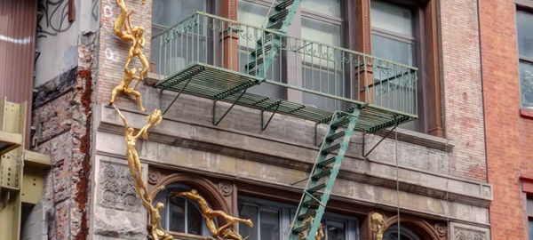
![IMG_0448_49_50Adjust [2/19/2012 2:01:17 PM] IMG_0448_49_50Adjust [2/19/2012 2:01:17 PM]](https://www.newyorkitecture.com/wp-content/gallery/bond-street-noho/img_0448_49_50adjust.jpg)
![IMG_0553_4_5Adjust [2/19/2012 2:37:42 PM] IMG_0553_4_5Adjust [2/19/2012 2:37:42 PM]](https://www.newyorkitecture.com/wp-content/gallery/bond-street-noho/img_0553_4_5adjust.jpg)
![IMG_0547_8_9Adjust [2/19/2012 2:36:35 PM] IMG_0547_8_9Adjust [2/19/2012 2:36:35 PM]](https://www.newyorkitecture.com/wp-content/gallery/bond-street-noho/img_0547_8_9adjust.jpg)
![IMG_0544_5_6Adjust [2/19/2012 2:34:53 PM] IMG_0544_5_6Adjust [2/19/2012 2:34:53 PM]](https://www.newyorkitecture.com/wp-content/gallery/bond-street-noho/img_0544_5_6adjust.jpg)
![IMG_0538_39_40Adjust [2/19/2012 2:33:39 PM] IMG_0538_39_40Adjust [2/19/2012 2:33:39 PM]](https://www.newyorkitecture.com/wp-content/gallery/bond-street-noho/img_0538_39_40adjust.jpg)
![IMG_0523_4_5Adjust [2/19/2012 2:30:08 PM] IMG_0523_4_5Adjust [2/19/2012 2:30:08 PM]](https://www.newyorkitecture.com/wp-content/gallery/bond-street-noho/img_0523_4_5adjust.jpg)
![IMG_0514_5_6Adjust [2/19/2012 2:26:28 PM] IMG_0514_5_6Adjust [2/19/2012 2:26:28 PM]](https://www.newyorkitecture.com/wp-content/gallery/bond-street-noho/img_0514_5_6adjust.jpg)
![IMG_0508_09_10Adjust [2/19/2012 2:24:01 PM] IMG_0508_09_10Adjust [2/19/2012 2:24:01 PM]](https://www.newyorkitecture.com/wp-content/gallery/bond-street-noho/img_0508_09_10adjust.jpg)
![IMG_0487_8_9Adjust [2/19/2012 2:18:59 PM] IMG_0487_8_9Adjust [2/19/2012 2:18:59 PM]](https://www.newyorkitecture.com/wp-content/gallery/bond-street-noho/img_0487_8_9adjust.jpg)
![IMG_0484_5_6Adjust [2/19/2012 2:17:40 PM] IMG_0484_5_6Adjust [2/19/2012 2:17:40 PM]](https://www.newyorkitecture.com/wp-content/gallery/bond-street-noho/img_0484_5_6adjust.jpg)
![IMG_0481_2_3Adjust [2/19/2012 2:15:47 PM] IMG_0481_2_3Adjust [2/19/2012 2:15:47 PM]](https://www.newyorkitecture.com/wp-content/gallery/bond-street-noho/img_0481_2_3adjust.jpg)
![IMG_0478_79_80Adjust [2/19/2012 2:14:06 PM] IMG_0478_79_80Adjust [2/19/2012 2:14:06 PM]](https://www.newyorkitecture.com/wp-content/gallery/bond-street-noho/img_0478_79_80adjust.jpg)
![IMG_0466_7_8Adjust [2/19/2012 2:08:06 PM] IMG_0466_7_8Adjust [2/19/2012 2:08:06 PM]](https://www.newyorkitecture.com/wp-content/gallery/bond-street-noho/img_0466_7_8adjust.jpg)
![IMG_0463_4_5Adjust [2/19/2012 2:07:07 PM] IMG_0463_4_5Adjust [2/19/2012 2:07:07 PM]](https://www.newyorkitecture.com/wp-content/gallery/bond-street-noho/img_0463_4_5adjust.jpg)
![IMG_0457_8_9Adjust [2/19/2012 2:04:10 PM] IMG_0457_8_9Adjust [2/19/2012 2:04:10 PM]](https://www.newyorkitecture.com/wp-content/gallery/bond-street-noho/img_0457_8_9adjust.jpg)
![IMG_0451_2_3Adjust [2/19/2012 2:02:17 PM] IMG_0451_2_3Adjust [2/19/2012 2:02:17 PM]](https://www.newyorkitecture.com/wp-content/gallery/bond-street-noho/img_0451_2_3adjust.jpg)
![IMG_0382_3_4Adjust [2/19/2012 1:36:02 PM] IMG_0382_3_4Adjust [2/19/2012 1:36:02 PM]](https://www.newyorkitecture.com/wp-content/gallery/bond-street-noho/img_0382_3_4adjust.jpg)
![IMG_0445_6_7Adjust [2/19/2012 2:00:20 PM] IMG_0445_6_7Adjust [2/19/2012 2:00:20 PM]](https://www.newyorkitecture.com/wp-content/gallery/bond-street-noho/img_0445_6_7adjust.jpg)
![IMG_0436_7_8Adjust [2/19/2012 1:58:14 PM] IMG_0436_7_8Adjust [2/19/2012 1:58:14 PM]](https://www.newyorkitecture.com/wp-content/gallery/bond-street-noho/img_0436_7_8adjust.jpg)
![IMG_0433_4_5Adjust [2/19/2012 1:57:01 PM] IMG_0433_4_5Adjust [2/19/2012 1:57:01 PM]](https://www.newyorkitecture.com/wp-content/gallery/bond-street-noho/img_0433_4_5adjust.jpg)
![IMG_0430_1_2Adjust [2/19/2012 1:56:02 PM] IMG_0430_1_2Adjust [2/19/2012 1:56:02 PM]](https://www.newyorkitecture.com/wp-content/gallery/bond-street-noho/img_0430_1_2adjust.jpg)
![IMG_0427_8_9Adjust [2/19/2012 1:55:05 PM] IMG_0427_8_9Adjust [2/19/2012 1:55:05 PM]](https://www.newyorkitecture.com/wp-content/gallery/bond-street-noho/img_0427_8_9adjust.jpg)
![IMG_0424_5_6Adjust [2/19/2012 1:54:22 PM] IMG_0424_5_6Adjust [2/19/2012 1:54:22 PM]](https://www.newyorkitecture.com/wp-content/gallery/bond-street-noho/img_0424_5_6adjust.jpg)
![IMG_0421_2_3Adjust [2/19/2012 1:53:48 PM] IMG_0421_2_3Adjust [2/19/2012 1:53:48 PM]](https://www.newyorkitecture.com/wp-content/gallery/bond-street-noho/img_0421_2_3adjust.jpg)
![IMG_0415_6_7Adjust [2/19/2012 1:52:23 PM] IMG_0415_6_7Adjust [2/19/2012 1:52:23 PM]](https://www.newyorkitecture.com/wp-content/gallery/bond-street-noho/img_0415_6_7adjust.jpg)
![IMG_0409_10_11Adjust [2/19/2012 1:49:32 PM] IMG_0409_10_11Adjust [2/19/2012 1:49:32 PM]](https://www.newyorkitecture.com/wp-content/gallery/bond-street-noho/img_0409_10_11adjust.jpg)
![IMG_0406_7_8Adjust [2/19/2012 1:48:42 PM] IMG_0406_7_8Adjust [2/19/2012 1:48:42 PM]](https://www.newyorkitecture.com/wp-content/gallery/bond-street-noho/img_0406_7_8adjust.jpg)
![IMG_0403_4_5Adjust [2/19/2012 1:47:39 PM] IMG_0403_4_5Adjust [2/19/2012 1:47:39 PM]](https://www.newyorkitecture.com/wp-content/gallery/bond-street-noho/img_0403_4_5adjust.jpg)
![IMG_0397_8_9Adjust [2/19/2012 1:45:14 PM] IMG_0397_8_9Adjust [2/19/2012 1:45:14 PM]](https://www.newyorkitecture.com/wp-content/gallery/bond-street-noho/img_0397_8_9adjust.jpg)
![IMG_0391_2_3Adjust [2/19/2012 1:40:49 PM] IMG_0391_2_3Adjust [2/19/2012 1:40:49 PM]](https://www.newyorkitecture.com/wp-content/gallery/bond-street-noho/img_0391_2_3adjust.jpg)
![IMG_0388_89_90Adjust [2/19/2012 1:37:48 PM] IMG_0388_89_90Adjust [2/19/2012 1:37:48 PM]](https://www.newyorkitecture.com/wp-content/gallery/bond-street-noho/img_0388_89_90adjust.jpg)
![IMG_0385_6_7Adjust [2/19/2012 1:37:07 PM] IMG_0385_6_7Adjust [2/19/2012 1:37:07 PM]](https://www.newyorkitecture.com/wp-content/gallery/bond-street-noho/img_0385_6_7adjust.jpg)
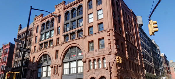
![IMG_0586_7_8Adjust [2/19/2012 2:46:50 PM] IMG_0586_7_8Adjust [2/19/2012 2:46:50 PM]](https://www.newyorkitecture.com/wp-content/gallery/soho/img_a_0586_7_8adjust.jpg)
![IMG_0592_3_4Adjust [2/19/2012 2:50:12 PM] IMG_0592_3_4Adjust [2/19/2012 2:50:12 PM]](https://www.newyorkitecture.com/wp-content/gallery/soho/img_a_0592_3_4adjust.jpg)
![IMG_0997_8_9Adjust [2/22/2012 12:43:28 PM] IMG_0997_8_9Adjust [2/22/2012 12:43:28 PM]](https://www.newyorkitecture.com/wp-content/gallery/soho/img_a_0997_8_9adjust.jpg)
![IMG_1027_8_9Adjust [2/22/2012 12:53:48 PM] IMG_1027_8_9Adjust [2/22/2012 12:53:48 PM]](https://www.newyorkitecture.com/wp-content/gallery/soho/img_a_1027_8_9adjust.jpg)
![IMG_1030_1_2Adjust [2/22/2012 12:59:53 PM] IMG_1030_1_2Adjust [2/22/2012 12:59:53 PM]](https://www.newyorkitecture.com/wp-content/gallery/soho/img_a_1030_1_2adjust.jpg)
![IMG_1051_2_3Adjust [2/22/2012 1:03:25 PM] IMG_1051_2_3Adjust [2/22/2012 1:03:25 PM]](https://www.newyorkitecture.com/wp-content/gallery/soho/img_a_1051_2_3adjust.jpg)
![IMG_1060_1_2Adjust [2/22/2012 1:05:30 PM] IMG_1060_1_2Adjust [2/22/2012 1:05:30 PM]](https://www.newyorkitecture.com/wp-content/gallery/soho/img_a_1060_1_2adjust.jpg)
![IMG_1063_4_5Adjust [2/22/2012 1:06:36 PM] IMG_1063_4_5Adjust [2/22/2012 1:06:36 PM]](https://www.newyorkitecture.com/wp-content/gallery/soho/img_a_1063_4_5adjust.jpg)
![IMG_1072_3_4Adjust [2/22/2012 1:09:09 PM] IMG_1072_3_4Adjust [2/22/2012 1:09:09 PM]](https://www.newyorkitecture.com/wp-content/gallery/soho/img_a_1072_3_4adjust.jpg)
![IMG_1078_79_80Adjust [2/22/2012 1:14:15 PM] IMG_1078_79_80Adjust [2/22/2012 1:14:15 PM]](https://www.newyorkitecture.com/wp-content/gallery/soho/img_a_1078_79_80adjust.jpg)
![IMG_1081_2_3Adjust [2/22/2012 1:16:09 PM] IMG_1081_2_3Adjust [2/22/2012 1:16:09 PM]](https://www.newyorkitecture.com/wp-content/gallery/soho/img_a_1081_2_3adjust.jpg)
![IMG_1084_5_6Adjust [2/22/2012 1:17:19 PM] IMG_1084_5_6Adjust [2/22/2012 1:17:19 PM]](https://www.newyorkitecture.com/wp-content/gallery/soho/img_a_1084_5_6adjust.jpg)
![IMG_1102_3_4Adjust [2/22/2012 1:22:40 PM] IMG_1102_3_4Adjust [2/22/2012 1:22:40 PM]](https://www.newyorkitecture.com/wp-content/gallery/soho/img_a_1102_3_4adjust.jpg)
![IMG_1114_5_6Adjust [2/22/2012 1:25:45 PM] IMG_1114_5_6Adjust [2/22/2012 1:25:45 PM]](https://www.newyorkitecture.com/wp-content/gallery/soho/img_a_1114_5_6adjust.jpg)
![IMG_1120_1_2Adjust [2/22/2012 1:27:14 PM] IMG_1120_1_2Adjust [2/22/2012 1:27:14 PM]](https://www.newyorkitecture.com/wp-content/gallery/soho/img_a_1120_1_2adjust.jpg)
![IMG_1126_7_8Adjust [2/22/2012 1:28:59 PM] IMG_1126_7_8Adjust [2/22/2012 1:28:59 PM]](https://www.newyorkitecture.com/wp-content/gallery/soho/img_a_1126_7_8adjust.jpg)
![IMG_1147_8_9Adjust [2/22/2012 1:33:28 PM] IMG_1147_8_9Adjust [2/22/2012 1:33:28 PM]](https://www.newyorkitecture.com/wp-content/gallery/soho/img_a_1147_8_9adjust.jpg)
![IMG_1162_3_4Adjust [2/22/2012 1:40:58 PM] IMG_1162_3_4Adjust [2/22/2012 1:40:58 PM]](https://www.newyorkitecture.com/wp-content/gallery/soho/img_a_1162_3_4adjust.jpg)
![IMG_1168_69_70Adjust [2/22/2012 1:43:23 PM] IMG_1168_69_70Adjust [2/22/2012 1:43:23 PM]](https://www.newyorkitecture.com/wp-content/gallery/soho/img_a_1168_69_70adjust.jpg)
![IMG_1177_8_9Adjust [2/22/2012 1:45:42 PM] IMG_1177_8_9Adjust [2/22/2012 1:45:42 PM]](https://www.newyorkitecture.com/wp-content/gallery/soho/img_a_1177_8_9adjust.jpg)
![IMG_1186_7_8Adjust [2/22/2012 1:48:09 PM] IMG_1186_7_8Adjust [2/22/2012 1:48:09 PM]](https://www.newyorkitecture.com/wp-content/gallery/soho/img_a_1186_7_8adjust.jpg)
![IMG_1192_3_4Adjust [2/22/2012 1:50:42 PM] IMG_1192_3_4Adjust [2/22/2012 1:50:42 PM]](https://www.newyorkitecture.com/wp-content/gallery/soho/img_a_1192_3_4adjust.jpg)
![IMG_1198_199_200Adjust [2/22/2012 1:52:16 PM] IMG_1198_199_200Adjust [2/22/2012 1:52:16 PM]](https://www.newyorkitecture.com/wp-content/gallery/soho/img_a_1198_199_200adjust.jpg)
![IMG_1207_8_9Adjust [2/22/2012 1:54:57 PM] IMG_1207_8_9Adjust [2/22/2012 1:54:57 PM]](https://www.newyorkitecture.com/wp-content/gallery/soho/img_a_1207_8_9adjust.jpg)
![IMG_1225_6_7Adjust [2/22/2012 1:57:53 PM] IMG_1225_6_7Adjust [2/22/2012 1:57:53 PM]](https://www.newyorkitecture.com/wp-content/gallery/soho/img_a_1225_6_7adjust.jpg)
![IMG_1228_29_30Adjust [2/22/2012 2:01:29 PM] IMG_1228_29_30Adjust [2/22/2012 2:01:29 PM]](https://www.newyorkitecture.com/wp-content/gallery/soho/img_a_1228_29_30adjust.jpg)
![IMG_1255_6_7Adjust [2/22/2012 2:08:08 PM] IMG_1255_6_7Adjust [2/22/2012 2:08:08 PM]](https://www.newyorkitecture.com/wp-content/gallery/soho/img_a_1255_6_7adjust.jpg)
![IMG_1267_8_9Adjust [2/22/2012 2:13:49 PM] IMG_1267_8_9Adjust [2/22/2012 2:13:49 PM]](https://www.newyorkitecture.com/wp-content/gallery/soho/img_a_1267_8_9adjust.jpg)
![IMG_1273_4_5Adjust [2/22/2012 2:15:00 PM] IMG_1273_4_5Adjust [2/22/2012 2:15:00 PM]](https://www.newyorkitecture.com/wp-content/gallery/soho/img_a_1273_4_5adjust.jpg)
![IMG_1282_3_4Adjust [2/22/2012 2:19:07 PM] IMG_1282_3_4Adjust [2/22/2012 2:19:07 PM]](https://www.newyorkitecture.com/wp-content/gallery/soho/img_a_1282_3_4adjust.jpg)
![IMG_1288_89_90Adjust [2/22/2012 2:21:45 PM] IMG_1288_89_90Adjust [2/22/2012 2:21:45 PM]](https://www.newyorkitecture.com/wp-content/gallery/soho/img_a_1288_89_90adjust.jpg)
![IMG_1291_2_3Adjust [2/22/2012 2:23:54 PM] IMG_1291_2_3Adjust [2/22/2012 2:23:54 PM]](https://www.newyorkitecture.com/wp-content/gallery/soho/img_a_1291_2_3adjust.jpg)
![IMG_1303_4_5Adjust [2/22/2012 2:30:35 PM] IMG_1303_4_5Adjust [2/22/2012 2:30:35 PM]](https://www.newyorkitecture.com/wp-content/gallery/soho/img_a_1303_4_5adjust.jpg)
![IMG_1306_7_8Adjust [2/22/2012 2:31:31 PM] IMG_1306_7_8Adjust [2/22/2012 2:31:31 PM]](https://www.newyorkitecture.com/wp-content/gallery/soho/img_a_1306_7_8adjust.jpg)
![IMG_1321_2_3Adjust [2/22/2012 2:40:00 PM] IMG_1321_2_3Adjust [2/22/2012 2:40:00 PM]](https://www.newyorkitecture.com/wp-content/gallery/soho/img_a_1321_2_3adjust.jpg)
![IMG_1324_5_6Adjust [2/22/2012 2:43:43 PM] IMG_1324_5_6Adjust [2/22/2012 2:43:43 PM]](https://www.newyorkitecture.com/wp-content/gallery/soho/img_a_1324_5_6adjust.jpg)
![IMG_1333_4_5Adjust [2/22/2012 2:46:33 PM] IMG_1333_4_5Adjust [2/22/2012 2:46:33 PM]](https://www.newyorkitecture.com/wp-content/gallery/soho/img_a_1333_4_5adjust.jpg)
![IMG_1339_40_41Adjust [2/22/2012 2:47:53 PM] IMG_1339_40_41Adjust [2/22/2012 2:47:53 PM]](https://www.newyorkitecture.com/wp-content/gallery/soho/img_a_1339_40_41adjust.jpg)
![IMG_1354_5_6Adjust [2/22/2012 2:50:54 PM] IMG_1354_5_6Adjust [2/22/2012 2:50:54 PM]](https://www.newyorkitecture.com/wp-content/gallery/soho/img_a_1354_5_6adjust.jpg)
![IMG_1390_1_2Adjust [2/22/2012 3:04:50 PM] IMG_1390_1_2Adjust [2/22/2012 3:04:50 PM]](https://www.newyorkitecture.com/wp-content/gallery/soho/img_a_1390_1_2adjust.jpg)
![IMG_1396_7_8Adjust [2/22/2012 3:07:52 PM] IMG_1396_7_8Adjust [2/22/2012 3:07:52 PM]](https://www.newyorkitecture.com/wp-content/gallery/soho/img_a_1396_7_8adjust.jpg)
![IMG_1402_3_4Adjust [2/22/2012 3:09:28 PM] IMG_1402_3_4Adjust [2/22/2012 3:09:28 PM]](https://www.newyorkitecture.com/wp-content/gallery/soho/img_a_1402_3_4adjust.jpg)
![IMG_1405_6_7Adjust [2/22/2012 3:10:04 PM] IMG_1405_6_7Adjust [2/22/2012 3:10:04 PM]](https://www.newyorkitecture.com/wp-content/gallery/soho/img_a_1405_6_7adjust.jpg)
![IMG_1414_5_6Adjust [2/22/2012 3:13:41 PM] IMG_1414_5_6Adjust [2/22/2012 3:13:41 PM]](https://www.newyorkitecture.com/wp-content/gallery/soho/img_a_1414_5_6adjust.jpg)
![IMG_1429_30_31Adjust [2/22/2012 3:19:30 PM] IMG_1429_30_31Adjust [2/22/2012 3:19:30 PM]](https://www.newyorkitecture.com/wp-content/gallery/soho/img_a_1429_30_31adjust.jpg)
![IMG_1438_39_40Adjust [2/22/2012 3:22:18 PM] IMG_1438_39_40Adjust [2/22/2012 3:22:18 PM]](https://www.newyorkitecture.com/wp-content/gallery/soho/img_a_1438_39_40adjust.jpg)
![IMG_1447_8_9Adjust [2/22/2012 3:26:49 PM] IMG_1447_8_9Adjust [2/22/2012 3:26:49 PM]](https://www.newyorkitecture.com/wp-content/gallery/soho/img_a_1447_8_9adjust.jpg)
![IMG_1459_60_61Adjust [2/22/2012 3:31:06 PM] IMG_1459_60_61Adjust [2/22/2012 3:31:06 PM]](https://www.newyorkitecture.com/wp-content/gallery/soho/img_a_1459_60_61adjust.jpg)
![IMG_1471_2_3Adjust [2/22/2012 3:36:28 PM] IMG_1471_2_3Adjust [2/22/2012 3:36:28 PM]](https://www.newyorkitecture.com/wp-content/gallery/soho/img_a_1471_2_3adjust.jpg)
![IMG_1477_8_9Adjust [2/22/2012 3:37:36 PM] IMG_1477_8_9Adjust [2/22/2012 3:37:36 PM]](https://www.newyorkitecture.com/wp-content/gallery/soho/img_a_1477_8_9adjust.jpg)
![IMG_1480_1_2Adjust [2/22/2012 3:41:01 PM] IMG_1480_1_2Adjust [2/22/2012 3:41:01 PM]](https://www.newyorkitecture.com/wp-content/gallery/soho/img_a_1480_1_2adjust.jpg)
![IMG_1492_3_4Adjust [2/22/2012 3:46:13 PM] IMG_1492_3_4Adjust [2/22/2012 3:46:13 PM]](https://www.newyorkitecture.com/wp-content/gallery/soho/img_a_1492_3_4adjust.jpg)
![IMG_1501_2_3Adjust [2/22/2012 3:49:13 PM] IMG_1501_2_3Adjust [2/22/2012 3:49:13 PM]](https://www.newyorkitecture.com/wp-content/gallery/soho/img_a_1501_2_3adjust.jpg)
![IMG_1507_8_9Adjust [2/22/2012 3:51:02 PM] IMG_1507_8_9Adjust [2/22/2012 3:51:02 PM]](https://www.newyorkitecture.com/wp-content/gallery/soho/img_a_1507_8_9adjust.jpg)
![IMG_1513_4_5Adjust [2/22/2012 3:52:56 PM] IMG_1513_4_5Adjust [2/22/2012 3:52:56 PM]](https://www.newyorkitecture.com/wp-content/gallery/soho/img_a_1513_4_5adjust.jpg)
![IMG_1528_29_30Adjust [2/22/2012 3:57:26 PM] IMG_1528_29_30Adjust [2/22/2012 3:57:26 PM]](https://www.newyorkitecture.com/wp-content/gallery/soho/img_a_1528_29_30adjust.jpg)
![IMG_1537_8_9Adjust [2/22/2012 3:58:39 PM] IMG_1537_8_9Adjust [2/22/2012 3:58:39 PM]](https://www.newyorkitecture.com/wp-content/gallery/soho/img_a_1537_8_9adjust.jpg)
![IMG_1546_7_8Adjust [2/22/2012 4:03:12 PM] IMG_1546_7_8Adjust [2/22/2012 4:03:12 PM]](https://www.newyorkitecture.com/wp-content/gallery/soho/img_a_1546_7_8adjust.jpg)
![IMG_1549_50_51Adjust [2/22/2012 4:04:48 PM] IMG_1549_50_51Adjust [2/22/2012 4:04:48 PM]](https://www.newyorkitecture.com/wp-content/gallery/soho/img_a_1549_50_51adjust.jpg)
![IMG_1555_6_7Adjust [2/22/2012 4:07:32 PM] IMG_1555_6_7Adjust [2/22/2012 4:07:32 PM]](https://www.newyorkitecture.com/wp-content/gallery/soho/img_a_1555_6_7adjust.jpg)
![IMG_1564_5_6Adjust [2/22/2012 4:09:59 PM] IMG_1564_5_6Adjust [2/22/2012 4:09:59 PM]](https://www.newyorkitecture.com/wp-content/gallery/soho/img_a_1564_5_6adjust.jpg)
![IMG_1567_8_9Adjust [2/27/2012 11:55:31 AM] IMG_1567_8_9Adjust [2/27/2012 11:55:31 AM]](https://www.newyorkitecture.com/wp-content/gallery/soho/img_a_1567_8_9adjust.jpg)
![IMG_1582_3_4Adjust [2/27/2012 11:57:24 AM] IMG_1582_3_4Adjust [2/27/2012 11:57:24 AM]](https://www.newyorkitecture.com/wp-content/gallery/soho/img_a_1582_3_4adjust.jpg)
![IMG_1372_3_4Adjust [2/22/2012 2:57:21 PM] IMG_1372_3_4Adjust [2/22/2012 2:57:21 PM]](https://www.newyorkitecture.com/wp-content/gallery/soho/img_b_1372_3_4adjust.jpg)
![IMG_1375_6_7Adjust [2/22/2012 2:58:02 PM] IMG_1375_6_7Adjust [2/22/2012 2:58:02 PM]](https://www.newyorkitecture.com/wp-content/gallery/soho/img_b_1375_6_7adjust.jpg)
![IMG_1378_79_80Adjust [2/22/2012 3:00:13 PM] IMG_1378_79_80Adjust [2/22/2012 3:00:13 PM]](https://www.newyorkitecture.com/wp-content/gallery/soho/img_b_1378_79_80adjust.jpg)
![IMG_1381_2_3Adjust [2/22/2012 3:02:01 PM] IMG_1381_2_3Adjust [2/22/2012 3:02:01 PM]](https://www.newyorkitecture.com/wp-content/gallery/soho/img_b_1381_2_3adjust.jpg)
![IMG_1585_6_7Adjust [2/27/2012 12:02:14 PM] IMG_1585_6_7Adjust [2/27/2012 12:02:14 PM]](https://www.newyorkitecture.com/wp-content/gallery/soho/img_b_1585_6_7adjust.jpg)
![IMG_1612_3_4Adjust [2/27/2012 12:07:47 PM] IMG_1612_3_4Adjust [2/27/2012 12:07:47 PM]](https://www.newyorkitecture.com/wp-content/gallery/soho/img_b_1612_3_4adjust.jpg)
![IMG_1615_6_7Adjust [2/27/2012 12:08:54 PM] IMG_1615_6_7Adjust [2/27/2012 12:08:54 PM]](https://www.newyorkitecture.com/wp-content/gallery/soho/img_b_1615_6_7adjust.jpg)
![IMG_1618_19_20Adjust [2/27/2012 12:09:29 PM] IMG_1618_19_20Adjust [2/27/2012 12:09:29 PM]](https://www.newyorkitecture.com/wp-content/gallery/soho/img_b_1618_19_20adjust.jpg)
![IMG_1624_5_6Adjust [2/27/2012 12:10:36 PM] IMG_1624_5_6Adjust [2/27/2012 12:10:36 PM]](https://www.newyorkitecture.com/wp-content/gallery/soho/img_b_1624_5_6adjust.jpg)
![IMG_1627_8_9Adjust [2/27/2012 12:11:16 PM] IMG_1627_8_9Adjust [2/27/2012 12:11:16 PM]](https://www.newyorkitecture.com/wp-content/gallery/soho/img_b_1627_8_9adjust.jpg)
![IMG_1630_1_2Adjust [2/27/2012 12:13:08 PM] IMG_1630_1_2Adjust [2/27/2012 12:13:08 PM]](https://www.newyorkitecture.com/wp-content/gallery/soho/img_b_1630_1_2adjust.jpg)
![IMG_1636_7_8Adjust [2/27/2012 12:14:14 PM] IMG_1636_7_8Adjust [2/27/2012 12:14:14 PM]](https://www.newyorkitecture.com/wp-content/gallery/soho/img_c_1636_7_8adjust.jpg)
![IMG_1642_3_4Adjust [2/27/2012 12:15:56 PM] IMG_1642_3_4Adjust [2/27/2012 12:15:56 PM]](https://www.newyorkitecture.com/wp-content/gallery/soho/img_c_1642_3_4adjust.jpg)
![IMG_1651_2_3Adjust [2/27/2012 12:18:16 PM] IMG_1651_2_3Adjust [2/27/2012 12:18:16 PM]](https://www.newyorkitecture.com/wp-content/gallery/soho/img_c_1651_2_3adjust.jpg)
![IMG_1669_70_71Adjust [2/27/2012 12:26:53 PM] IMG_1669_70_71Adjust [2/27/2012 12:26:53 PM]](https://www.newyorkitecture.com/wp-content/gallery/soho/img_c_1669_70_71adjust.jpg)
![IMG_1684_5_6Adjust [2/27/2012 12:31:42 PM] IMG_1684_5_6Adjust [2/27/2012 12:31:42 PM]](https://www.newyorkitecture.com/wp-content/gallery/soho/img_c_1684_5_6adjust.jpg)
![IMG_1693_4_5Adjust [2/27/2012 12:33:42 PM] IMG_1693_4_5Adjust [2/27/2012 12:33:42 PM]](https://www.newyorkitecture.com/wp-content/gallery/soho/img_c_1693_4_5adjust.jpg)
![IMG_1699_700_701Adjust [2/27/2012 12:35:32 PM] IMG_1699_700_701Adjust [2/27/2012 12:35:32 PM]](https://www.newyorkitecture.com/wp-content/gallery/soho/img_c_1699_700_701adjust.jpg)
![IMG_1720_1_2Adjust [2/27/2012 12:41:43 PM] IMG_1720_1_2Adjust [2/27/2012 12:41:43 PM]](https://www.newyorkitecture.com/wp-content/gallery/soho/img_c_1720_1_2adjust.jpg)
![IMG_1738_39_40Adjust [2/27/2012 12:46:12 PM] IMG_1738_39_40Adjust [2/27/2012 12:46:12 PM]](https://www.newyorkitecture.com/wp-content/gallery/soho/img_c_1738_39_40adjust.jpg)
![IMG_1762_3_4Adjust [2/27/2012 12:53:20 PM] IMG_1762_3_4Adjust [2/27/2012 12:53:20 PM]](https://www.newyorkitecture.com/wp-content/gallery/soho/img_c_1762_3_4adjust.jpg)
![IMG_1783_4_5Adjust [2/27/2012 12:57:42 PM] IMG_1783_4_5Adjust [2/27/2012 12:57:42 PM]](https://www.newyorkitecture.com/wp-content/gallery/soho/img_c_1783_4_5adjust.jpg)
![IMG_1801_2_3Adjust [2/27/2012 1:01:52 PM] IMG_1801_2_3Adjust [2/27/2012 1:01:52 PM]](https://www.newyorkitecture.com/wp-content/gallery/soho/img_c_1801_2_3adjust.jpg)
![IMG_1810_1_2Adjust [2/27/2012 1:05:42 PM] IMG_1810_1_2Adjust [2/27/2012 1:05:42 PM]](https://www.newyorkitecture.com/wp-content/gallery/soho/img_c_1810_1_2adjust.jpg)
![IMG_1819_20_21Adjust [2/27/2012 1:08:21 PM] IMG_1819_20_21Adjust [2/27/2012 1:08:21 PM]](https://www.newyorkitecture.com/wp-content/gallery/soho/img_c_1819_20_21adjust.jpg)
![IMG_1822_3_4Adjust [2/27/2012 1:09:52 PM] IMG_1822_3_4Adjust [2/27/2012 1:09:52 PM]](https://www.newyorkitecture.com/wp-content/gallery/soho/img_c_1822_3_4adjust.jpg)
![IMG_1834_5_6Adjust [2/27/2012 1:17:13 PM] IMG_1834_5_6Adjust [2/27/2012 1:17:13 PM]](https://www.newyorkitecture.com/wp-content/gallery/soho/img_c_1834_5_6adjust.jpg)
![IMG_1840_1_2Adjust [2/27/2012 1:18:55 PM] IMG_1840_1_2Adjust [2/27/2012 1:18:55 PM]](https://www.newyorkitecture.com/wp-content/gallery/soho/img_c_1840_1_2adjust.jpg)
![IMG_1852_3_4Adjust [2/27/2012 1:20:31 PM] IMG_1852_3_4Adjust [2/27/2012 1:20:31 PM]](https://www.newyorkitecture.com/wp-content/gallery/soho/img_c_1852_3_4adjust.jpg)
![IMG_1855_6_7Adjust [2/27/2012 1:21:34 PM] IMG_1855_6_7Adjust [2/27/2012 1:21:34 PM]](https://www.newyorkitecture.com/wp-content/gallery/soho/img_c_1855_6_7adjust.jpg)
![IMG_1864_5_6Adjust [2/27/2012 1:23:36 PM] IMG_1864_5_6Adjust [2/27/2012 1:23:36 PM]](https://www.newyorkitecture.com/wp-content/gallery/soho/img_c_1864_5_6adjust.jpg)
![IMG_1876_7_8Adjust [2/27/2012 1:26:46 PM] IMG_1876_7_8Adjust [2/27/2012 1:26:46 PM]](https://www.newyorkitecture.com/wp-content/gallery/soho/img_c_1876_7_8adjust.jpg)
![IMG_1918_19_20Adjust [2/27/2012 1:32:55 PM] IMG_1918_19_20Adjust [2/27/2012 1:32:55 PM]](https://www.newyorkitecture.com/wp-content/gallery/soho/img_c_1918_19_20adjust.jpg)
![IMG_1924_5_6Adjust [2/27/2012 1:34:03 PM] IMG_1924_5_6Adjust [2/27/2012 1:34:03 PM]](https://www.newyorkitecture.com/wp-content/gallery/soho/img_c_1924_5_6adjust.jpg)
![IMG_1954_5_6Adjust [2/27/2012 1:37:33 PM] IMG_1954_5_6Adjust [2/27/2012 1:37:33 PM]](https://www.newyorkitecture.com/wp-content/gallery/soho/img_c_1954_5_6adjust.jpg)
![IMG_d_1966_7_8Adjust [2/28/2012 11:46:02 AM] IMG_d_1966_7_8Adjust [2/28/2012 11:46:02 AM]](https://www.newyorkitecture.com/wp-content/gallery/soho/img_d_1966_7_8adjust.jpg)
![IMG_d_1978_79_80Adjust [2/28/2012 11:50:17 AM] IMG_d_1978_79_80Adjust [2/28/2012 11:50:17 AM]](https://www.newyorkitecture.com/wp-content/gallery/soho/img_d_1978_79_80adjust.jpg)
![IMG_d_2008_09_10Adjust [2/28/2012 11:54:02 AM] IMG_d_2008_09_10Adjust [2/28/2012 11:54:02 AM]](https://www.newyorkitecture.com/wp-content/gallery/soho/img_d_2008_09_10adjust.jpg)
![IMG_d_2026_7_8Adjust [2/28/2012 11:57:07 AM] IMG_d_2026_7_8Adjust [2/28/2012 11:57:07 AM]](https://www.newyorkitecture.com/wp-content/gallery/soho/img_d_2026_7_8adjust.jpg)
![IMG_d_2050_1_2Adjust [2/28/2012 12:02:09 PM] IMG_d_2050_1_2Adjust [2/28/2012 12:02:09 PM]](https://www.newyorkitecture.com/wp-content/gallery/soho/img_d_2050_1_2adjust.jpg)
![IMG_d_2074_5_6Adjust [2/28/2012 12:09:12 PM] IMG_d_2074_5_6Adjust [2/28/2012 12:09:12 PM]](https://www.newyorkitecture.com/wp-content/gallery/soho/img_d_2074_5_6adjust.jpg)
![IMG_d_2086_7_8Adjust [2/28/2012 12:11:23 PM] IMG_d_2086_7_8Adjust [2/28/2012 12:11:23 PM]](https://www.newyorkitecture.com/wp-content/gallery/soho/img_d_2086_7_8adjust.jpg)
![IMG_d_2095_6_7Adjust [2/28/2012 12:12:25 PM] IMG_d_2095_6_7Adjust [2/28/2012 12:12:25 PM]](https://www.newyorkitecture.com/wp-content/gallery/soho/img_d_2095_6_7adjust.jpg)
![IMG_d_2101_2_3Adjust [2/28/2012 12:15:17 PM] IMG_d_2101_2_3Adjust [2/28/2012 12:15:17 PM]](https://www.newyorkitecture.com/wp-content/gallery/soho/img_d_2101_2_3adjust.jpg)
![IMG_d_2104_5_6Adjust [2/28/2012 12:20:24 PM] IMG_d_2104_5_6Adjust [2/28/2012 12:20:24 PM]](https://www.newyorkitecture.com/wp-content/gallery/soho/img_d_2104_5_6adjust.jpg)
![IMG_d_2122_3_4Adjust [2/28/2012 12:31:59 PM] IMG_d_2122_3_4Adjust [2/28/2012 12:31:59 PM]](https://www.newyorkitecture.com/wp-content/gallery/soho/img_d_2122_3_4adjust.jpg)
![IMG_d_2140_1_2Adjust [2/28/2012 12:37:25 PM] IMG_d_2140_1_2Adjust [2/28/2012 12:37:25 PM]](https://www.newyorkitecture.com/wp-content/gallery/soho/img_d_2140_1_2adjust.jpg)
![IMG_d_2152_3_4Adjust [2/28/2012 12:41:45 PM] IMG_d_2152_3_4Adjust [2/28/2012 12:41:45 PM]](https://www.newyorkitecture.com/wp-content/gallery/soho/img_d_2152_3_4adjust.jpg)
![IMG_d_2173_4_5Adjust [2/28/2012 12:50:09 PM] IMG_d_2173_4_5Adjust [2/28/2012 12:50:09 PM]](https://www.newyorkitecture.com/wp-content/gallery/soho/img_d_2173_4_5adjust.jpg)
![IMG_d_2188_89_90Adjust [2/28/2012 12:53:30 PM] IMG_d_2188_89_90Adjust [2/28/2012 12:53:30 PM]](https://www.newyorkitecture.com/wp-content/gallery/soho/img_d_2188_89_90adjust.jpg)
![IMG_d_2203_4_5Adjust [2/28/2012 1:00:23 PM] IMG_d_2203_4_5Adjust [2/28/2012 1:00:23 PM]](https://www.newyorkitecture.com/wp-content/gallery/soho/img_d_2203_4_5adjust.jpg)
![IMG_d_2212_3_4Adjust [2/28/2012 1:01:47 PM] IMG_d_2212_3_4Adjust [2/28/2012 1:01:47 PM]](https://www.newyorkitecture.com/wp-content/gallery/soho/img_d_2212_3_4adjust.jpg)
![IMG_d_2215_6_7Adjust [2/28/2012 1:04:43 PM] IMG_d_2215_6_7Adjust [2/28/2012 1:04:43 PM]](https://www.newyorkitecture.com/wp-content/gallery/soho/img_d_2215_6_7adjust.jpg)
![IMG_d_2230_1_2Adjust [2/28/2012 1:10:40 PM] IMG_d_2230_1_2Adjust [2/28/2012 1:10:40 PM]](https://www.newyorkitecture.com/wp-content/gallery/soho/img_d_2230_1_2adjust.jpg)
![IMG_d_2245_6_7Adjust [2/28/2012 1:16:27 PM] IMG_d_2245_6_7Adjust [2/28/2012 1:16:27 PM]](https://www.newyorkitecture.com/wp-content/gallery/soho/img_d_2245_6_7adjust.jpg)
![IMG_d_2251_2_3Adjust [2/28/2012 1:18:15 PM] IMG_d_2251_2_3Adjust [2/28/2012 1:18:15 PM]](https://www.newyorkitecture.com/wp-content/gallery/soho/img_d_2251_2_3adjust.jpg)
![IMG_d_2260_1_2Adjust [2/28/2012 1:22:30 PM] IMG_d_2260_1_2Adjust [2/28/2012 1:22:30 PM]](https://www.newyorkitecture.com/wp-content/gallery/soho/img_d_2260_1_2adjust.jpg)
![IMG_d_2266_7_8Adjust [2/28/2012 1:25:44 PM] IMG_d_2266_7_8Adjust [2/28/2012 1:25:44 PM]](https://www.newyorkitecture.com/wp-content/gallery/soho/img_d_2266_7_8adjust.jpg)
![IMG_d_2275_6_7Adjust [2/28/2012 1:29:52 PM] IMG_d_2275_6_7Adjust [2/28/2012 1:29:52 PM]](https://www.newyorkitecture.com/wp-content/gallery/soho/img_d_2275_6_7adjust.jpg)
![IMG_d_2296_7_8Adjust [2/28/2012 1:36:53 PM] IMG_d_2296_7_8Adjust [2/28/2012 1:36:53 PM]](https://www.newyorkitecture.com/wp-content/gallery/soho/img_d_2296_7_8adjust.jpg)
![IMG_d_2305_6_7Adjust [2/28/2012 1:43:07 PM] IMG_d_2305_6_7Adjust [2/28/2012 1:43:07 PM]](https://www.newyorkitecture.com/wp-content/gallery/soho/img_d_2305_6_7adjust.jpg)
![IMG_d_2311_2_3Adjust [2/28/2012 1:43:52 PM] IMG_d_2311_2_3Adjust [2/28/2012 1:43:52 PM]](https://www.newyorkitecture.com/wp-content/gallery/soho/img_d_2311_2_3adjust.jpg)
![IMG_d_2317_8_9Adjust [2/28/2012 1:47:07 PM] IMG_d_2317_8_9Adjust [2/28/2012 1:47:07 PM]](https://www.newyorkitecture.com/wp-content/gallery/soho/img_d_2317_8_9adjust.jpg)
![IMG_d_2326_7_8Adjust [2/28/2012 1:51:25 PM] IMG_d_2326_7_8Adjust [2/28/2012 1:51:25 PM]](https://www.newyorkitecture.com/wp-content/gallery/soho/img_d_2326_7_8adjust.jpg)
![IMG_d_2332_3_4Adjust [2/28/2012 1:52:15 PM] IMG_d_2332_3_4Adjust [2/28/2012 1:52:15 PM]](https://www.newyorkitecture.com/wp-content/gallery/soho/img_d_2332_3_4adjust.jpg)
![IMG_d_2338_39_40Adjust [2/28/2012 1:54:25 PM] IMG_d_2338_39_40Adjust [2/28/2012 1:54:25 PM]](https://www.newyorkitecture.com/wp-content/gallery/soho/img_d_2338_39_40adjust.jpg)
![IMG_d_2341_2_3Adjust [2/28/2012 1:55:50 PM] IMG_d_2341_2_3Adjust [2/28/2012 1:55:50 PM]](https://www.newyorkitecture.com/wp-content/gallery/soho/img_d_2341_2_3adjust.jpg)
![IMG_d_2377_8_9Adjust [2/28/2012 2:04:50 PM] IMG_d_2377_8_9Adjust [2/28/2012 2:04:50 PM]](https://www.newyorkitecture.com/wp-content/gallery/soho/img_d_2377_8_9adjust.jpg)