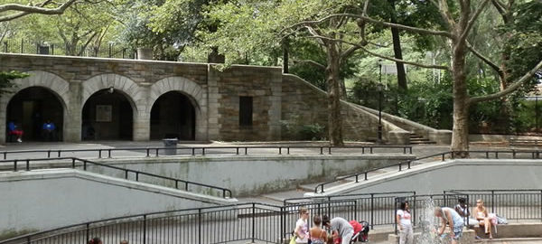
Governors Island is open only during the summer on Fridays, Saturdays, Sundays, and holiday Mondays. Free ferries run approximately every half hour from The Battery in Manhattan and every ten minutes from Brooklyn Bridge Park in Brooklyn. Visit The Trust for Governor’s Island for the 2015 schedule.
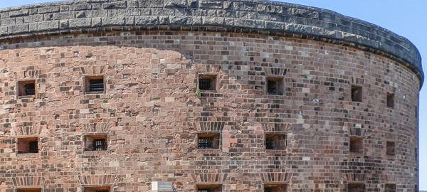
The island has two forts – Fort Jay and Castle Williams – that date back to 1806. (Castle Williams, which had been closed for renovations, has been reopened.) Other structures were added by the U.S. Army over the years; the island ended its military career as First Army HQ in 1966, when Governors Island was turned over to the Coast Guard. The Coast Guard moved out in 1996; in 2001 the forts (and the land between them) were designated a National Monument. The federal government sold the island to the City and State of New York in 2003; “Open Access Weekends” began in 2005. Currently, Governors Island Alliance, the Trust for Governors Island, and the National Park Service are expanding the island’s park facilities and programs.
![Central Park Reflections: CP13 [] Central Park Reflections: CP13 []](https://www.newyorkitecture.com/wp-content/gallery/central-park-reflections/CP13.jpg)
![Central Park Reflections: CP24 [] Central Park Reflections: CP24 []](https://www.newyorkitecture.com/wp-content/gallery/central-park-reflections/CP24.jpg)
![Central Park Reflections: CP23 [] Central Park Reflections: CP23 []](https://www.newyorkitecture.com/wp-content/gallery/central-park-reflections/CP23.jpg)
![Central Park Reflections: CP22 [] Central Park Reflections: CP22 []](https://www.newyorkitecture.com/wp-content/gallery/central-park-reflections/CP22.jpg)
![Central Park Reflections: CP21 [] Central Park Reflections: CP21 []](https://www.newyorkitecture.com/wp-content/gallery/central-park-reflections/CP21.jpg)
![Central Park Reflections: CP20 [] Central Park Reflections: CP20 []](https://www.newyorkitecture.com/wp-content/gallery/central-park-reflections/CP20.jpg)
![Central Park Reflections: CP19 [] Central Park Reflections: CP19 []](https://www.newyorkitecture.com/wp-content/gallery/central-park-reflections/CP19.jpg)
![Central Park Reflections: CP18 [] Central Park Reflections: CP18 []](https://www.newyorkitecture.com/wp-content/gallery/central-park-reflections/CP18.jpg)
![Central Park Reflections: CP17 [] Central Park Reflections: CP17 []](https://www.newyorkitecture.com/wp-content/gallery/central-park-reflections/CP17.jpg)
![Central Park Reflections: CP16 [] Central Park Reflections: CP16 []](https://www.newyorkitecture.com/wp-content/gallery/central-park-reflections/CP16.jpg)
![Central Park Reflections: CP15 [] Central Park Reflections: CP15 []](https://www.newyorkitecture.com/wp-content/gallery/central-park-reflections/CP15.jpg)
![Central Park Reflections: CP14 [] Central Park Reflections: CP14 []](https://www.newyorkitecture.com/wp-content/gallery/central-park-reflections/CP14.jpg)
![Central Park Reflections: CP01 [] Central Park Reflections: CP01 []](https://www.newyorkitecture.com/wp-content/gallery/central-park-reflections/CP01.jpg)
![Central Park Reflections: CP12 [] Central Park Reflections: CP12 []](https://www.newyorkitecture.com/wp-content/gallery/central-park-reflections/CP12.jpg)
![Central Park Reflections: CP11 [] Central Park Reflections: CP11 []](https://www.newyorkitecture.com/wp-content/gallery/central-park-reflections/CP11.jpg)
![Central Park Reflections: CP10 [] Central Park Reflections: CP10 []](https://www.newyorkitecture.com/wp-content/gallery/central-park-reflections/CP10.jpg)
![Central Park Reflections: CP09 [] Central Park Reflections: CP09 []](https://www.newyorkitecture.com/wp-content/gallery/central-park-reflections/CP09.jpg)
![Central Park Reflections: CP08 [] Central Park Reflections: CP08 []](https://www.newyorkitecture.com/wp-content/gallery/central-park-reflections/CP08.jpg)
![Central Park Reflections: CP07 [] Central Park Reflections: CP07 []](https://www.newyorkitecture.com/wp-content/gallery/central-park-reflections/CP07.jpg)
![Central Park Reflections: CP06 [] Central Park Reflections: CP06 []](https://www.newyorkitecture.com/wp-content/gallery/central-park-reflections/CP06.jpg)
![Central Park Reflections: CP05 [] Central Park Reflections: CP05 []](https://www.newyorkitecture.com/wp-content/gallery/central-park-reflections/CP05.jpg)
![Central Park Reflections: CP04 [] Central Park Reflections: CP04 []](https://www.newyorkitecture.com/wp-content/gallery/central-park-reflections/CP04.jpg)
![Central Park Reflections: CP03 [] Central Park Reflections: CP03 []](https://www.newyorkitecture.com/wp-content/gallery/central-park-reflections/CP03.jpg)
![Central Park Reflections: CP02 [] Central Park Reflections: CP02 []](https://www.newyorkitecture.com/wp-content/gallery/central-park-reflections/CP02.jpg)
![IMG_3118_19_20Adjust [3/7/2012 4:12:16 PM] IMG_3118_19_20Adjust [3/7/2012 4:12:16 PM]](https://www.newyorkitecture.com/wp-content/gallery/battery-park-city/img_3118_19_20adjust.jpg)
![IMG_7208 [11/3/2011 11:41:02 AM] IMG_7208 [11/3/2011 11:41:02 AM]](https://www.newyorkitecture.com/wp-content/gallery/septuagesimo-uno/IMG_7208.jpg)
